
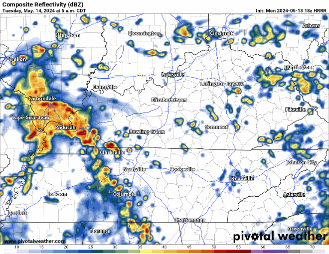
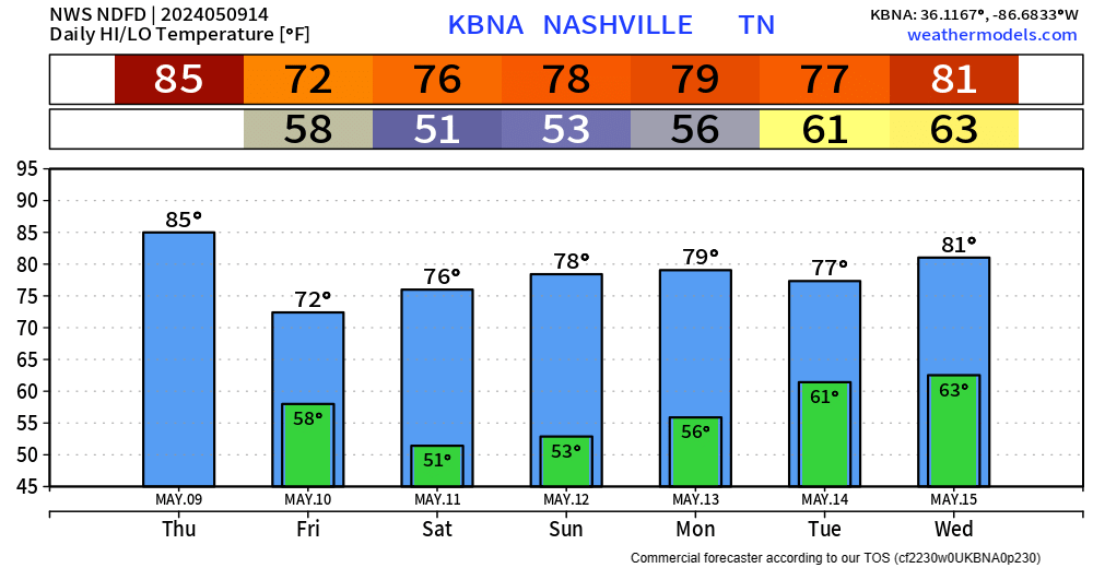
A few showers moving thru this mid-morning. these are no worries.
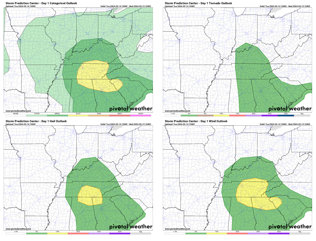
Our severe chances have increased just a tad since yesterday.

Within 25 miles of you, there is a 15% chance of damaging straight-line winds, 15% chance of large hail, and a 2% chance of a tornado. (another way to look at it is there is a 98% chance that there will not be a tornado within 25 miles of you!)


You must be logged in to post a comment.