Today will be the day to get any yardwork done before the weekend.
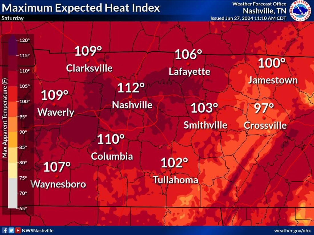
Friday will be hot, but Saturday will take the cake.
With heat index values reaching into the 105° – 110°+ range, it will be downright brutal.

Today will be the day to get any yardwork done before the weekend.
Friday will be hot, but Saturday will take the cake.
With heat index values reaching into the 105° – 110°+ range, it will be downright brutal.
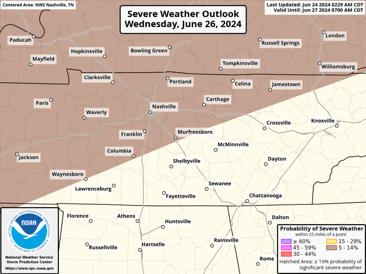
We’re still dealing with the low probability (5% chance within 25 miles) of damaging straight-line winds and hail.
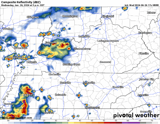
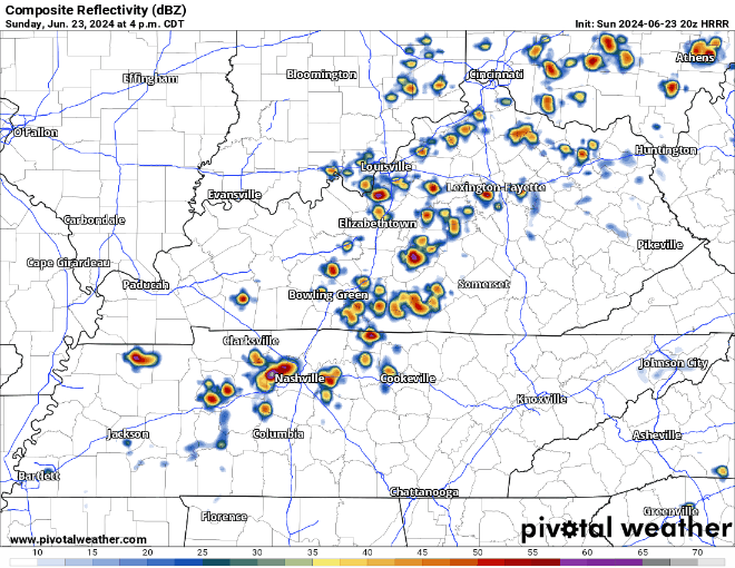
Timing wise, we are still looking at a timeframe of late afternoon into the evening – shown below by the HRRR model.

The low but nonzero chance of a strong to severe thunderstorm Wednesday continues to exist.
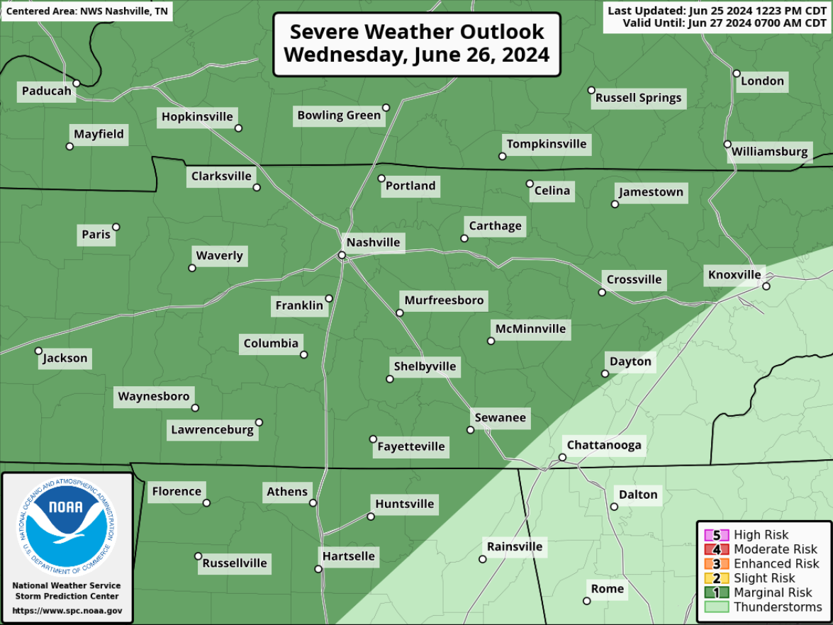
The Storm Predicition Center still has both of our counties highlighted in a 5% chance of severe weather within 25 miles.
Main headline this forecast will be the low potential for strong to possibly severe storms Wednesday – most likely in the afternoon and evening.
The Storm Predicition Center has outlooked both of our counties with a 5% chance of severe weather within 25 miles.
Another hot one, but today some lucky folks will see a shower or storm to help cool things off.
HRRR model (above) demonstrates the potential for scattered showers and storms throughout the evening, with things quieting down after sunset. A few strong to severe storms cannot be ruled out, with lightning, damaging straight-line, and heavy rain being the main concerns. No tornado concerns.
Another very hot day is underway, thankfully the dewpoints have been relatively tame in the low to mid 60s, so heat index values are “only” hovering around 100°.
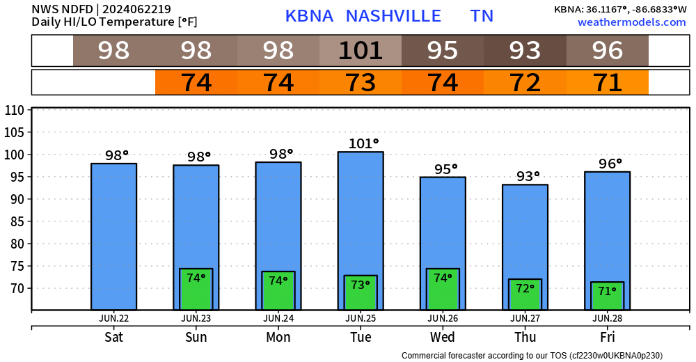
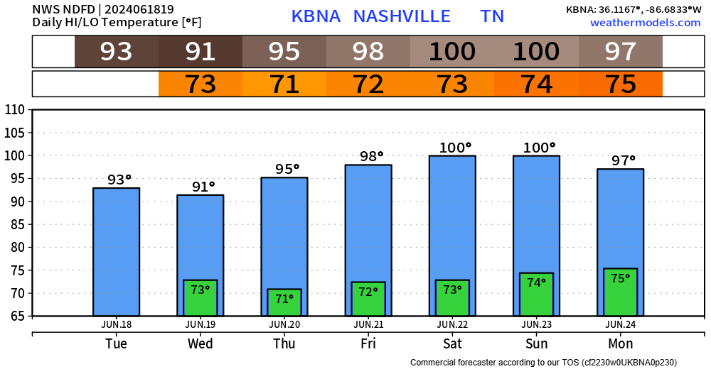
There will be no shortage of hot temperatures thru Tuesday. High temperatures in the upper 90s daily, possibly surpassing the century mark on Tuesday.
“Find Some Shade” was the title of this morning’s Situation Report (also known as the SitRep) issued by the NWS office in Nashville. That will be great advice for this weekend and at least the first half of next week as the heat will really let its presence be felt.
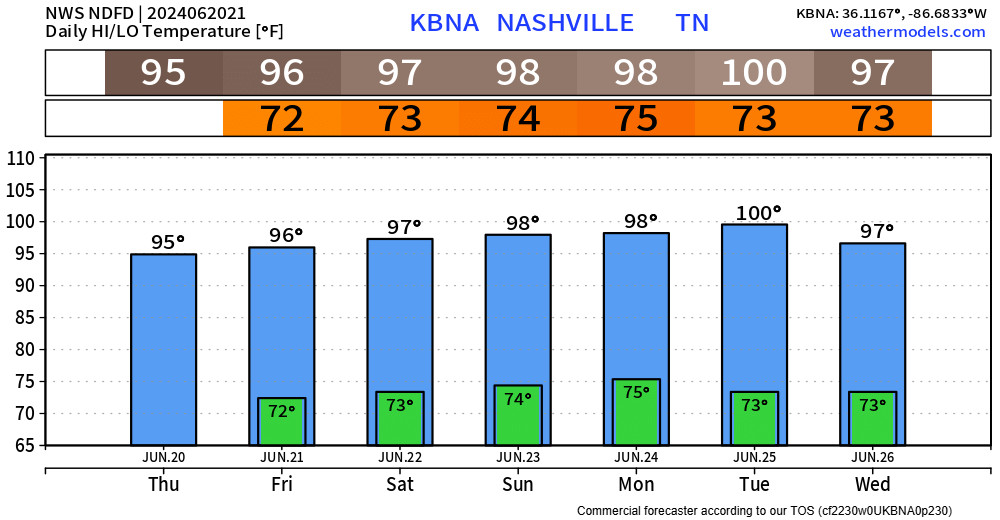
Today is the official start of summer for us (and everyone else in the Northern Hemisphere), and the forecast certainly looks like it.
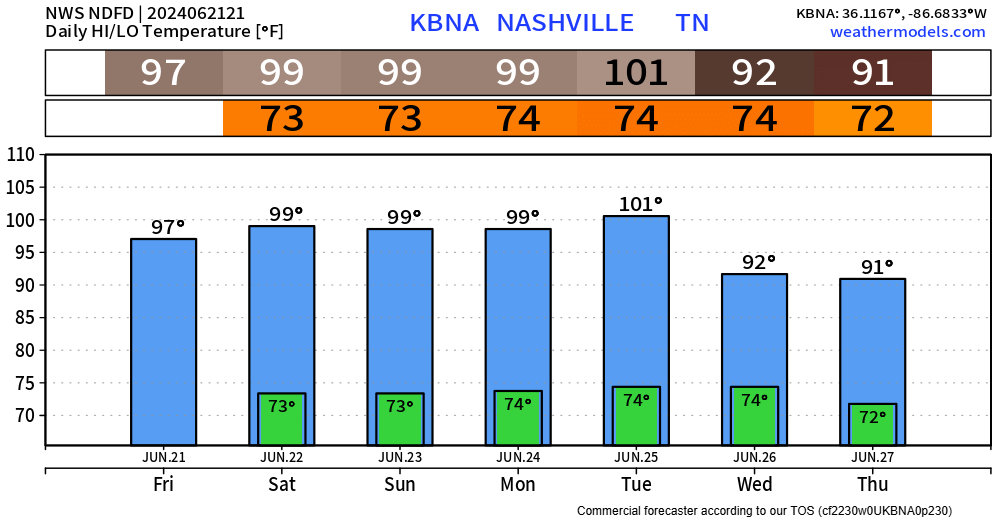
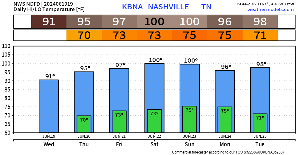
High temperatures in the mid to upper 90s for at least the next 6 days will be a brutal stretch.
Summer will officially begin tomorrow and there will be no doubt about it.
Today is the coolest day in the forecast – rest of the forecast holds high temperatures in the mid to upper 90s. Saturday and Sunday we’ll be flirting with 100°.
Although there are still some Wattery winners today, fewer tickets have been chosen. Similar to past days, any “winner” could see some brief heavy rain, lightning and gusty winds. These storms tend to fall apart just as fast as they pop up, but a quick inch or so of rain is possible.
You must be logged in to post a comment.