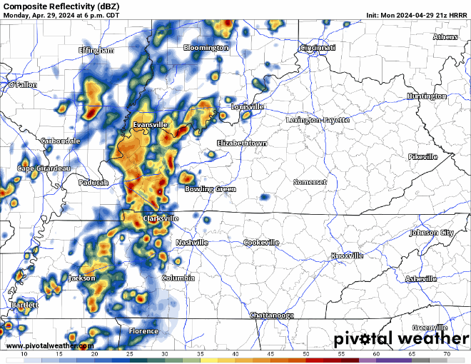
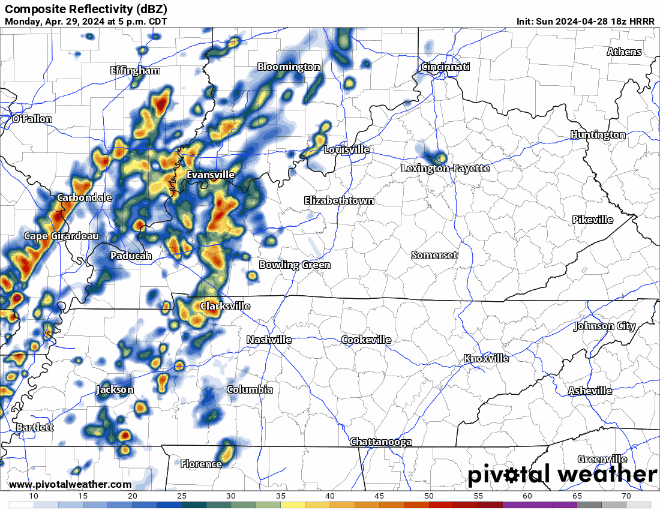
Activity should ramp up over the next couple hours, bringing in some showers and sub-severe storms. Maybe a few rumbles of thunder and some gusty winds, but nothing of concern. HRRR model below shows the story.

Activity should ramp up over the next couple hours, bringing in some showers and sub-severe storms. Maybe a few rumbles of thunder and some gusty winds, but nothing of concern. HRRR model below shows the story.
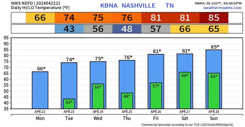
High temperatures will get into the low 80s Monday before some rain/storm chances arrive.
HRRR model (above) has a rough ETA of 7-9 pm Monday. A few rumbles of thunder are possible, but no severe weather is expected. Majority of the activity should be to our east by rush hour Tuesday morning.

Windy yet very warm day today. Wind gusts up to 25 – 30 mph will be possible throughout the day but expected to stay below Wind Advisory levels.
Sunday will be very similar, a tad less windy though. Good viewing weather for the Preds bounce back game.
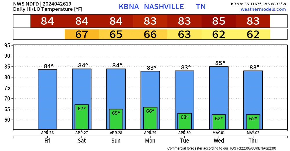
Very warm upcoming week, as high temps will run about 10° above average. We may not see temps in the 50s for the next 7 days.
Very nice Friday evening in store, perfect for watching a Preds dub.

Marathon weather still looks alright. Only hiccup could be a quick sprinkle.
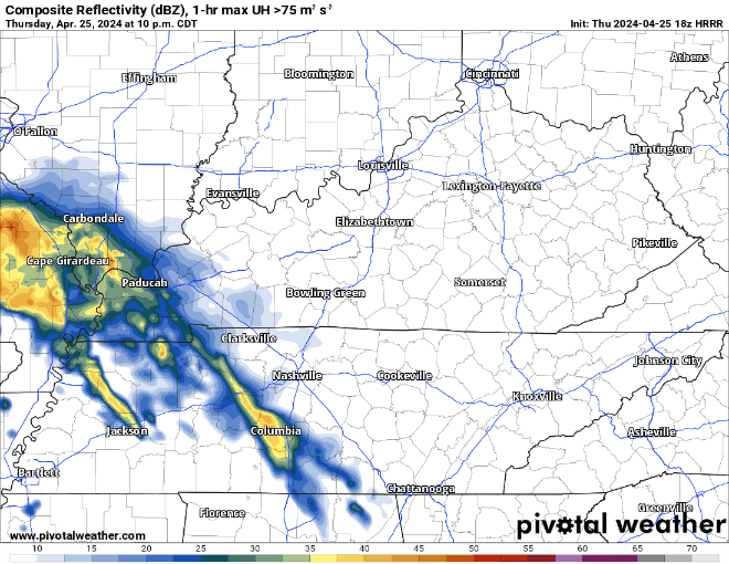
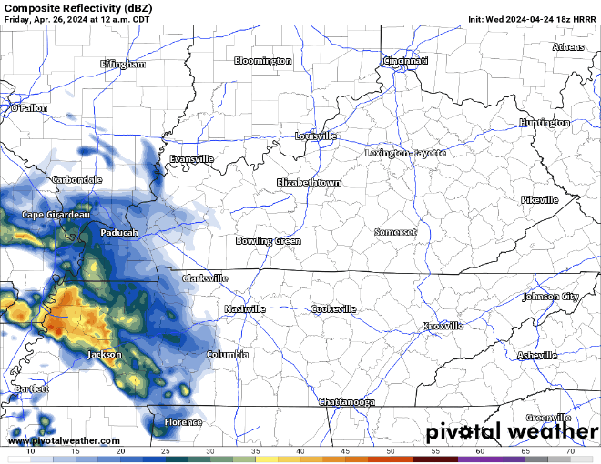
A couple scattered showers are possible starting tonight, lasting thru about mid-morning Friday. HRRR model below paints the picture.
Maybe a rumble of thunder, but meh.
Friday during the day should be lovely, highs getting all the way up into the low to mid 80s.
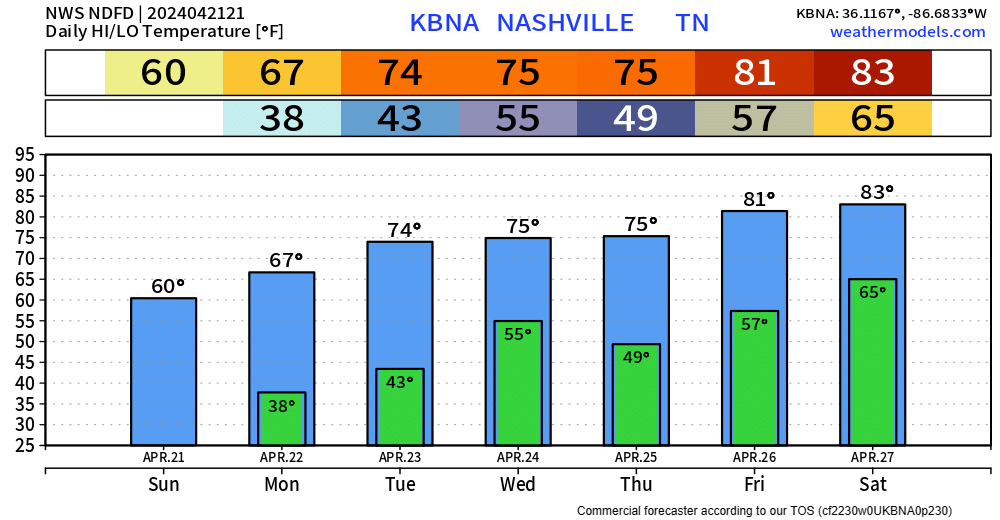
Nice weather during the day Thursday, high temps in the mid 70s. Some may say that it’s fantastic.
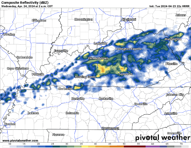
A warm front is to blame for some scattered rain chances Friday morning.
HRRR model shows the mostly light rain moving thru Friday morning. Rain jacket may be needed for the walk into school or work. Most of the rain should be gone by lunchtime.
A few sprinkles are possible early Wednesday morning, but these will be NBD.
Another rain chance comes around Thursday night/Friday morning, but again these rain chances look low and light. Not rainout amounts.
After some frost this morning, there are no more chances for the foreseeable future. I don’t want to guarantee we are done for the Spring, but long-term models suggest that just might be the case. There aren’t any historical records on latest frost, but the latest freeze recorded in Nashville was April 25, 1910.
Temps will dip down into the mid 30s tonight, so NWS Nashville went ahead and issued a Frost Advisory from 1am ’til 8am Monday. Protect any loved plants.
Thankfully, we’ll warm up throughout the weekend, with a return to the 80s by the end of the week.
Few sprinkles possible here and there this weekend, but not looking like any rainouts.
High temps stuck in the 60s thru Monday, around average for this time of the year. We’ll quickly get back into the 70s by early next week.
You must be logged in to post a comment.