
Stormy afternoon and evening ahead of us.
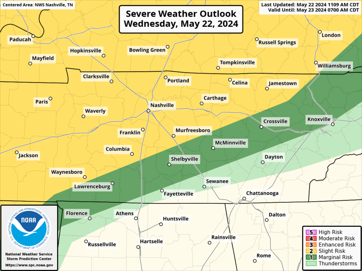
The Storm Prediction Center has outlooked our Davidson and Williamson counties with a:
- 15% chance of damaging straight-line winds within 25 miles
- 15% chance of severe hail within 25 miles
- we are not included in any tornado probabilities, the chances are extremely low but not zero
And not to be forgotten is the flash flooding threat.
Timing:
Coverage of storms should gradually increase over the next couple of hours.
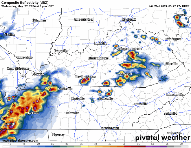
One or two scattered storms could impact us this afternoon, but our main focus will be on the line of storms pushing east from West TN. This run of the HRRR model thinks the ETA for storms, possibly including some damaging wind and hail will be around 5 – 6pm. This could be off by an hour or so, be sure to stay updated for any forecast changes!
Regardless of if the storms reach severe criteria, this line will bring some legit downpours and lightning. You do not want to be caught outside or stuck in rush hour traffic when the line passes thru. We’ll be posting updates on Twitter/X as needed and will go live on our YouTube channel if a warning is issued for any portion of our counties.
This is just the beginning of our active stretch of weather that will keep us on our toes.
We have another low-end chance for severe weather on Thursday.
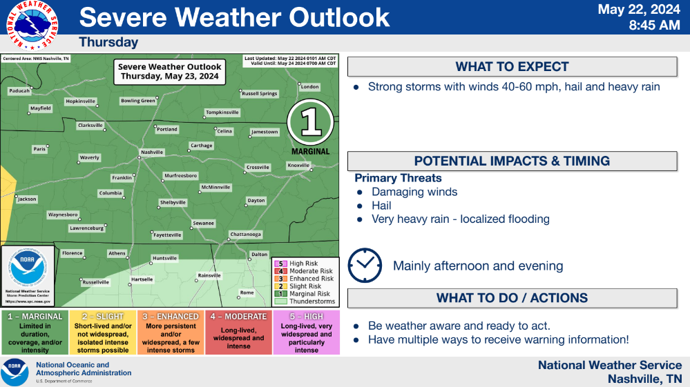
Our main concern for tomorrow will be damaging winds, hail and some localized flash flooding. The atmosphere does not look supportive of tornadoes.
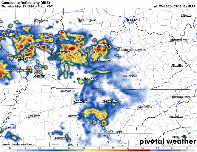
This run of the HRRR model thinks our timeframe for any severe weather potential will be around lunchtime Thursday. The HRRR and other models are graduation-friendly, showing a dry rest of the day. I am a tad hesitant on this, but so far signs are encouraging. Continue to check back for updates.
Our unsettled weather pattern goes absolutely nowhere, with rain/storm chances daily thru Memorial Day. Strong to severe storms will be possible daily. You probably won’t see rain or a storm every single day, but it will be important to stay weather aware the entire weekend – especially if you have any outdoor plans.
Severe weather wise – the day with the most concern will be Sunday.
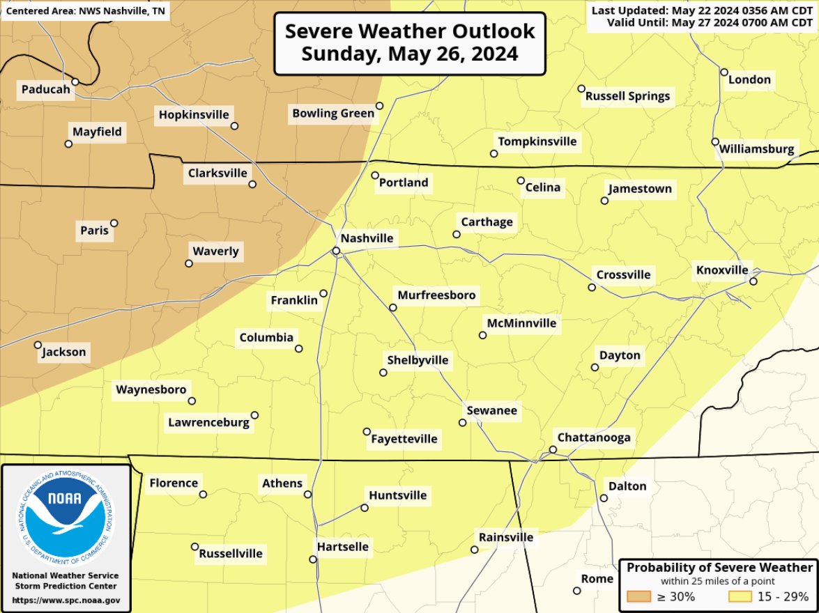
Both counties are already outlooked with a 15% chance of severe weather within 25 miles, with a 30% chance right on our doorstep. Still a lot of details to be ironed out, but certainly worth keeping an eye on. No need to panic, be prepared and have a severe weather plan.
Categories: Featured Blog