
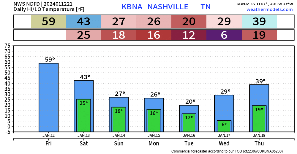
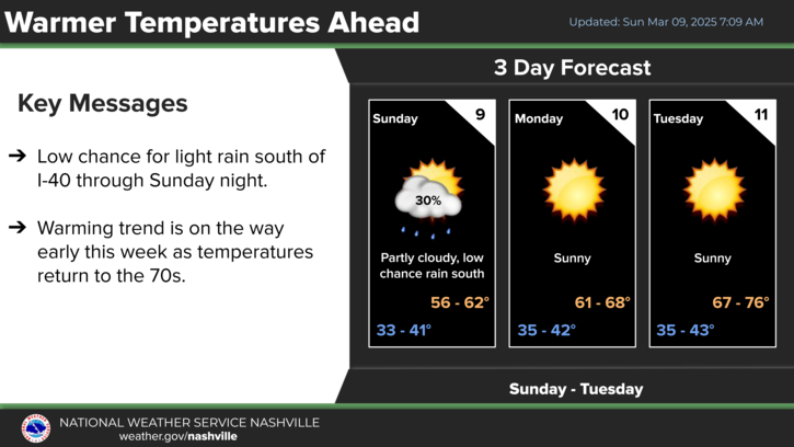
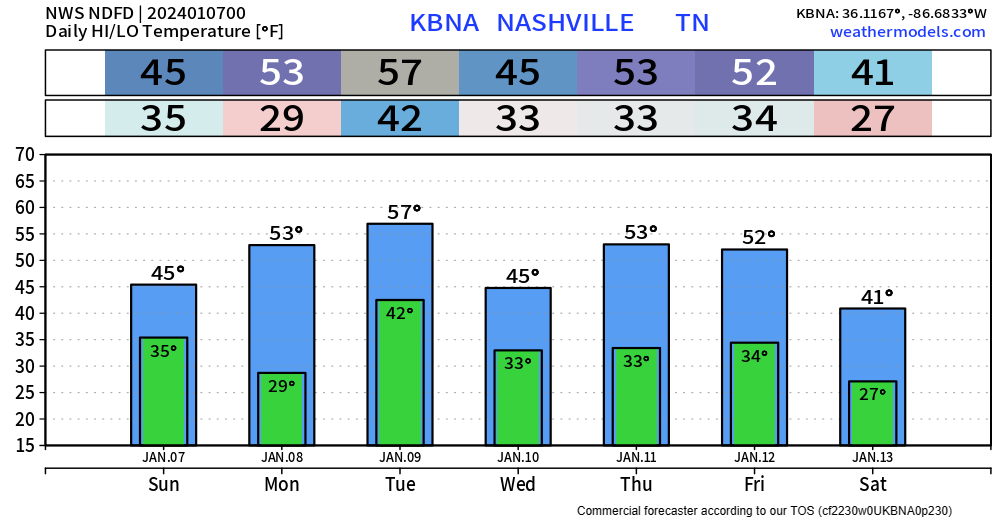
Overnight tonight a cold front will swing thru, bringing in our very cold air. Along the front, there could be some flurries. Areas north of I-40 could see a dusting, no major impacts expected.
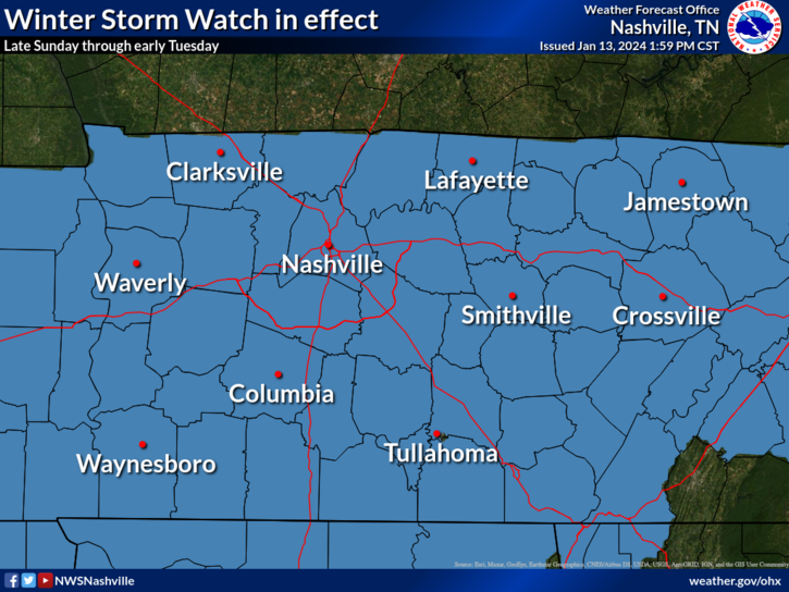
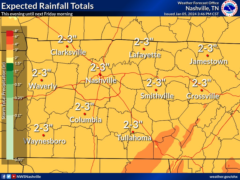
Both of our counties are under a Winter Storm Watch from Sunday evening thru Tuesday morning. This will likely be changed to a Winter Storm Warning later tonight or tomorrow.


You must be logged in to post a comment.