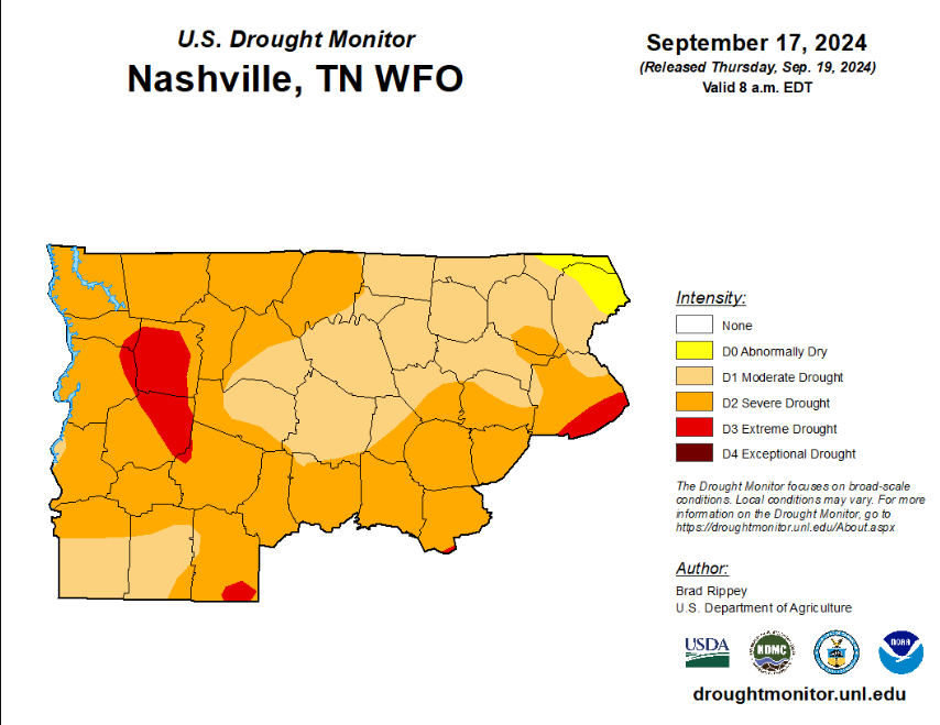
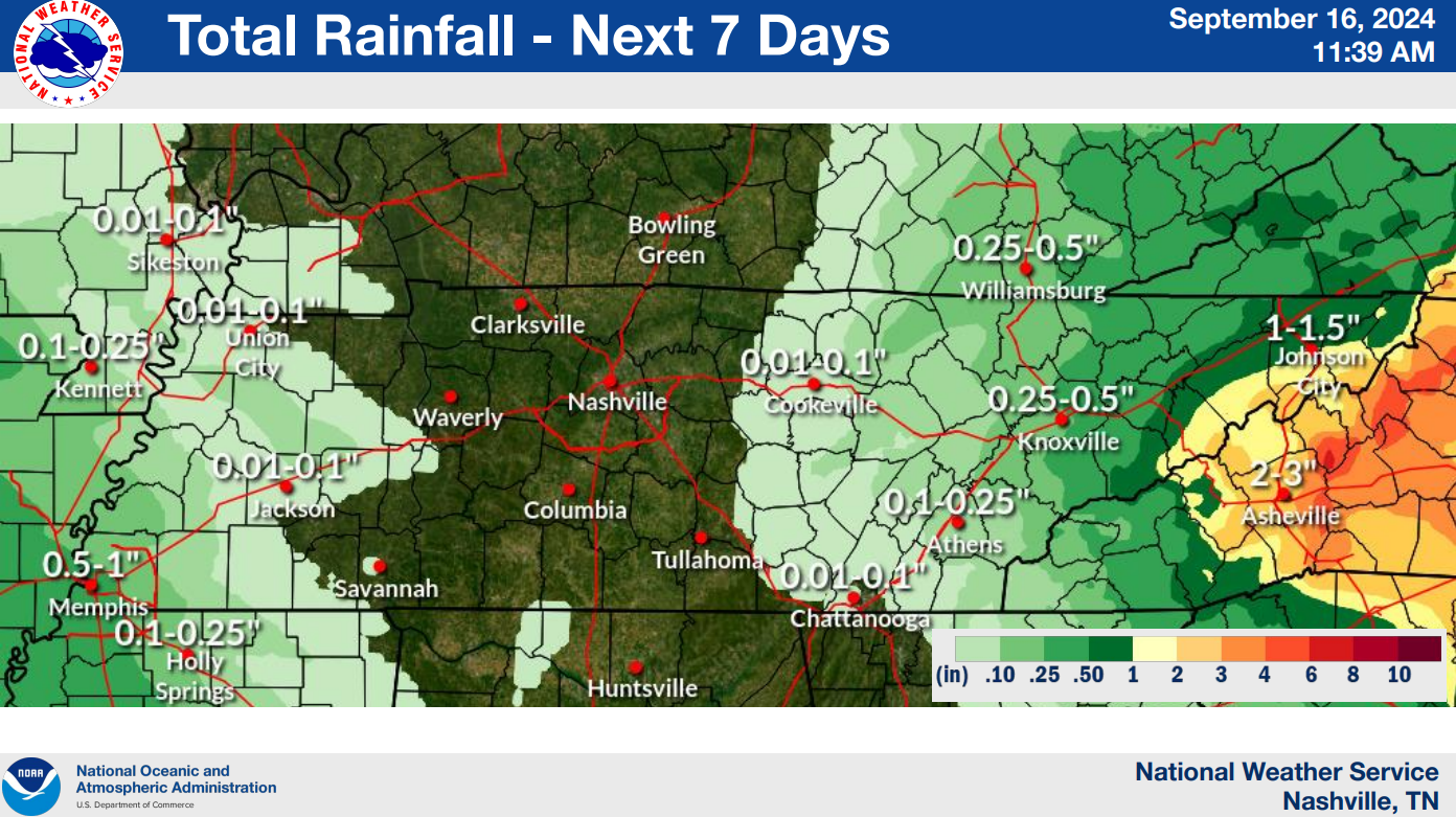
On and off light rain is moving into the area.

HRRR (above) shows the rain ending early Sunday morning. We should be dry for your drive to church, brunch, Titans game.

Rainfall totals look like not an awful lot, only 0.25″ – 0.5″.
Started out with temps below freezing this morning, but plenty of sunshine has propelled our temperatures into the mid to upper 50s.
This will be a reoccurring theme throughout the work week.
Rain chances will increase Saturday/Sunday thanks to a low-pressure system to our south. Usually around this time of year, if we mention a low-pressure system to our south, we’d normally have to talk about snow. However, with no cold air in place, we’ll be stuck with just rain chances.
A Tornado Watch has been issued for both of our counties until 7pm tonight.
Our probabilities from the Storm Prediction Center are:
Our main threat today continues to be damaging straight-line winds, but severe hail and a tornado or two cannot be ruled out.