

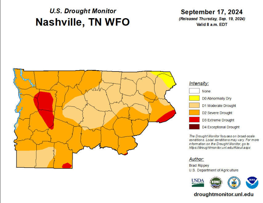
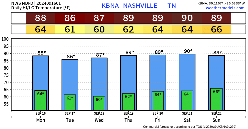
Hot this weekend with temps in the low 90s. Fall officially arrives at 7:43p on Sunday, but it won’t feel like it. “Fall-like” temps hold off until middle of next week.
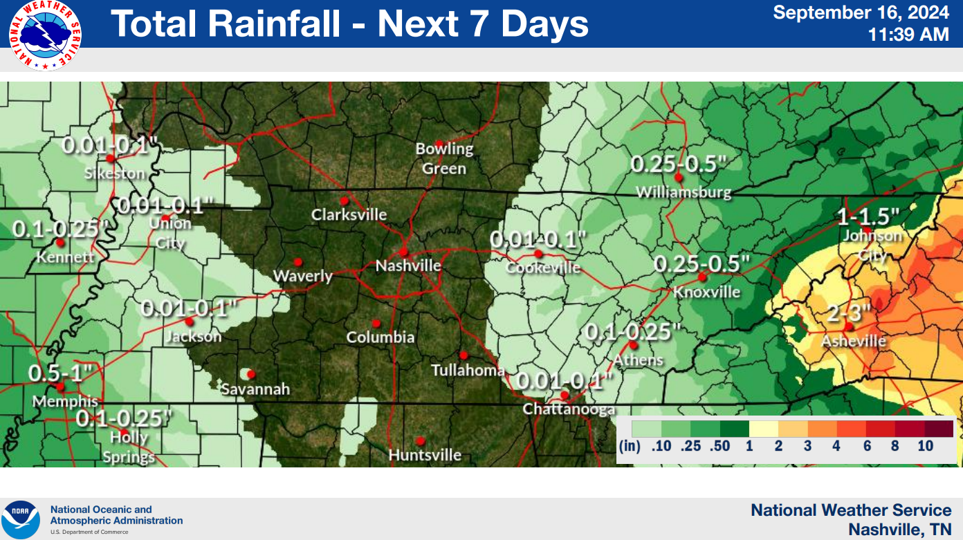
Low chance of a shower this weekend. Most of us stay dry, but a few of us could get a quick shower. NBD – no need to alter outdoor plans.


You must be logged in to post a comment.