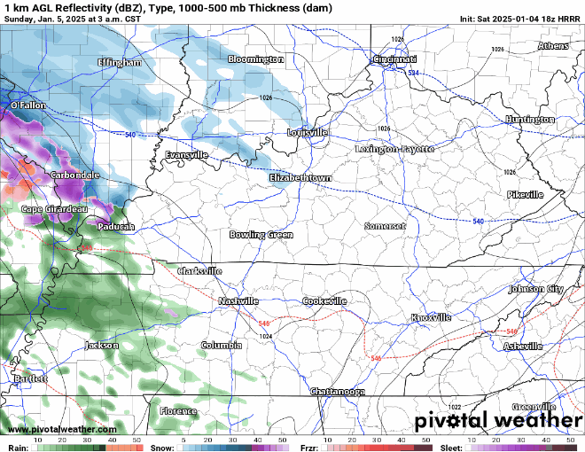
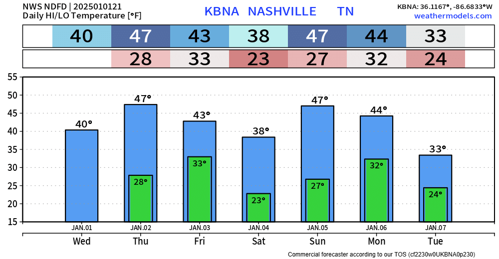
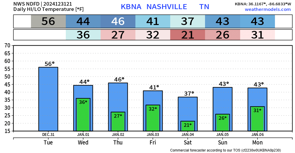
BNA officially ended October with 0.49″ of rainfall, not very much. Your backyard could’ve seen more/less, just depends on location.

Stubborn clouds that have finally cleared kept the temps down today, with highs only in the upper 60s for most.
BNA officially ended October with 0.49″ of rainfall, not very much. Your backyard could’ve seen more/less, just depends on location.

Stubborn clouds that have finally cleared kept the temps down today, with highs only in the upper 60s for most.
Happy Halloween!

A line of rain (heavy at times) is quickly approaching, bringing us our second rain chance of the month.
You can check the radar anytime on our website here: Radar | Nashville Severe Weather
Rain is likely on Halloween – just the exact timing is still up in the air.
Best way to get a grasp on timing is to dive in the models, which can still be wrong!
The latest HRRR model (below) shows a line of moderate rain moving thru during the afternoon and evening, mostly out by 8pm or so, with lingering on/off showers possible.
Models continue to indicate that we could be in for some rain Thursday afternoon and evening. While exact timing is still iffy, current guesstimates are not the best news for trick or treating.
The Euro (left) and GFS (right) continue to be quite consistent in agreement with rain in the area during prime trick or treat time.

Models continue to indicate Halloween may be a wet one.
While the week up until Thursday will be dry, a cold front will approach us and bring us our rain chances.
The GFS, Euro, and ICON model continue to be consistent with timing, showing a rainy time for candy getting. While the NAM model thinks maybe the rain holds off just a tad, allowing for some dry trick or treating.
Officially 0.05″ of rain fell at BNA yesterday, other places got closer to an inch of rain. Most didn’t get a ton, but at least it’s something.
Our second rain chance this month will of course fall on Halloween, potentially putting a damper on trick or treating.
Daily record high of 84° at BNA was broken today – we got all the way up to 87°. Late October or May? A strong SW wind has helped really get those temps up today – gusting to 20 mph at times. Winds should relax as we get closer to sunset.
Before the cold front, record high temps will be possible on Friday. The daily record high is 84° and the current forecast is 86° – nearly 20° above average for this time of year.
Winds could get a little breezy Friday afternoon and evening, with gusts up to 20mph.
Still our only rain chance in the next 7 days is the potential for a sprinkle, maybe a quick shower Friday night thru Saturday morning.
“NBM has a slight chance pop for Friday night in our northern counties, but a shower appears possible area wide Friday night into Saturday per GFS/ECMWF.” – NWS Nashville AFD
Today is the 23rd consecutive day of no rain. That is no good.
The only chance of rain in the next week, and it’s not very promising, is Friday night into Saturday morning.
And by chance of rain, the current probability of seeing any measurable rainfall is ~10%. The odds are certainly against us, and at most it would be a quick sprinkle. Nothing of significance.
You must be logged in to post a comment.