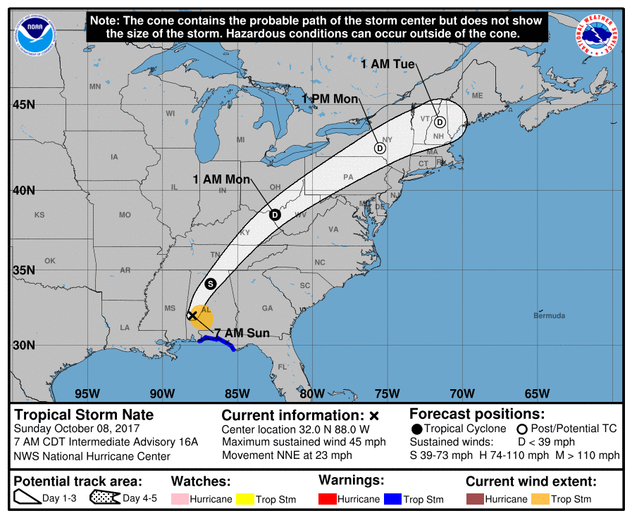
Hurricane Nate made landfall on the northern Gulf Coast.
Nate’s now a tropical storm, speeding northeast into Middle and Eastern Tennessee. The center of Nate should pass east of us.

Rain
Off and on all day.

Hurricane Nate made landfall on the northern Gulf Coast.
Nate’s now a tropical storm, speeding northeast into Middle and Eastern Tennessee. The center of Nate should pass east of us.
Off and on all day.

Testing streaming with some new equipment. Here’s Will (and Sam) on tonight’s sunset:
October means “you’ll say ‘brrrr’ eight times.”
You’ll probably want a jacket in the morning.

Heat and humidity will continue through Wednesday, but rain isn’t expected over the next 7 days.
A dry north wind is on the way thanks to Hurricane Maria.
Hurricane Maria will pass northward off the Mid-Atlantic coast by mid-week, then into the North Atlantic Ocean at the end of the week. We’re on the western side of it, and as a result we will receive a dry northerly surface wind.
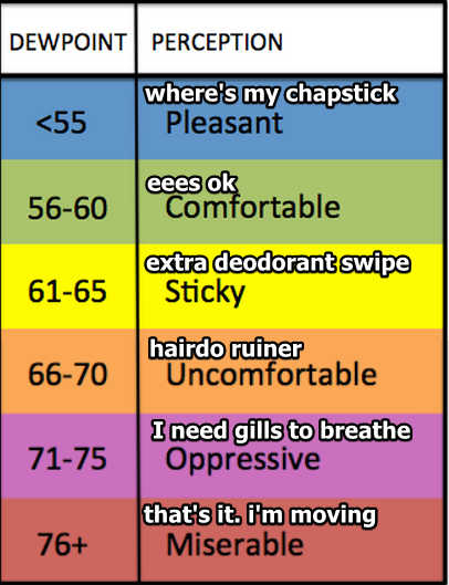
Heat and humidity remain. Mid/Upper 60° dewpoints with a high temp of 91° in the shade. It’s going to be much hotter in the sun.
Gross.
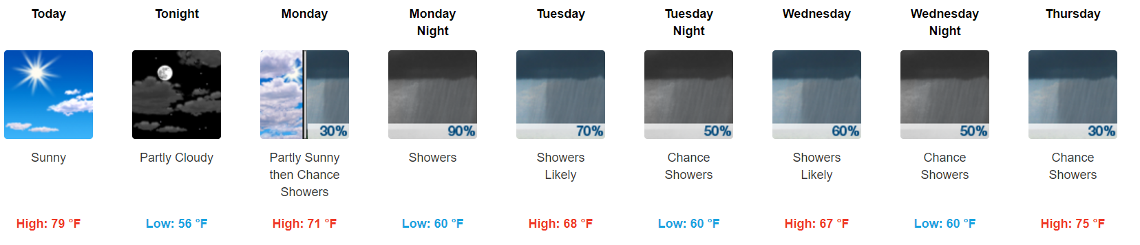
Our chance of a brief shower today is small. Someone in Tennessee will get a little wet, it probably won’t be us, but it might. A classic summertime battle of competing forces is to blame for forecast uncertainty:
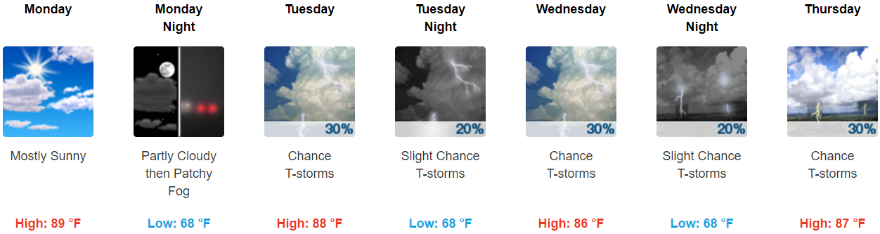
Monday — Rain chances remain very low. The better rain chances will be northwest of Nashville.
Rest of the Week — The morning shift at NWS-Nashville thought Wednesday afternoon would bring the best chance of rain.
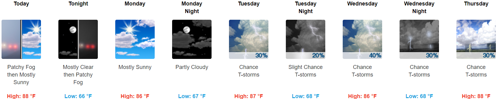
Today — Temps soaring to 88° this afternoon should lift our sweaty, drippy air mass, producing a few pop up showers or weak storms somewhere in Middle Tennessee. The rain will probably be northwest of us, but we can’t rule out a shower. Without low instability, this will probably be a non-event, which will end as temps fall tonight.
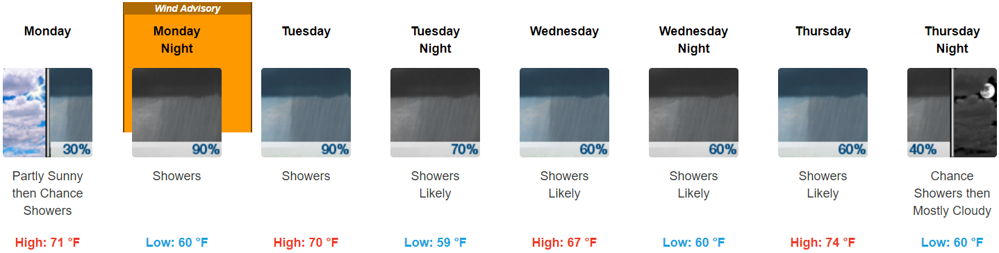
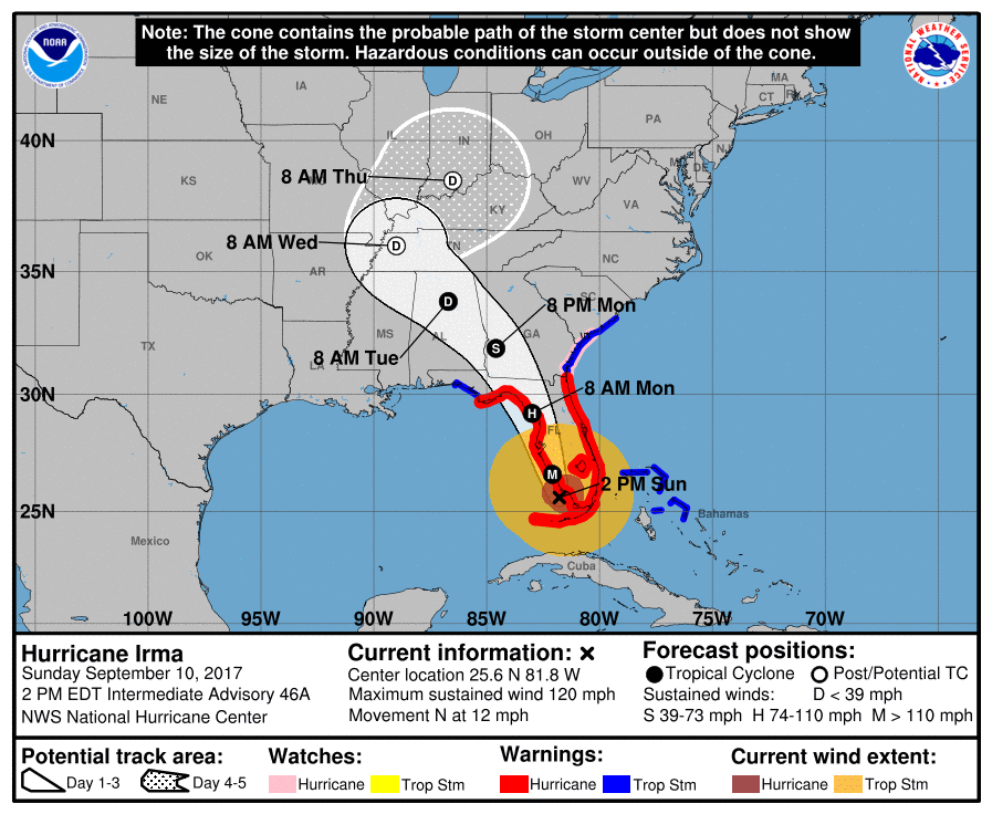
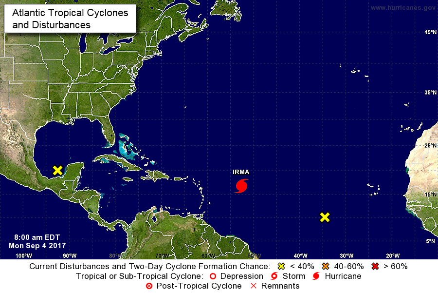
Late Monday night, Irma’s center will pass to our south. See the red “L” below.
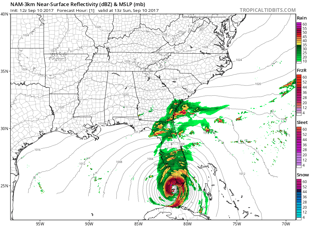
Irma is a large storm. Before Irma’s center crosses I-65 in Alabama, rain will approach from our southeast.
This morning, Irma is a Cat 4 hurricane with maximum sustained winds of 130 MPH.
Sunrise revealed Irma’s eye striking Key West at 7:49 AM CDT:

Irma is a large storm. Although its center is in Key West, the moisture train extends to the North Carolina-Virginia border:
We aren’t sure when it’ll start.
Chances begin around 3 AM, or . . . around 10 AM . . . or sometime in between. Models disagree!

(1) The NAM3 model thinks 3 AM. Here it is coming down I-24 tonight:
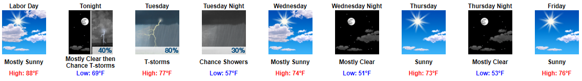
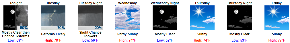
Sunny, high 88°, with mid-60°s dewpoint will make a great Labor Day.
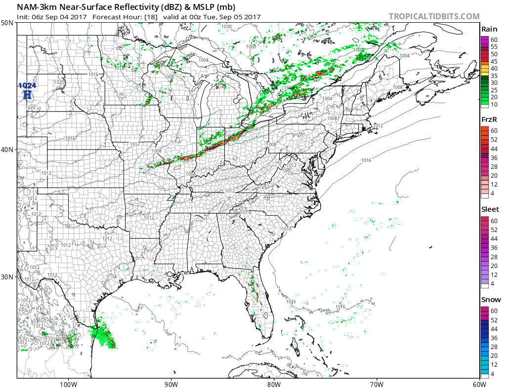
Late tonight, rain and a few thunderstorms will form in the midwest, then dive southeast, pick up I-24, and arrive here in the wee hours of Tuesday morning.
You must be logged in to post a comment.