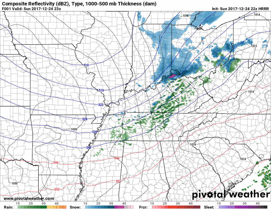
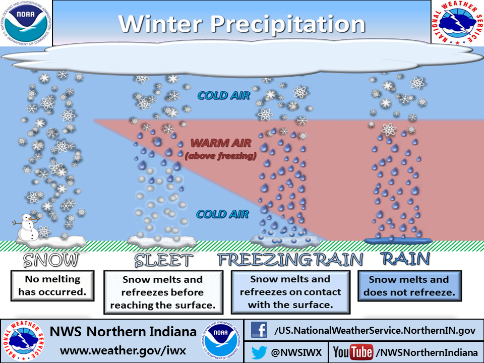
On close inspection, as this afternoon’s rain fell, it turned into a wintry mix at about 1,000 feet. As that mix skydove, it encountered above-freezing air, changing it back to rain. That rain hit your windshield having had a wild ride.

On close inspection, as this afternoon’s rain fell, it turned into a wintry mix at about 1,000 feet. As that mix skydove, it encountered above-freezing air, changing it back to rain. That rain hit your windshield having had a wild ride.
If you’re going to the Titans game, it’s going to be cold and windy, bundle up. Winds will run 8-11 MPH by game time. As precip falls later in the afternoon, winds will pick up too. By tonight winds may gust to 28 MPH.

Maybe a little fog early.
Rain should begin Tuesday night.
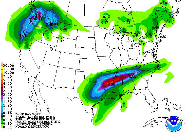
Southern Middle Tennessee should see the most rain, a real soaker, more than 2″.
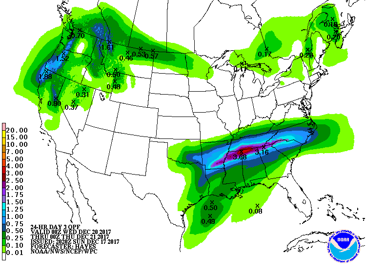
It’s possible the models are a bit off and we will see that very heavy rain here.
This gross cold rain should end before or by noon, replaced by drizzly foggy funk beneath a blanket of clouds.
From NWS-Nashville:
The last recorded rainfall at Nashville airport was back on December 5th. While today`s rainfall isn`t going to go far to relieve us from this latest snap of dry weather, we will make up for it through the rest of this week.
A sprinkle is possible but no measurable rainfall is expected. A forgotten umbrella is no big deal.
Southwest wind pumping in warmer air.
The afternoon forecast shift for NWS-Nashville removed our slight chance of flurries. The flurry chance is really for the Plateau, further east and at higher elevation.
Finally, the sun comes out. Warmer. A bit breezy. We may even reach the lower 50°s.
Another cold start, but more sun, more southwest winds, therefore warmer.
A small area of low pressure will streak across Middle Tennessee Monday night into Tuesday morning. This will bring sprinkles and some flurries mainly across the plateau, but we could see a few flakes fly over here.

One more nice day, y’all.
Winds will gradually increase Monday. Secure your outdoor Christmas stuff. Winds will gust near 30 MPH Monday night.
That’s right, it’s another @WendyMonday! Get it?!
Sunshine today, maybe a few clouds here and there, mid 60s this afternoon, gentle east breeze blowing over the top of Nissan Stadium for the Titans game.
Pretty great for December 3.
It’s all going downhill from here.
Fluctuations in temperature this week have to do with which way the wind is blowing.

Colder north winds today will turn south tomorrow and Saturday and warm us up.
Saturday night another cold front arrives to turn the temp back down Sunday, but no rain is expected with the passage of the front.
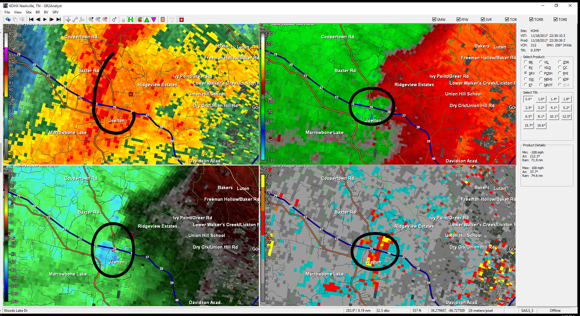
The warning system did well for the “Gladeville” Tornado, because it showed itself on radar.
It was EF-1, winds 100 MPH.
Before the tornado formed, intense straight line winds swept ENE from Cane Ridge.
You must be logged in to post a comment.