Rain is likely Saturday morning, afternoon, and evening. How much and when remains uncertain. Let’s get to it.
ETA
Depends on the model you believe. But we think the storms will arrive early Saturday morning.

Rain is likely Saturday morning, afternoon, and evening. How much and when remains uncertain. Let’s get to it.
Depends on the model you believe. But we think the storms will arrive early Saturday morning.
Temps around sunrise are below freezing. Some areas are in the mid/upper 20°s.
Temps will rise into the low/mid 50°s as clouds arrive this afternoon.
Our air is really dry. No rain expected today.
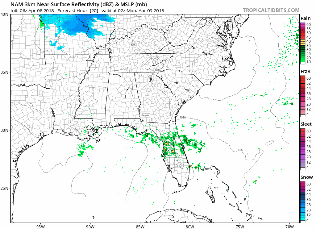
A shortwave will cross by after midnight. It may drop us a little rain, but not enough to rain stuff out. Here’s the NAM3 model:
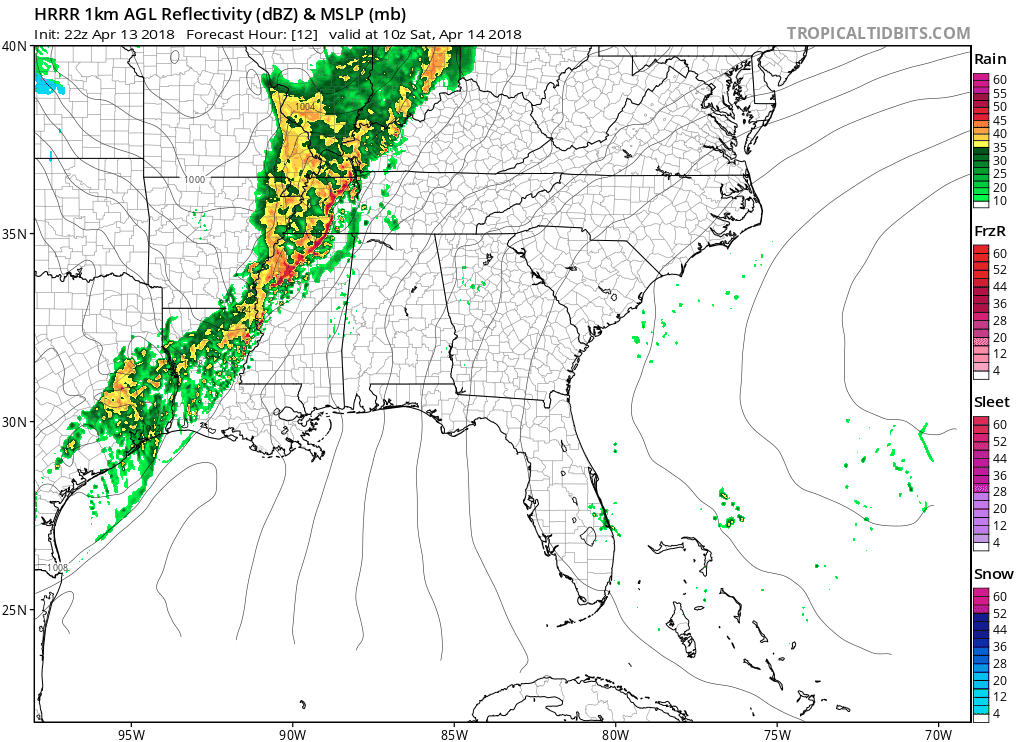
Dewpoints are already over 60° in Middle Tennessee. Temps are rising above 70°. A strong cold front sits out west with its eye on us tonight. The coming collision of cold, dry air slamming into our warm, moist airmass will happen overhead tonight.
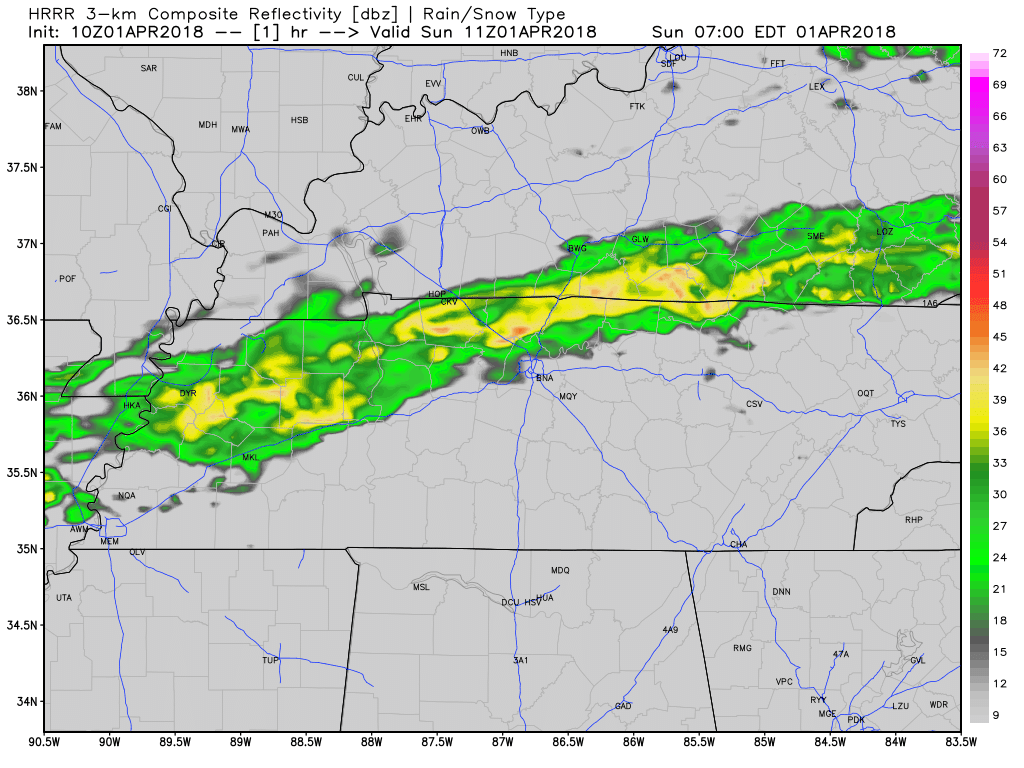
Clouds will gather tonight, forming light rain in the morning. Shortly before lunch, some of the rain may be heavy, at least that’s according to the HRRR model:
A few more showers are possible through the day Monday. It may be enough rain to rain out Monday night games. That will depend on the field.
As I write this, light rain has arrived.
The HRRR model thinks rain will leave before lunch, leaving clouds behind for the rest of the day, with a chance of a passing shower or two by late afternoon:
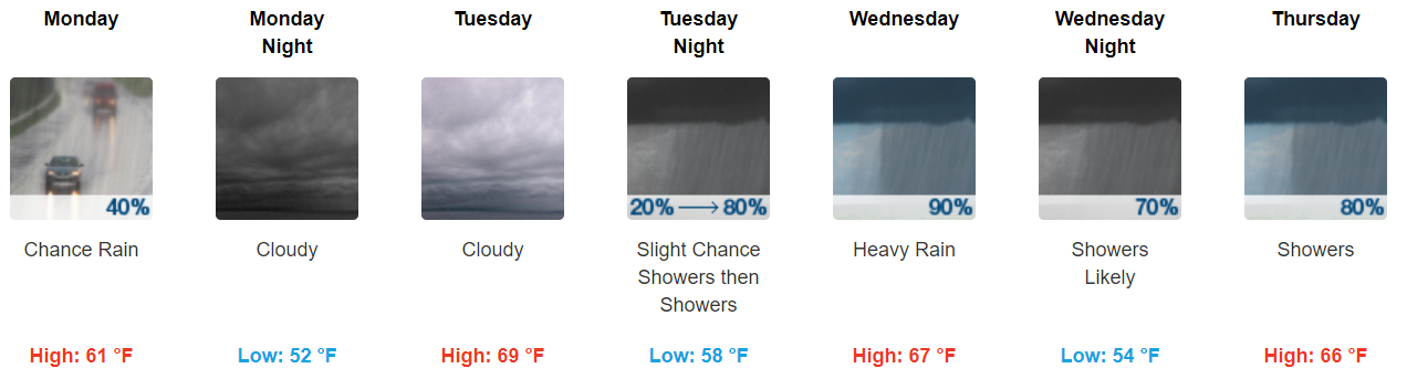
1. Heavy rain showers at times, mainly Tuesday night through Thursday, with some flooding possible.
2. Cloudy all week.
3. No severe thunderstorms expected.
We may see a passing shower or two early this morning. HRRR model thru 8 AM:

1. Heavy rain showers at times, mainly Tuesday night through Thursday, with some flooding possible.
2. Cloudy all week.
3. No severe thunderstorms expected.

Drier and cooler air worked in behind the drizzle, rain, and (for those in Nashville) that thunderstorm last night.
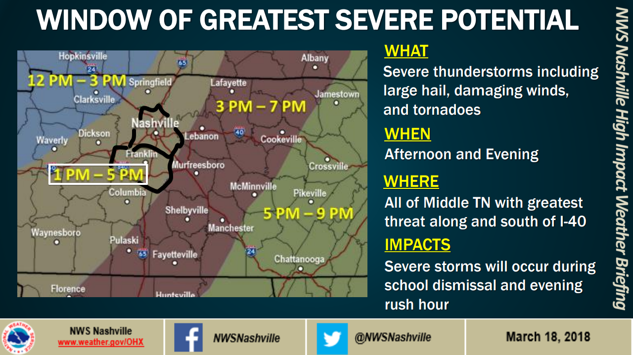
1 PM to 5 PM Monday.
Obviously, this risk will occur during school dismissal and the evening commute.
Hail, and/or damaging thunderstorm winds, and/or tornadoes.
In the order of likelihood, assuming we get a storm: (1) Hail–most likely. (2) Damaging thunderstorm winds–next most likely. (3) Tornadoes–third most likely. Hail is not that much more likely than tornadoes, though. Consult the below chart from NWS-Nashville:
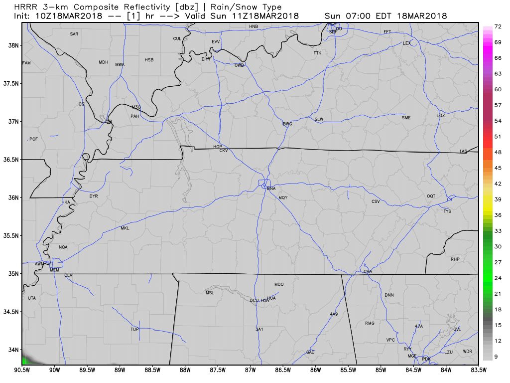
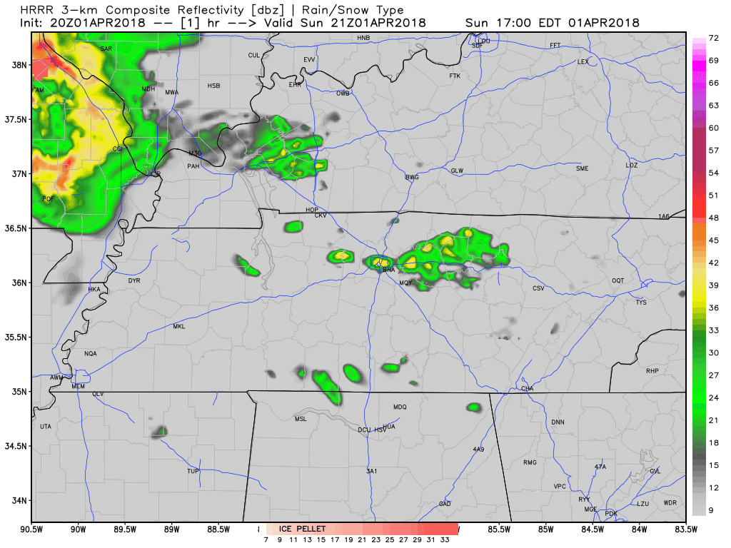
Quickly, about today, we’re not expecting rain. We may see light rain show up late tonight. Here’s the HRRR model’s prediction thru 11 PM:
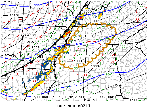
The Storm Prediction Center issues outlooks for severe weather. Six categories for severe weather are used, beginning at general, non-severe thunderstorms, and running all the way from 1 through 5, with five being the “worst.”
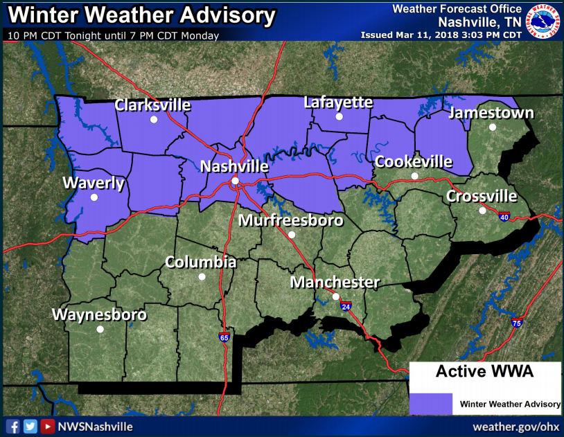
Williamson County is excluded from the Advisory.
So, I’m going to break this down by county.
The Winter Weather Advisory is for the northernmost counties in Middle Tennessee. Davidson County is included as part of the second row of those northernmost counties.
You must be logged in to post a comment.