
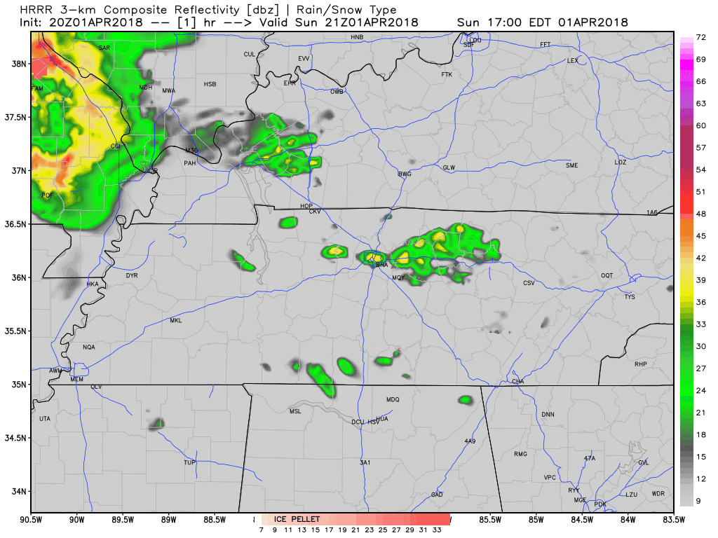
Clouds will gather tonight, forming light rain in the morning. Shortly before lunch, some of the rain may be heavy, at least that’s according to the HRRR model:
A few more showers are possible through the day Monday. It may be enough rain to rain out Monday night games. That will depend on the field.
Windy Tuesday, Line of Storms Tuesday Night
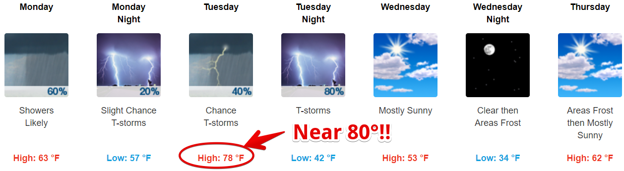
Temps will soar into the upper 70°s Tuesday afternoon while winds gust from the south/southwest over 30 MPH. Meanwhile, a cold front will approach from the west, pushing a line of thunderstorms our way.
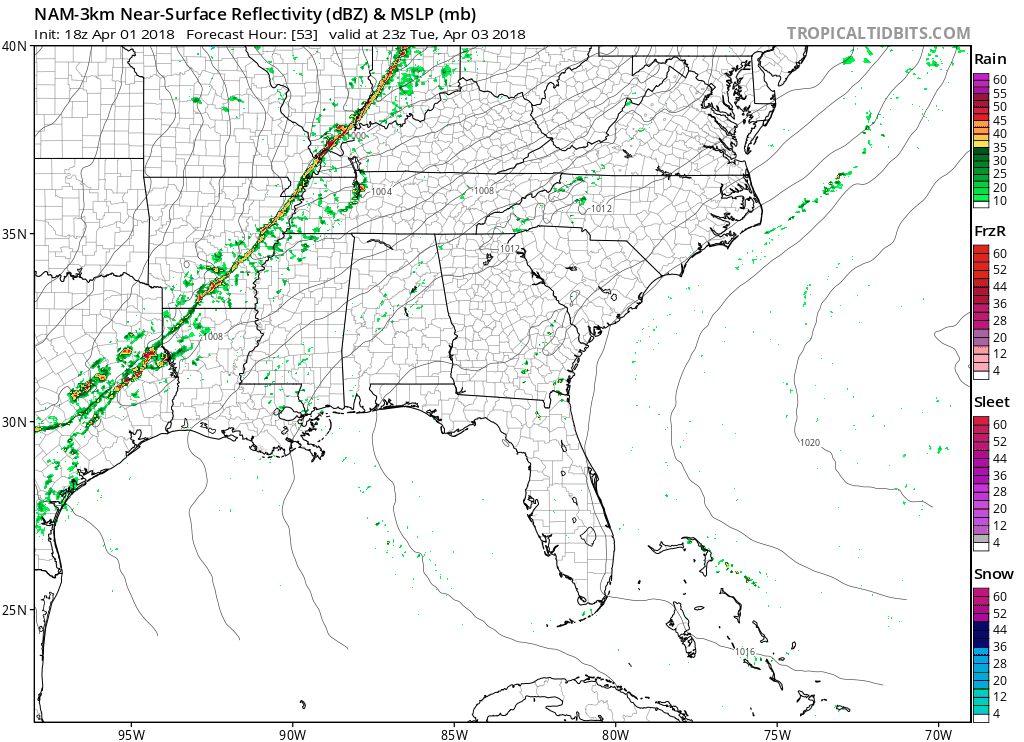
This line of storms is expected to arrive sometime late Tuesday afternoon into Tuesday night. The NAM3 model thinks they will look nasty:
Briefly-heavy rain is most likely, followed by lightning, and, less likely, there’s a damaging straight-line winds risk.
Although this doesn’t have tornado ingredients…
[t]here is a risk for severe thunderstorms. The main low pressure system driving the front will track well north of us, and instability could be lacking, but strong wind fields and adequate instability will likely bring some severe storms with damaging straight line winds.
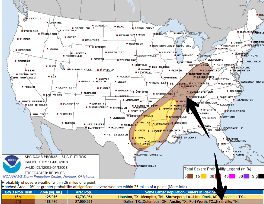
The Storm Prediction Center gives us a 5% chance of a severe weather event happening within 25 miles of you.
Cooler Wednesday & Thursday, Frost Possible Early Thursday AM
Again, from NWS-Nashville:
After the front passes Tuesday night, cooler air will move in for Wednesday and Wednesday night. Frost/Freeze headlines are likely for late Wednesday night into Thursday morning with temps dipping toward 30 degrees.
Officially, the low for us before sunrise Thursday is 33°.
Friday & Saturday, and Beyond
Here we go again, rain now appears likely Saturday.

It’s a six day away forecast, so not worth enough to alter plans, but I wish it didn’t look like rain, possibly thunderstorms.
When NWS-Nashville refers to “unsettled pattern,” they mean rain:
[T]he unsettled pattern will return for Friday into Saturday with another system bringing more showers and possible thunderstorms. It looks like the unsettled pattern will continue into next week as well with a series of systems producing showers every couple of days.
Spring is definitely here.

Categories: Forecast Blogs (Legacy)
You must be logged in to post a comment.