The cold front causing all this rain still has not yet pushed through. Only 0.36″ so far in BNA’s official rain. This system is underperforming model data. Only about 0.5″ total expected.

The cold front causing all this rain still has not yet pushed through. Only 0.36″ so far in BNA’s official rain. This system is underperforming model data. Only about 0.5″ total expected.

Monday and Tuesday will be great. Low 40°s early, warming to 66° Monday and 75° Tuesday. No rain either day. Tuesday night will be breezy and mild, a fact you may find important by the time you get to the bottom of this page.
Tonight will be several degrees warmer with lows dipping to around 40 degrees. By Tuesday morning a weak dry front will dip into the mid state, but will really only bring a change in wind direction. Temperatures are expected to rise into the mid to upper 60s by the afternoon hours making for a pleasant fall day. Wednesday will see similar conditions as light northerly winds and mostly sunny skies continue.
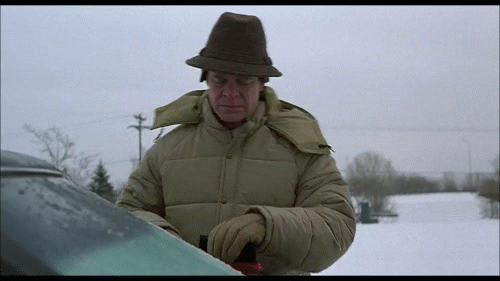
Locate your windshield scraper. You’ll probably need that scraper.
Also cover plants you don’t want freezing temps to kill.
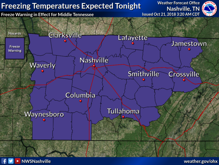
The low is 33° at BNA, 2° colder than last night. Local areas should be colder. Frost is likely with light winds.
Cover or shelter loved plants and locate your windshield scraper.
It was a blast of reinforcing cold northern air. During the 10 PM hour winds hit 35 MPH at BNA. They relaxed after midnight and colder air raced in. BNA hit 35° before sunrise.
First, this happened today. Apologies to anyone who read all 100,000 of these.
This is our 100,000th tweet. Below is tweet #1 from August 10, 2009.
Nothing has changed. https://t.co/naWEDdh6YP
— NashSevereWx (@NashSevereWx) October 15, 2018
Heavy rain is ending, but it’s not over. Most areas along and north of I-40 got 2″ to 3″.
2" to 3" of rain estimated by radar last 12 hours along and north of I-40. Rain slacking off now. Blue arrows depict approach of a cold front. It's 67° now at BNA, expecting upper 50°s before/around dark with arrival of Jerk North Wind. pic.twitter.com/jgz9kJ14So
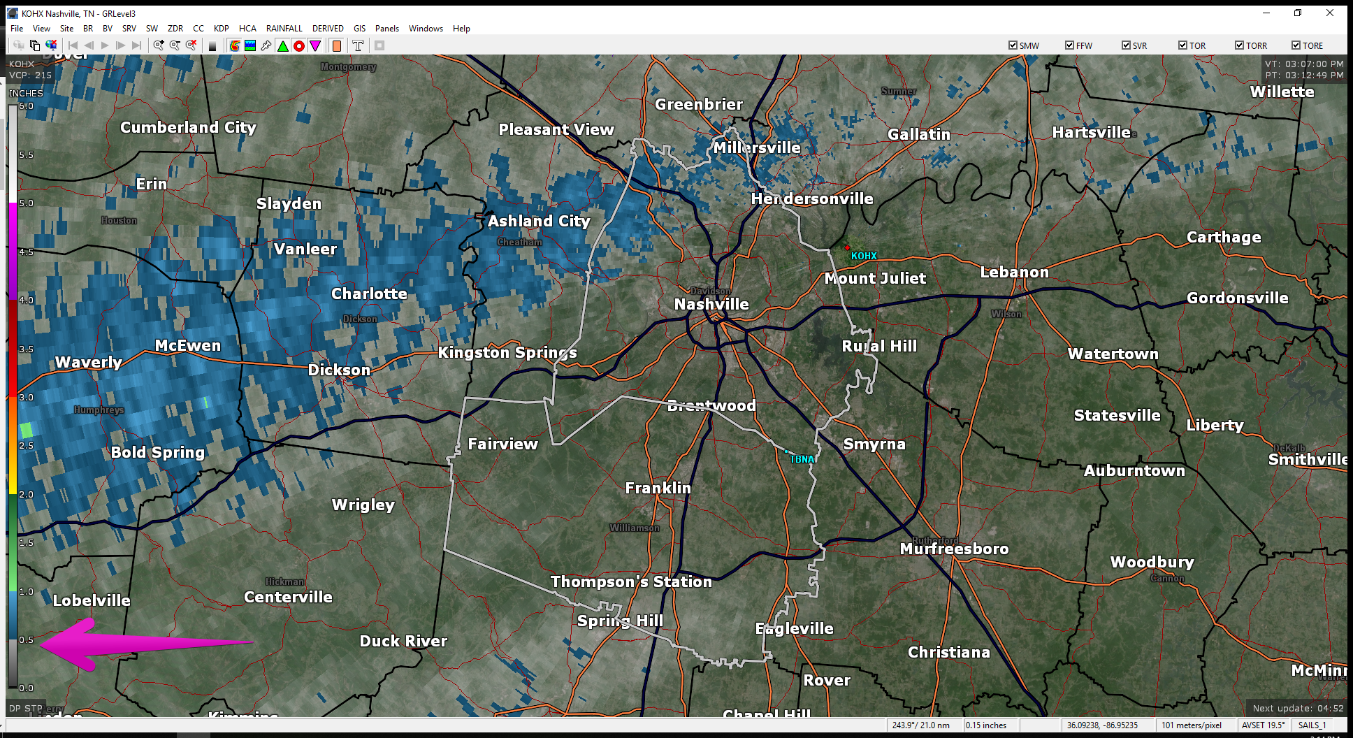
Rain hasn’t been terribly heavy today. As of 3:12 pm, radar estimates most of us have received under a 1/2 inch . Blue indicates 1/2 to 1 inch. That doesn’t include many of us…just Joeltinians/Joeltonites. Someone fill us in on what you’re called if you’re from Joelton. We shouldn’t have started guessing, but since we’re here, help.

It’s going to get cold overnight into the morning.
Ditch the t-shirt. Gonna be cold tomorrow morning!
We’ll only warm to 64° Friday afternoon.
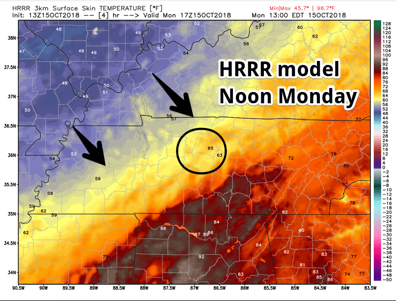
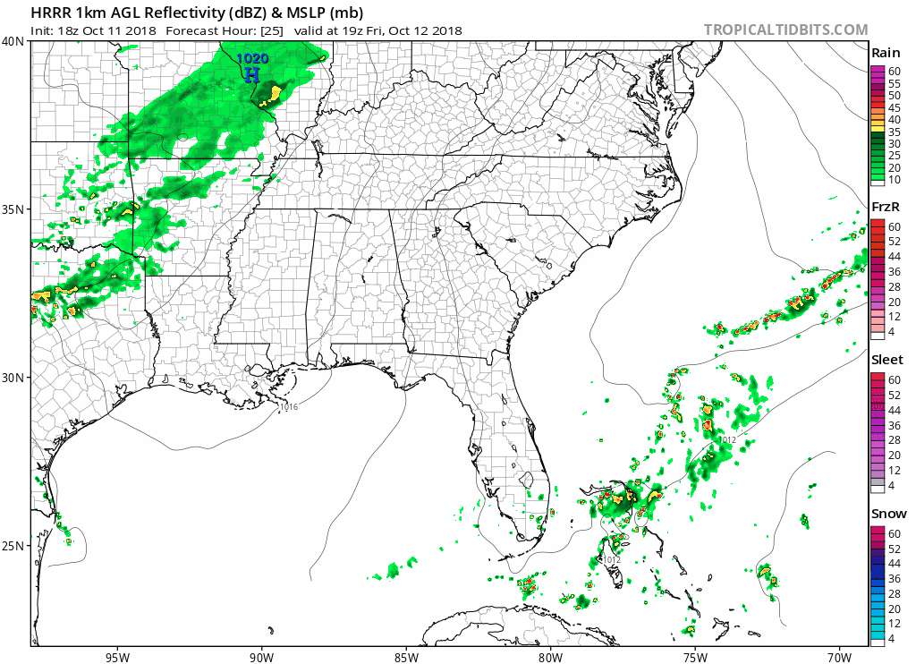
Extended HRRR model run (18z) shows it:

Temps dropped overnight with cold front passage. The front also scoured out summertime humidity.
BNA recorded the drop:
In 12 hours the temp dropped 15° (74° to 59°) and the dewpoint dropped 19° (71° to 52°). #ColdFront #GoodbyeSummer pic.twitter.com/9ESIhcN9Tg
You must be logged in to post a comment.