Author Archives

David

Black Ice Concerns Tonight & Overnight, with 3 more Wintry-Precip-Possible Systems on our Horizon

Image

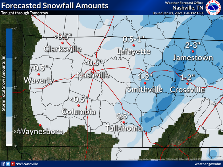
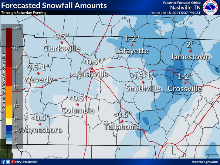
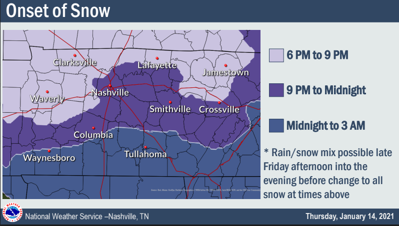
Rain ended after lunch. Instead of dry weather and a stiff wind, we got a steady drizzle for several hours.

Drizzle wet the streets.

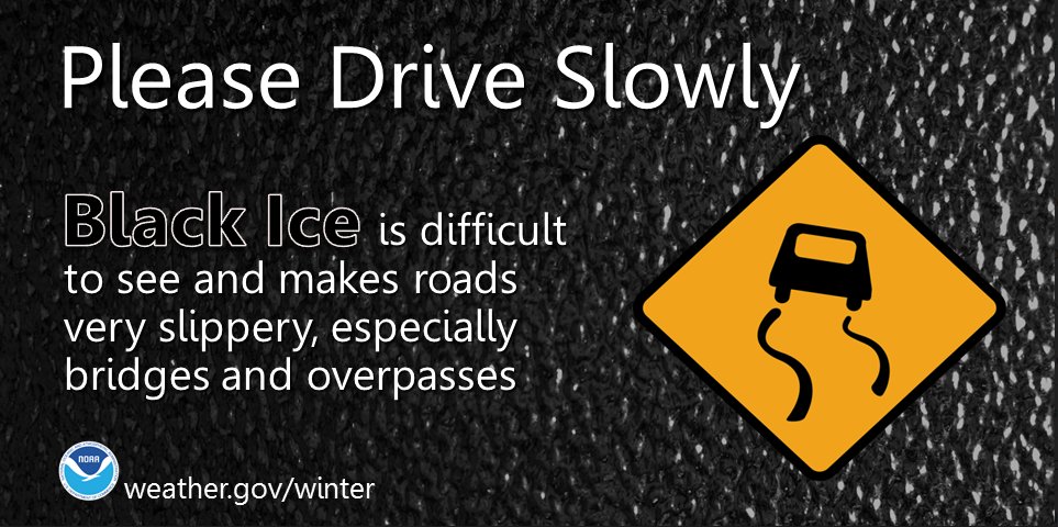
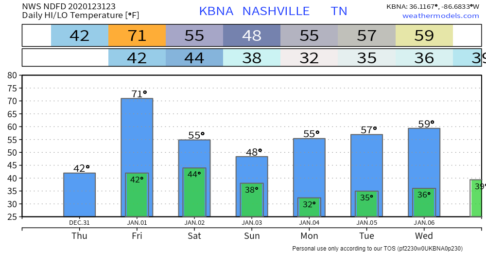
Temps are dropping and should reach freezing everywhere in Davidson and Williamson Counties tonight. Black ice will form in spots, regardless of elevation. Many places will drop to 30°, some may get colder. read more

A Snow Update.

Initial, big snowflakes now falling early this evening will melt on above-freezing surfaces. Temps are supercold and below-freezing above 3,000 feet. Temps are above-freezing below 3,000 feet. Flakes lack the time to change back to sleet or rain by the time they hit the earth. Splat. Melt. read more

Doesn’t Look Good, Snow Fans

Confidence is “low to medium” (NWS-Nashville) in forecast accuracy for snow Monday.

Variables include:

  1. Temperatures. South of us, snow is likely Monday morning. We may be too far north to get snow. Snow may not even extend into Will Co, much less Nashville, but it’ll be close. If snow gets far enough north, by mid-morning surface temps may warm into the mid-30s, causing any flakes to splat:melt. It may even get warm enough to change snow to rain. Noon temps around 35, upper 30s possible Monday afternoon.
  2. Moisture. Most moisture will be well south of us. We will get the northern edge. If we had more moisture incoming, temps wouldn’t rise as fast. But moisture is limited, so those at elevation (hills, on bridges and overpasses) may be the only spots cold enough to collect snow. There’s just not enough “stuff” there to tap to make a good snow event.

NWS-Nashville make no changes to its snow total forecast. Under a half inch, which includes us getting nothing. Most of those north of I-40 get shut out: read more