
Growing szn is “effectively” over. No more Frost or Freeze Warnings. We’ll freeze again this fall/winter for sure. It’s just that there will be no more official frost or freeze warnings from NWS until next fall 👇🏽

Growing szn is “effectively” over. No more Frost or Freeze Warnings. We’ll freeze again this fall/winter for sure. It’s just that there will be no more official frost or freeze warnings from NWS until next fall 👇🏽
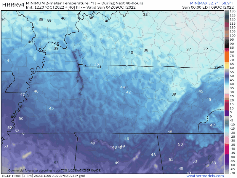
BNA did not hit freezing this morning but BNA runs hot. Most dropped unburrrr1️⃣ 30°. My backyard went sub 29°. Expect a repeat Thursday morning then temps rise 👇🏽
Rain?
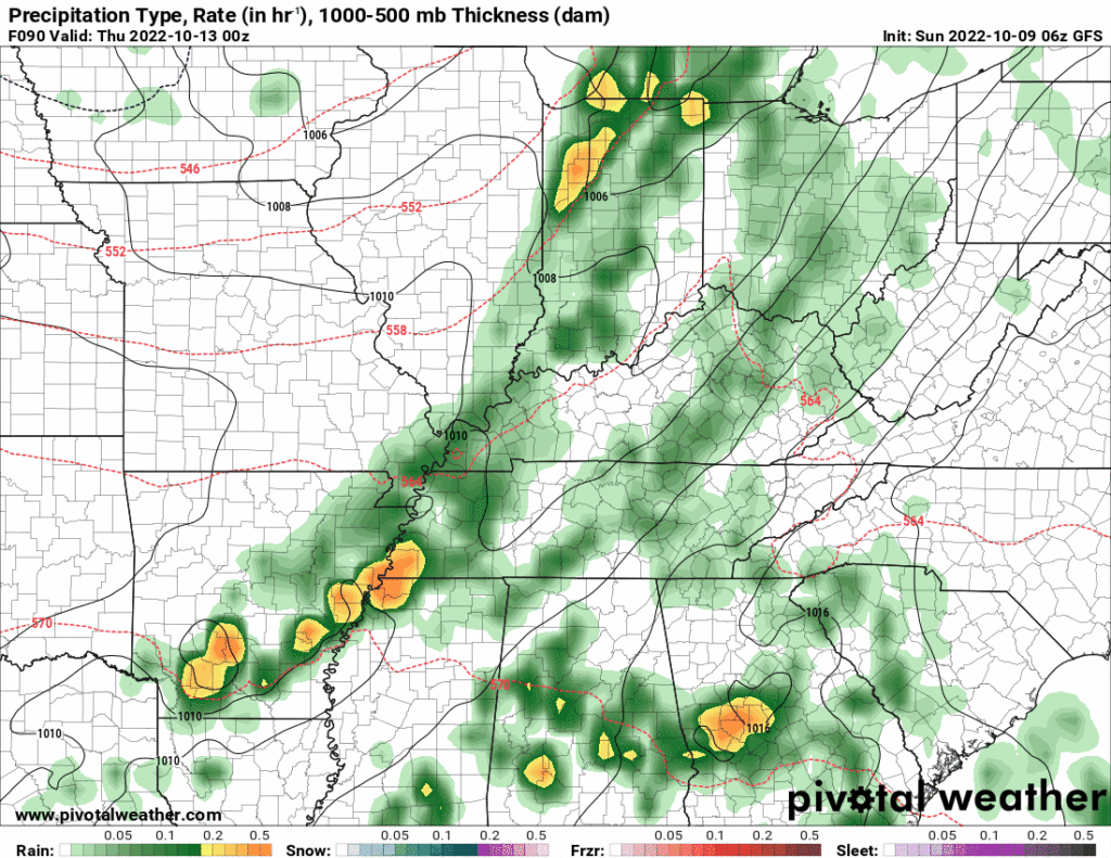
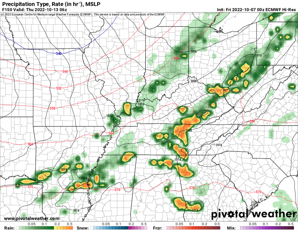
Tuesday Oct 25 to Weds Oct 26 begins next rain chance. Euro mean says around 0.5″ or so total by late next week.
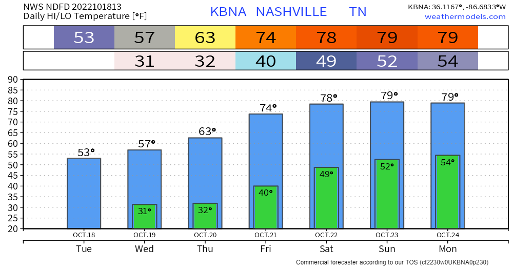
BNA should hit freezing Wednesday morning.
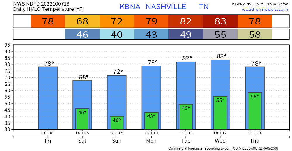
Warm up weekend, near eighty.
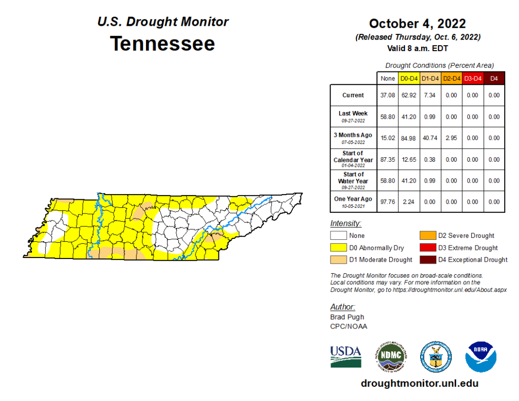
No rain in sight. The Mississippi River at Memphis is at its lowest depth since 1954.
Drought isn’t just local. Much worse west. Mississippi River receiving little water.
A Freeze Warning is in effect officially from 1 AM to 9 AM Tuesday. Coldest temps will happen around sunrise.
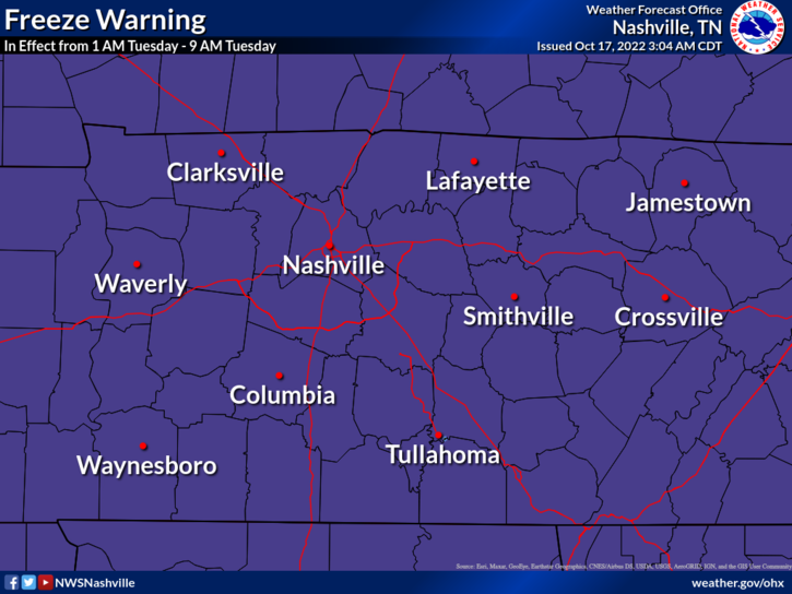
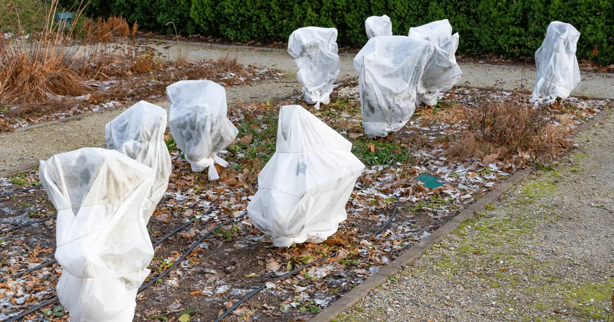
Frost and freeze conditions will kill crops, other sensitive vegetation and possibly damage unprotected outdoor plumbing.
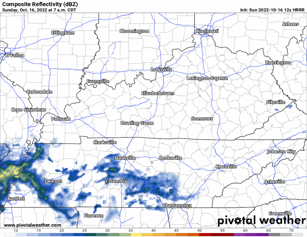
Little bit of rain coming today, meh.
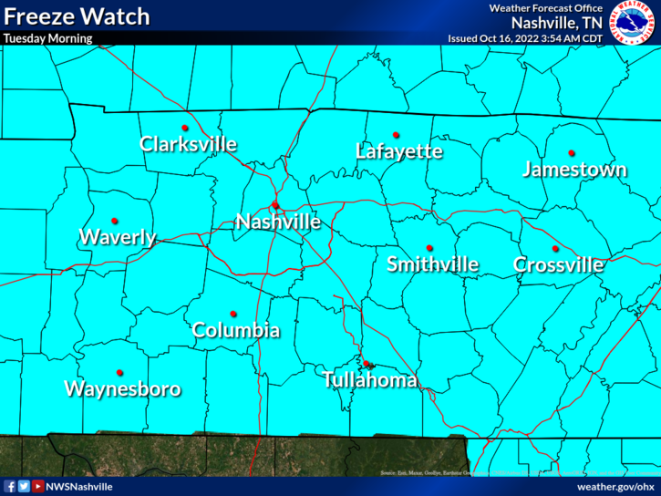
⚠️ Early Tuesday morning Freeze Watch . . .
Frost and freeze conditions could kill crops, other sensitive vegetation, and possibly damage unprotected outdoor plumbing.
Probably won’t rain today. Not totes sure about that but I’m keeping my outdoor plans.
Rain expected Sunday.
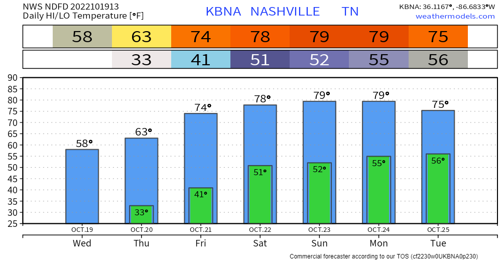
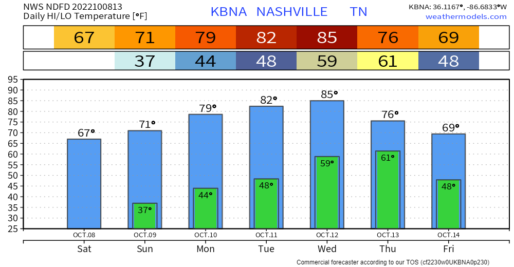
Frozen Tuesday-Wednesday-Thursday mornings incoming. Below chart shows lows around freezing. Most local backyards get a bit colder than official lows so expect below freezing temps 👇🏽:
Fires may spread quickly out of control because
The Warning expires at 7 PM.
Late Saturday into Sunday rain looks meh, off and on. Total under 0.20″ won’t dent drought.
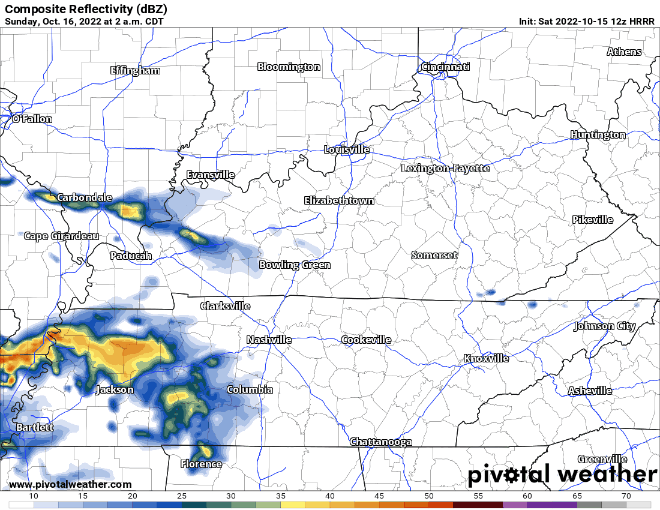
🌩️ Few thunderstorms possible Saturday but the meh severe risk is in that dark green way west of us Saturday 👇🏽
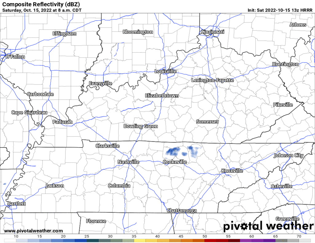
What’ll be a 31 day streak without 0.02″+ of rain might end Thursday morning.
🗣️ Wait, what was that about “might“?
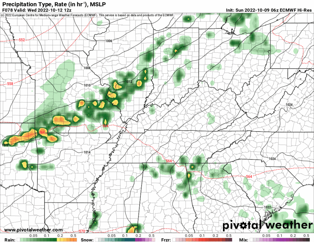
🗣️ Which one is right?
National Blend of Models thinks rain totaling 0.4″, so I guess go for that? I’m not betting on anything. We need the higher res models to get into range Tuesday to get a grip.
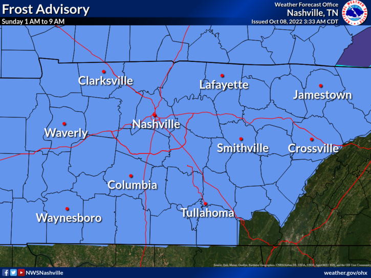
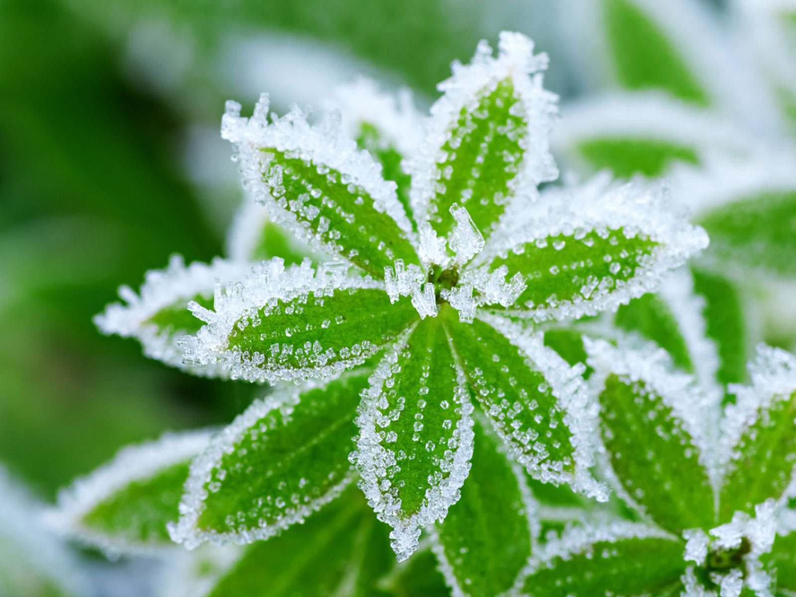
Frost Advisory tonight.
Cover or shelter beloved frost sensitive plants.
Rain increasingly likely late Wednesday into Thursday.
🤞🏽 Thunderstorms – probably not severe – may accompany this rain. This’ll be a “high shear, low instability” event common here in the fall.

Dry cold front arrives today.
Gradual warmup next week 📈.
Drought continues ⌛
Quick References:
Weather changes constantly.
Follow @NashSevereWx on Twitter for any changes to this forecast.
Live coverage during tornado and severe thunderstorm warnings.
You must be logged in to post a comment.