
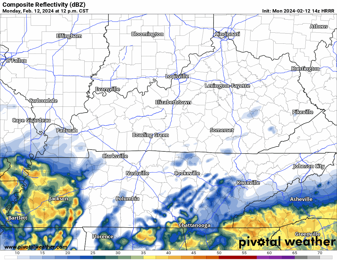
Thunderstorms and heavy downpours in model data, ETA 5-6 PM, plus or minus a few hours. You’ll want to be inside then.
David
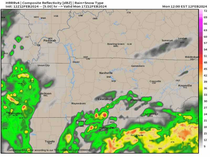
Rain passing thru bt 4:30 PM and 7 PM. Very little snow 9-10 PM tonight. Few/No travel impacts. Bridges, Overpasses, High Elevation Areas may be slick.

Wind chills below freezing from around 9 PM tonight through late morning Sunday.

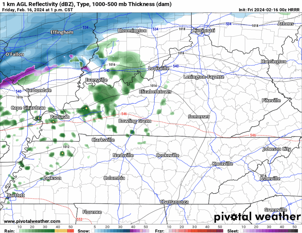
New HRRR model run, Friday timing. Estimates only. May change:
- Rain arriving bt 4 PM – 7 PM
- Rain to Sleet to Snow bt 9 PM – Midnight
Most snow to melt on impact. Little to no accumulation.
Bridges, Overpasses, and Areas at Higher Elevation may be slick late Friday night thru Sat AM. Expecting below freezing temps late Friday night until about 9 AM Sat. Bridges and overpasses are the exception because they cool down way faster than earth.
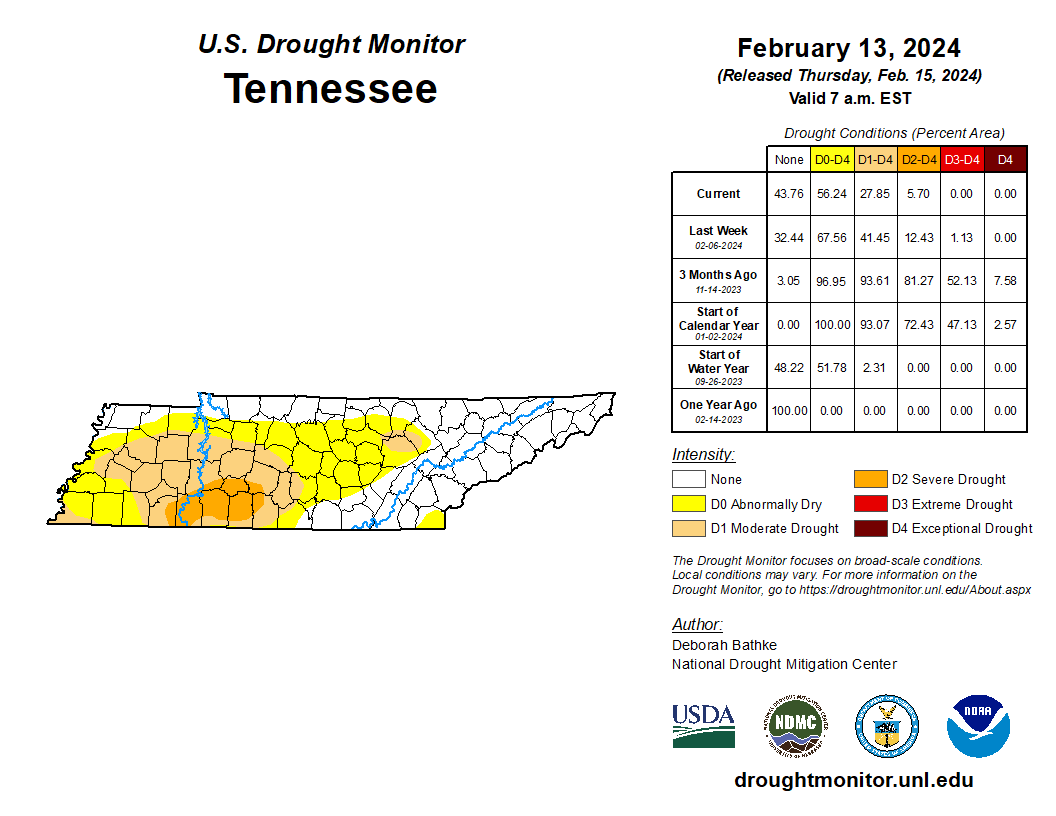
We’re still droughty, just less droughty. Takes time to catch up from our big rain deficit.

Very little/no snow expected locally tonight.
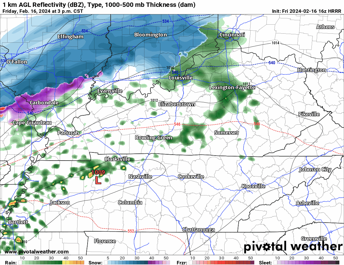
Deets: Notice the surface low (the red L below) that’s now just passed to our south. It’s racing to Knoxville then Carolina mtns.

This means:
- Temps are about to drop fast.
- But precip will pull east and away from us quick.
- The 700 MB chart shows the base of the trough getting here late, delaying local rain/snow transition.
- While flakes may fly, surface temps should be too warm for accumulation.
High elevations may get dusted. 99% of us nah.
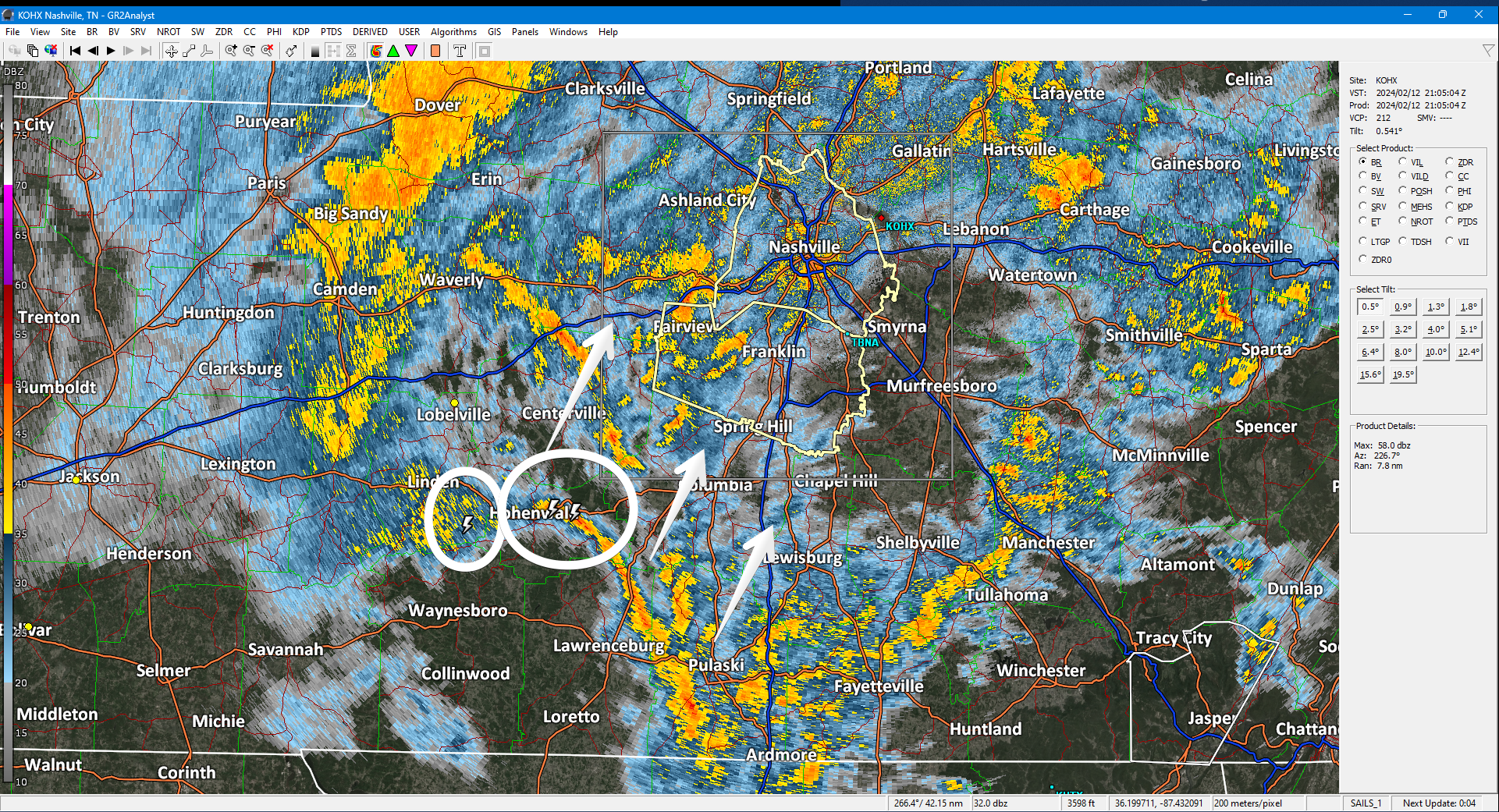
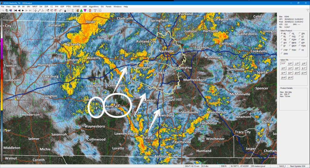
Off/On downpours. Storm center remains south. Some lightning there. Radar below at 305 PM.
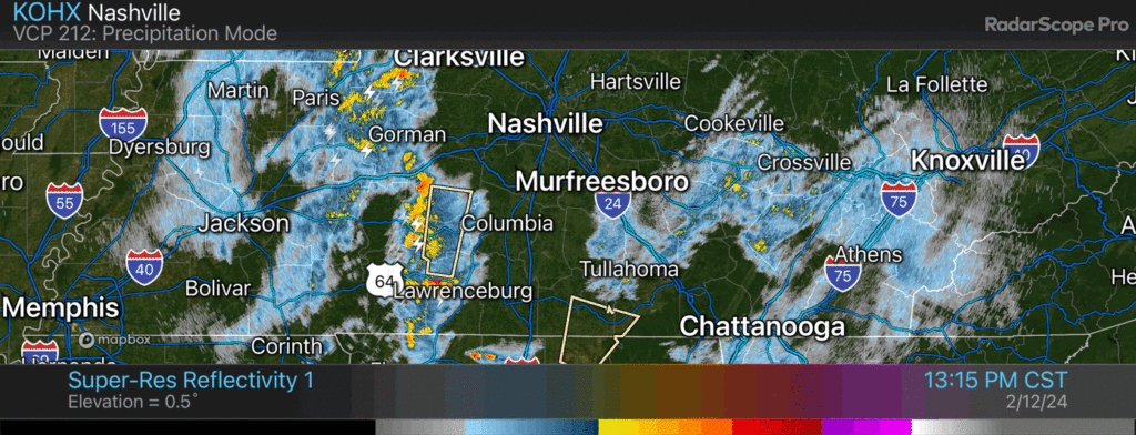
Precip will continue tonight. Mix of rain/snow. Few/No impacts locally. Higher elevations may see a dusting — those up a big hill, Fairview, SE Will Co, and other high spots. HRRR model thinks rain/snow gone by midnight.
Heavy rain, lightning, approaching. Low probability of strong winds and small hail. No tornado.
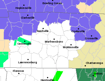
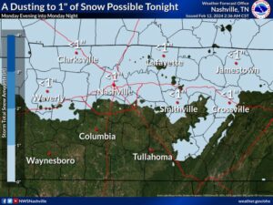
New Winter Weather Advisory does NOT include Nashville or Will Co. Advisory in blue counties below.
Deets: For those in the WWA
There is a lot of uncertainty about snow amounts. If cold air moves in quickly, snow totals could increase above 2 inches for some spots north of I-40. But, since temperatures have been warm, much of the falling snow may melt resulting in little or no accumulation. Either way, any travel impacts are expected to be limited to elevated surfaces like bridges and overpasses.
TLDR: Downpouring during school dismissal thru PM rush hour. Tonight rain/snow mix, very little accumulation. Deets:
HRRR model has the rain coming through late this afternoon. Severe unlikely with expected southern track of the low pressure center.
Heavy afternoon rain. Few storms. Severe unlikely. Tonight: fast cool down. Dusting possible < 1”. New HRRR model has less snow vs last night’s model.
Official NWS-Nashville forecast:
Reason for forecast change: models shifted the center of the storm south. This reduced severe concerns. It increased snow potential.
You must be logged in to post a comment.