
More rain expected overnight. No severe worries. We good, fam. 🛌.
David
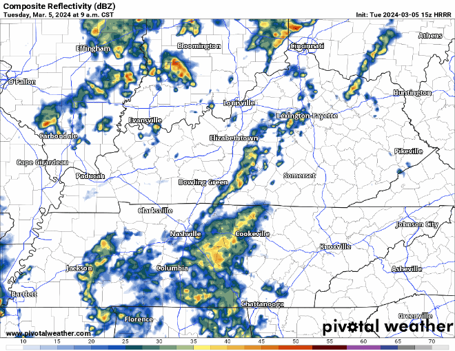
Rain off and on today and tonight. HRRR backed off on lightningstorm threat tonight. No severe weather or flood concerns.
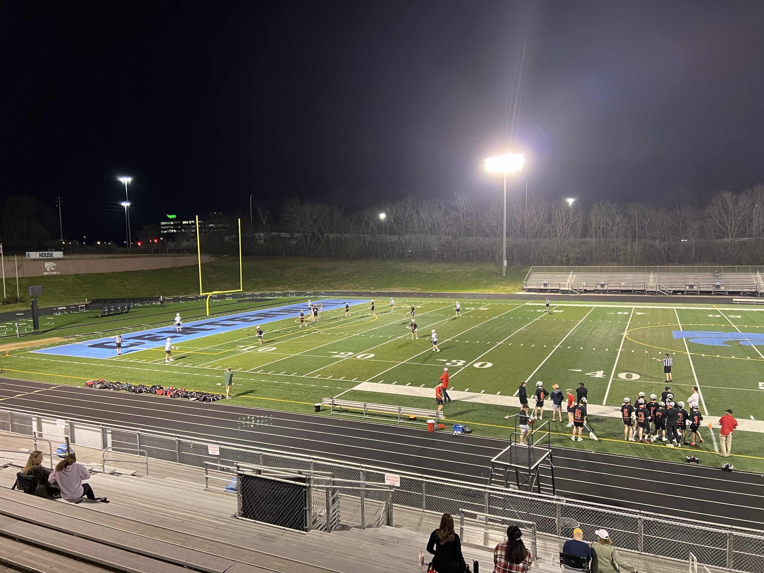
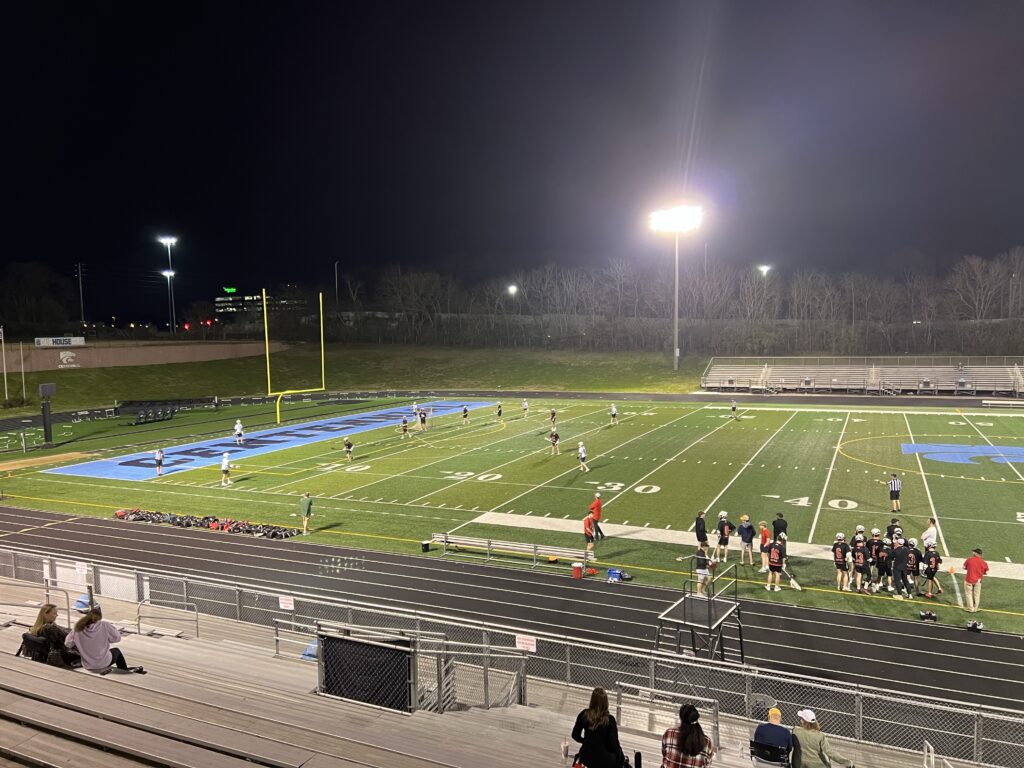
Lacrosse, pickleball (I need a partner), kite flying won’t be possible this time tomorrow night if the HRRR model is correct. ⚡️🌧️
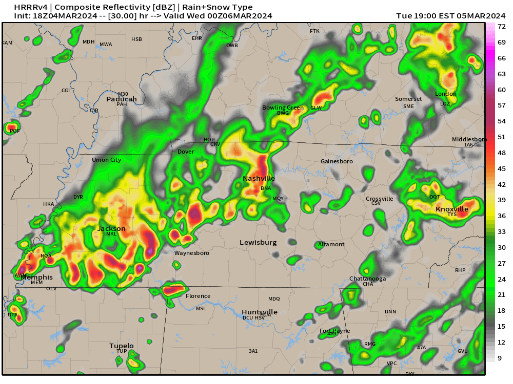
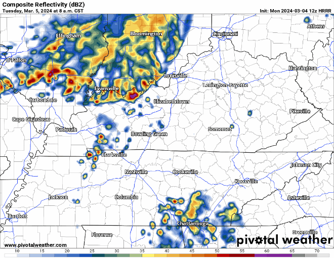
Rainouts, lightning possible Tue night. Iso shower possible Tue AM. Main rain/storm event late afternoon-evening. No severe worries atm. ETAs via HRRR model, subject to change.
Avg total rainfall 0.5″ to 0.75″ well below flood concern levels.
Remembering again Mike + Albree, loved so well by family and friends.
Dense Fog Advisory. #LowBeams
Four years ago tonight a supercell was spinning to our west, moving east. Just after 12:30 AM, it dropped an EF-3 tornado that tore the heart of our city. Tonight and tomorrow we remember our two locals lost, loved so much, missed immeasurably. Written by those who knew and loved them best.
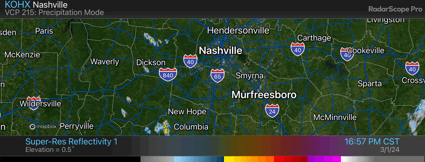
Drizzlemist tonight. Rain developed in Will Co.
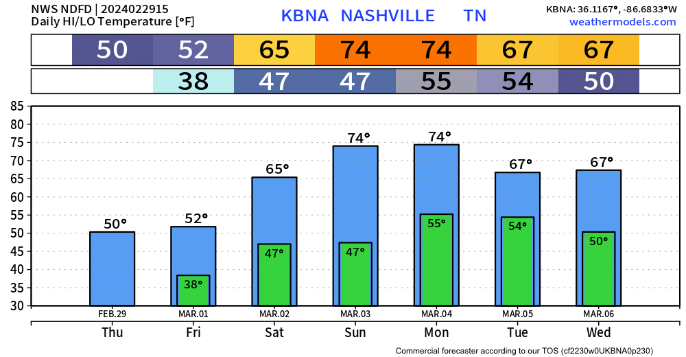
Warm weekend incoming.
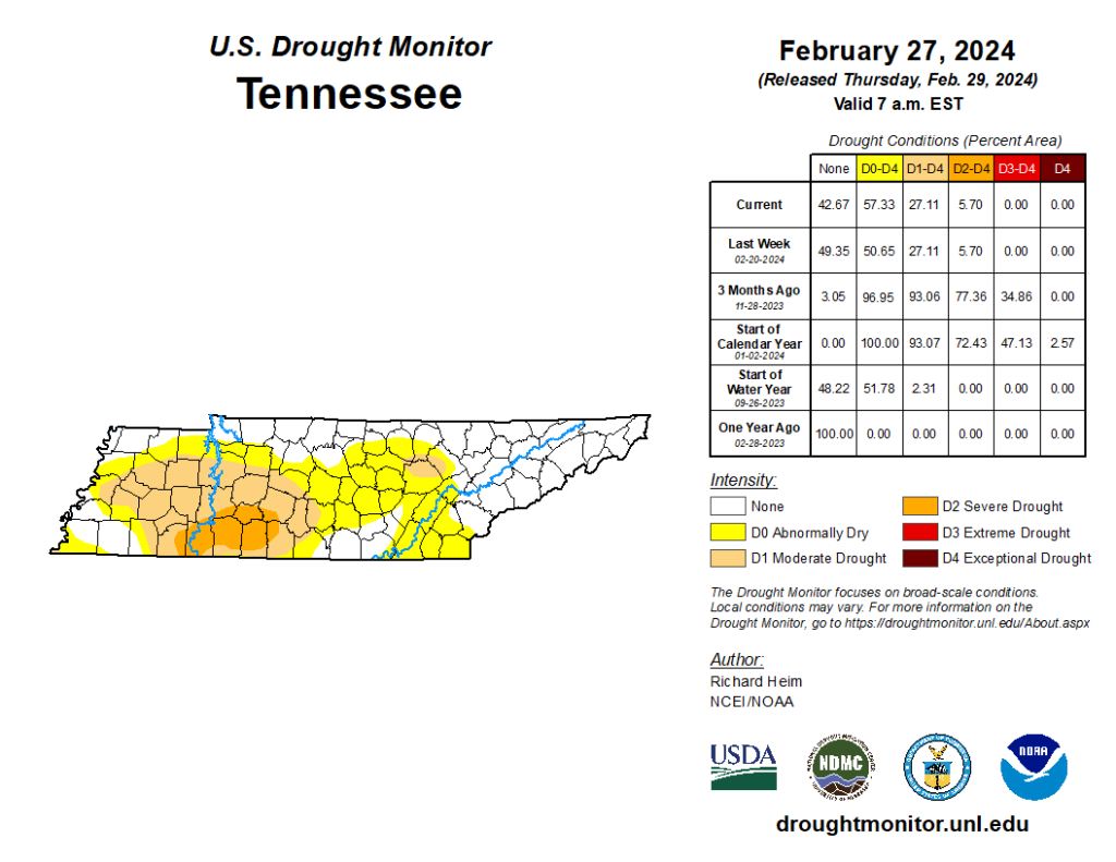
New drought monitor. Most of Nashville out of drought. Many abnormally dry. Low end drought remains for about half of Will Co.
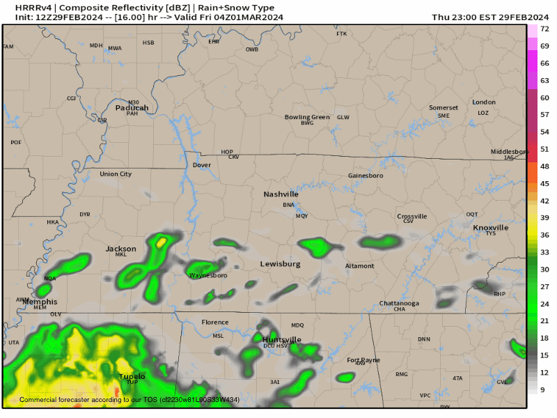
Light rain off and on Friday. HRRR model 👇🏽.
Total rainfall ~ 0.25”.
Rain next week.
“[M]ultiple rounds of rain is expected Monday through at least the middle of the week. Forecast rain amounts over this time period is currently around 1 to 1.5 inches.” -NWS-Nashville
You must be logged in to post a comment.