Current Temps and Radar

Rest of Tuesday – Chilly, Clouds Gradually Clearing – Afternoon High 44°
The clouds should clear out after dark.
Wednesday – Warmer, Sunny – Wake Up 27°, High 49°

Current Temps and Radar
Rest of Tuesday – Chilly, Clouds Gradually Clearing – Afternoon High 44°
The clouds should clear out after dark.
Wednesday – Warmer, Sunny – Wake Up 27°, High 49°
Current Temps and Radar
Tonight expect a cold, intermittent rain to continue. The rain is being generated by a low pressure center moving east across Kentucky. This is the same system poised to smith the east coast with blizzard conditions.
Current Temps and Radar
Today – Rain, Thunderstorms; Overnight Snow? – High 53°
So, yeah, this is weird.
As you can see from the above radar, rain is coming. It should be here this afternoon.
Current Temps and Radar
Friday night’s snow totals:
1/2″ in Bellevue:
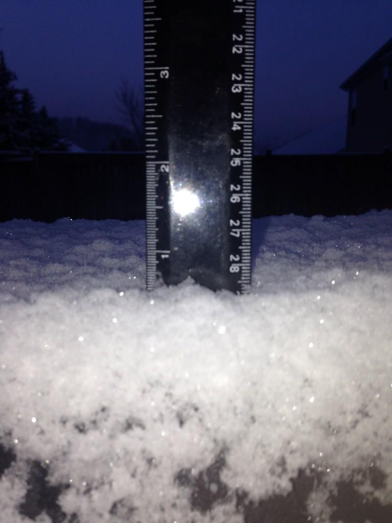
Hermitage 3/4″:
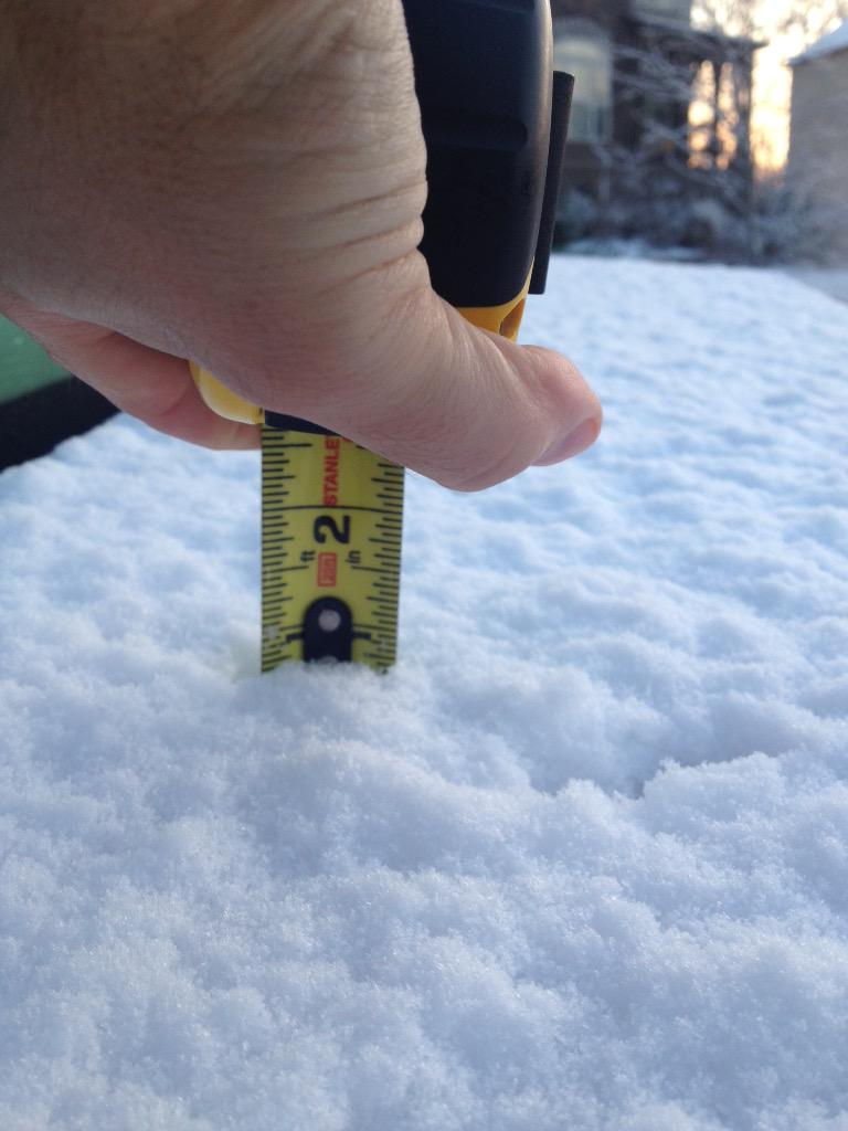
Spring Hill got 3/4″:
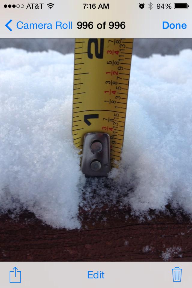
Nolensville, 1″ atop a mailbox post:
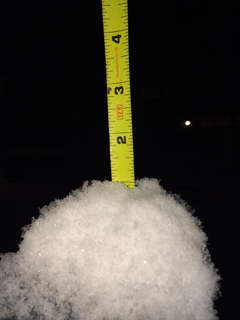
Almost 1″ in Franklin (another spotter reported 1″):
Current Temps and Radar
You’re getting two forecasts with this post. (1) One I wrote, and (2) a video by the Intern 2.0, who by the way is a real person.
Friday Night – Rain, Sleet & Snow
Current Temps and Radar
Friday — Rain. Snow? — Wake Up 35°, High 40°
As you can see from the above radar images, rain is approaching from the SW. We might see a few light showers south of I-40 overnight. By sunrise, precip is expected to arrive, continuing on and off, but mostly “on,” most of the day.
(yeah, probably, you should prepare to be disappointed. But first…).
Current Temps and Radar
,
Click the above box for a full screen radar. Works on all browsers and platforms. Note: seeing “rain” during sunup/sundown? Usually just radar clutter.
Current Temps and Radar
Click the above box for a full screen radar. Works on all browsers and platforms. Note: seeing “rain” during sunup/sundown? Usually just radar clutter.
The Intern 2.0 starts a new semester, and needs to take Tuesdays off.
Current Temps and Radar
Click the above box for a full screen radar. Works on all browsers and platforms.
Martin Luther King Jr Day – Very Nice – Wake Up 36°, High 57°

Tuesday – Evening Chance of Rain – Wake Up 37°, High 59°
Current Temps and Radar
Click the above box for a full screen radar. Works on all browsers and platforms.
The weekend weather gets my seal of approval.


Saturday – Mostly Sunny, Warmer; Small Rain Chance Tonight – High 58°