Search Results for:
Cool Conditions Continue. A Look at the Wintry Precip. Possibility on Saturday.
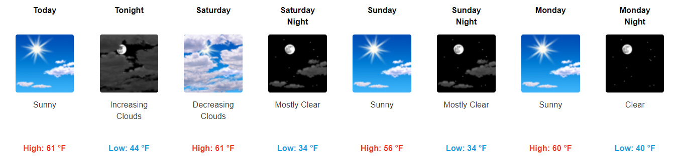
Some Sun and Some Clouds Carry Us into the Weekend
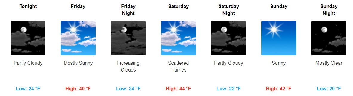
Our cooler temperature pattern looks to continue for the foreseeable future. Temps generally look to stay in the 40s for our highs, and drop into the 20s for our overnight lows.

Sunshine will not be of much help over the next few days either. While we may see the sun at times, expect partly to mostly cloudy skies to hang around through Friday.
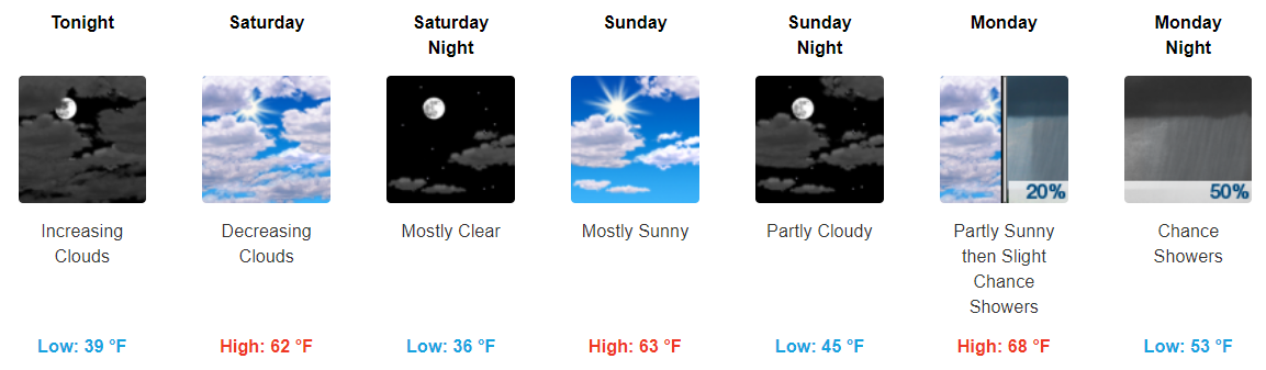
One Last Warm Day, Cooler Temps Arrive Tomorrow, Plus Wintry Mix Talk for Friday
Sunshine Through the Weekend, Much Cooler Weather Finally in Sight
Sunny Skies and Gradually Warming Temps Through Monday
It’s finally December, but it sure will not feel like it today through the beginning of next week.

Temps continue to climb a degree or two each day with highs in the low-60s today, mid-60s this weekend, and then into upper-60s by Monday. Sunshine looks to hang around through it all, so all weekend activities look to be in great shape.
A Break From the Sunshine Tomorrow, a Tiny Bit Cooler Temps on Friday
Sunshine and a Bit Warm Today
More of the same today with the only difference being that our high temps will be even warmer today than yesterday. Besides that, throw some shades on and enjoy the nice weather!

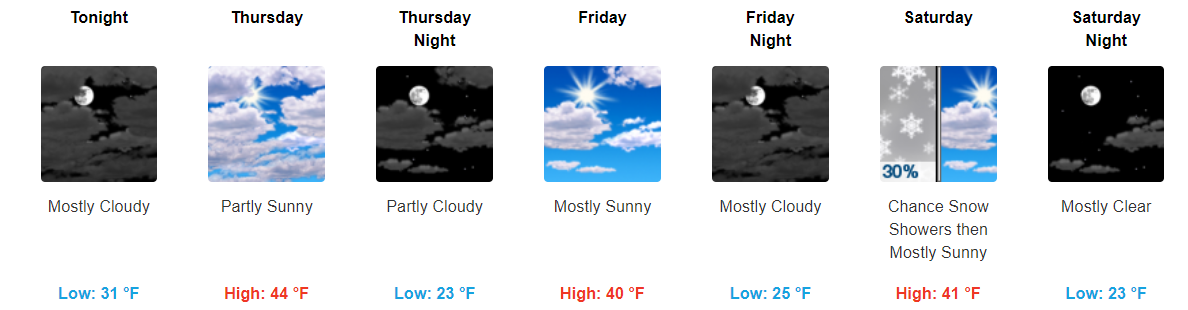
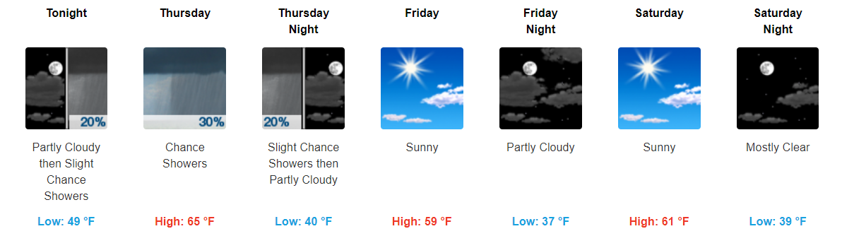
Off and On No-Worry Showers Tomorrow
Tomorrow’s rain looks to be pretty meh if you ask me. Total accumulation looks in the tenth of an inch rain, so barely if any at all. Most models show a few scattered showers early in the day with a bit more showers possibly in the afternoon/early evening.
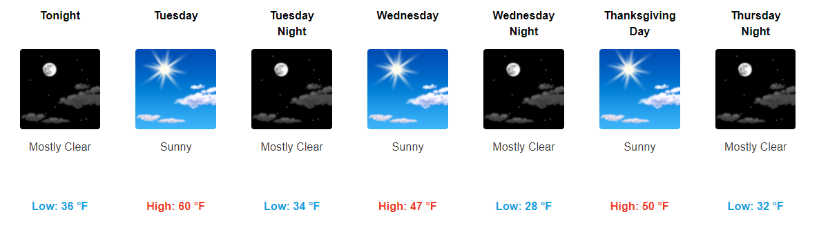
Sunny First Half of the Week, a Few Showers Thursday, More Sunshine Friday
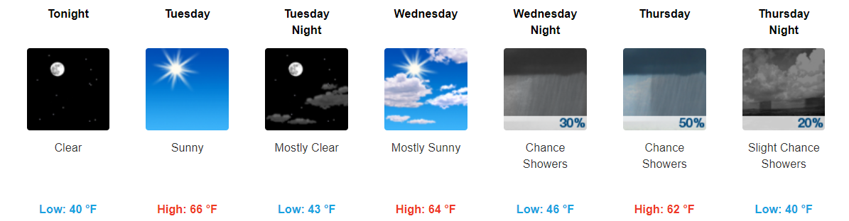
Sunny Skies & Above Average Temps Through Wednesday
Enjoy the sunshine and comfortable daytime temps for the first half of the week.

Chance of Showers Thursday
Unfortunately, as it gets closer, this system continues to look less impressive in terms of rainfall. Models agree a bit more on timing now. However, the overall rainfall accumulation from this system continues to be less and less.
Temps Remain Above Average Throughout Most of the Week
Temps Continue to Creep Up, Sunny Skies Through Wednesday
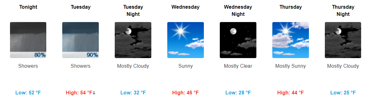
High pressure remains well in control today and to start the beginning of the week. Sunny skies will stick around through Tuesday with only a little more cloud coverage on Wednesday.
Highs will be above average through a good bit of the week. Tuesday looks to be the warmest day, with highs in the mid to upper 60s.
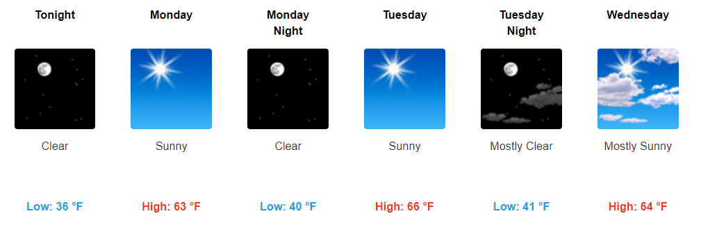
Quiet Forecast with Sunshine & a Dry Cold Front Passage Tomorrow
Somewhat Warmer Temps Continue, Dry Cold Front Passing Through Tomorrow
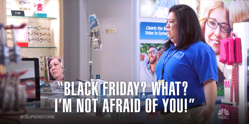
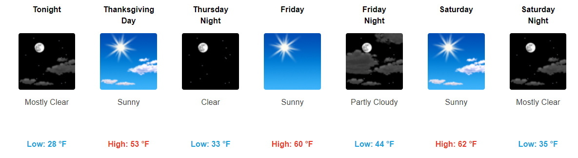
Black Friday shopping conditions look pretty great. Sunny skies with highs reaching into the low 60s.
Tonight into tomorrow, expect for a few more clouds than we’ve seen recently. A dry cold front will move through the area tomorrow, bringing somewhat cooler temps for Sunday. Full on sunshine will return then.
Temperature Roller Coaster Continues, Thanksgiving Day Looks Great
Cool Temps & Sunny Skies are in Control
Sunny & Dry Through the Week, Only Temperature Variations
This week looks to be pretty boring in terms of precipitation, with no real chances in the near future. Our local NWS started their morning forecast discussion with this:
“Dry is the word of the forecast! There will be some upper level pattern changes over the next week, as well as some dry cold fronts, but otherwise not too much in the way of precip chances until middle of next week.”