
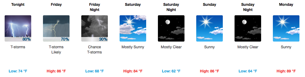
HOT and Muggy Today, Storms Also On the Way
There’s probably one word that would describe “outside”, today: unpleasant. Afternoon temperatures, even with some intermittent cloud cover, are expected to reach into the middle 90s here in Davidson/Williamson Counties.
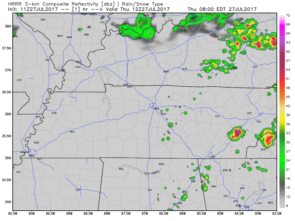
A few pop-up showers/storms cannot be ruled out, but expect better rain chances by tonight and overnight when an approaching cold front sparks more widespread activity. The latest HRRR model agrees:
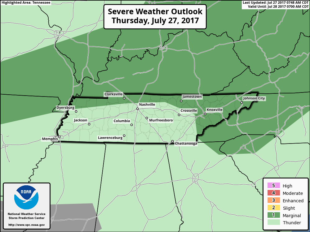
The Storm Prediction Center has removed both counties entirely from a severe weather risk, although I still would not be surprised if someone gets a strong wind gust out of tonight’s storms.
SPC Day 1 Convective Outlook
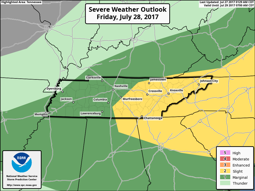
Storms are expected to continue and re-develop Friday afternoon, with some potential for severe weather. We are under a “Marginal Risk” for Friday:
Another possibility with storms tonight and on Friday is heavy rainfall. An inch or two total will not be uncommon across middle Tennessee by Friday night.
What. A. Weekend.
We haven’t had that “picture perfect” weather in a very long time, but it may very well return on Saturday and Sunday. How do temperatures in the mid 80s with no rain sound? Boating, hiking, shopping…this weekend will be primo for doing anything in the great outdoors.

To Next Monday…and Beyond!

Temperatures will slowly climb the ladder, but not all that much. Highs in the upper 80s to low 90s will still be an improvement from what we’ve become accustomed to. Isolated thunderstorms will re-enter stage right by Tuesday afternoon.

Categories: Forecast Blogs (Legacy)
You must be logged in to post a comment.