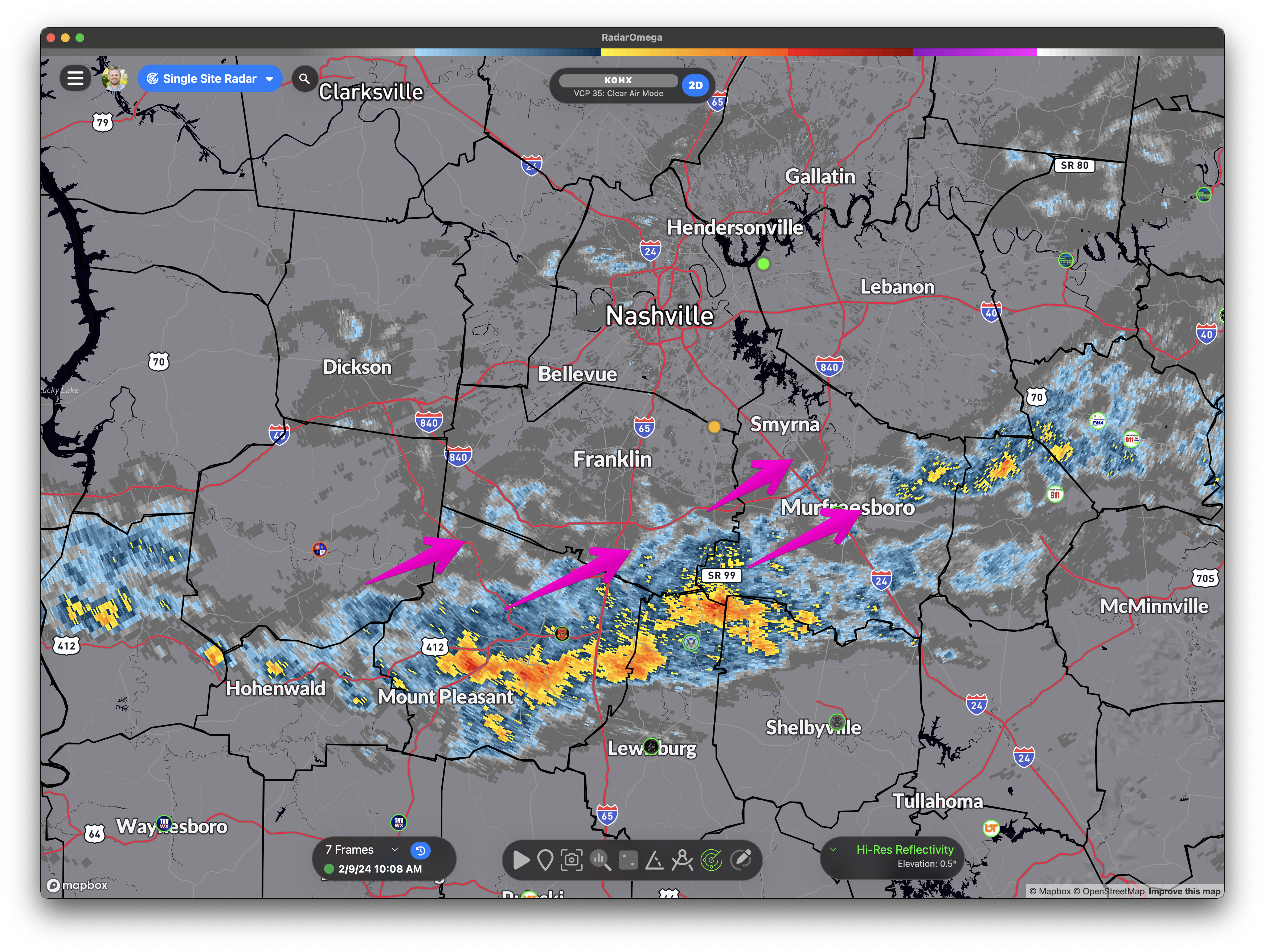
Radar Update 10:22 am: Heavier rain missing us juuuuust off to the SE. Sneaky cell headed our way tho from the SW. Off/On showers continue through the day, some brief moderate/heavy rain possible.
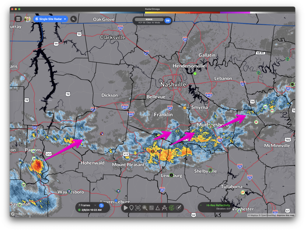

Radar Update 10:22 am: Heavier rain missing us juuuuust off to the SE. Sneaky cell headed our way tho from the SW. Off/On showers continue through the day, some brief moderate/heavy rain possible.
First Saturday of the month. Monthly test of Williamson County tornado sirens is at 1:00 pm. Just a test.
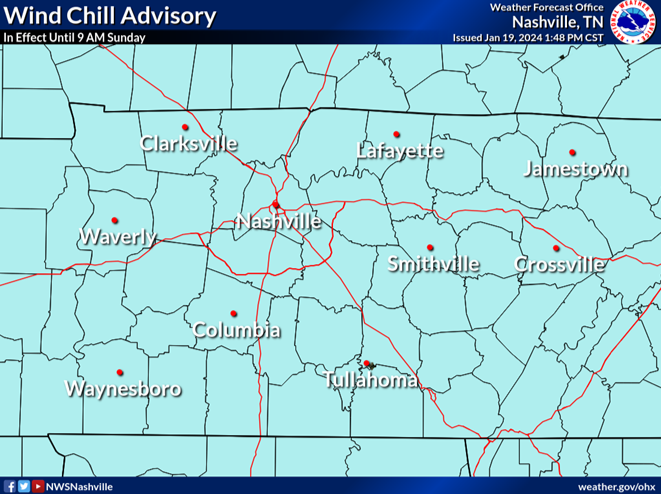
The brutal cold is the big story. More on that in just a bit. First, quick note about the snow.
Light snow showers across the area have been stubborn to dissipate today with some sites still reporting light snow or flurries ongoing this afternoon. So a dusting or a quick half inch of snow isn`t out of the question still through this afternoon, but all of this should wind down within the next few hours. NWS NashvilleIf you get a quick burst of snow, roads can deteriorate quickly on a local level, even if just for a few minutes. Take it easy out there.
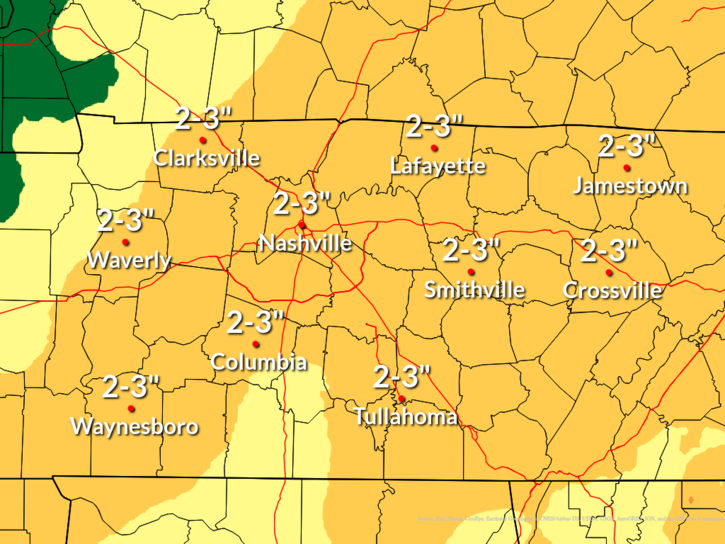
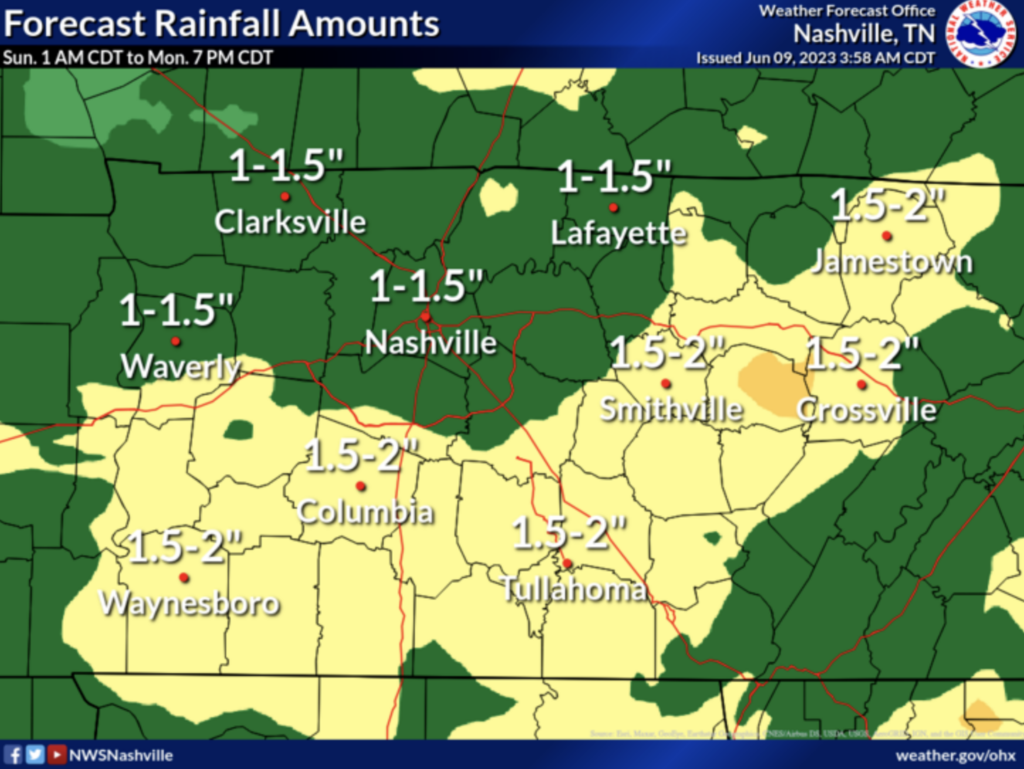
Forecast rain amounts have increased in the last 24 hours, with widespread 2-3 inch rainfall expected between Friday evening and Sunday evening.

Now that the leaves have fallen, this is a good time to check the drainage on your property and clear out any gutters/drains/culverts/ditches that are designed to carry water away. While the flood threat is low, clogged drains could create an issue.
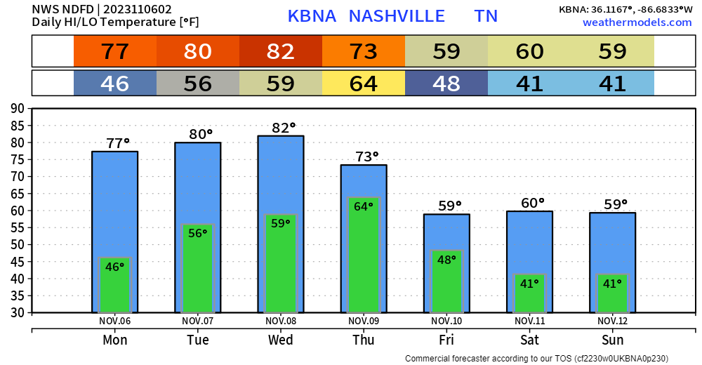
Record highs in Nashville for Monday, Tuesday and Wednesday are 79°, 80° and 83°, according to the National Weather Service. If we don’t tie or break those records this week, we’ll be awfully close. We’ll cool off behind a cold front for the weekend, but still not seeing any freezing temps in the long range computer models.
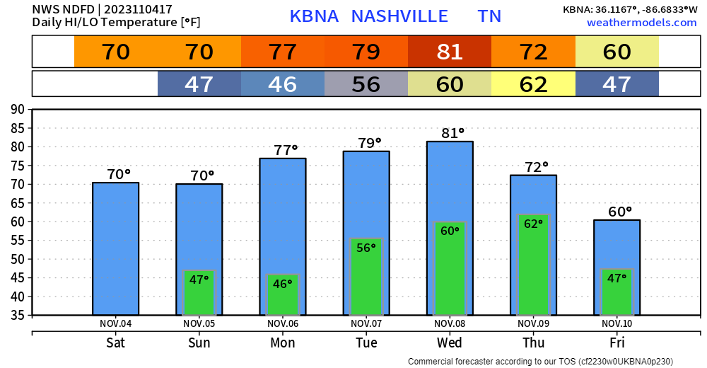
Temps stay very comfortable over the next week or so with cool nights and warm days. No freezing temperatures in the 7-day forecast. Listen closely, and you’ll hear your mums rejoice.
“I dream of rain; I dream of gardens in the desert sand. I dream of rain; I lift my gaze to empty skies above.”

Whether you’ve seen rain today all depends on where you are. Some have seen a lot and got a flood advisory out of it. Some haven’t had a drop. Rain totals as of 11:12 am (Radar Estimates, NOT Observations):
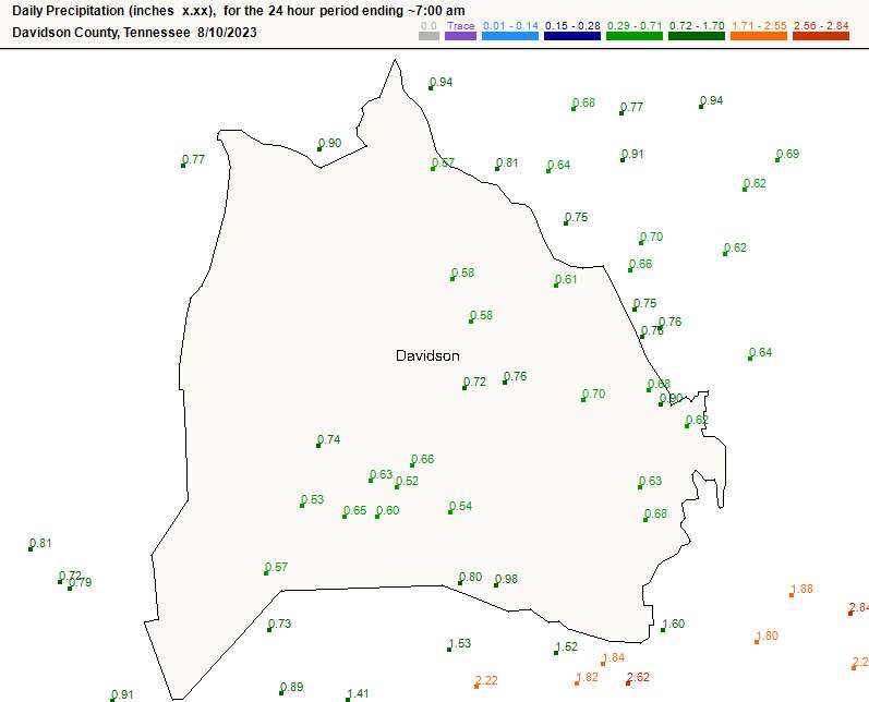
If you slept through the storms early this morning, grats. The lightning output was pretty incredible, and we saw a brief wind gust that damaged a tree or two in S Brentwood.
Decent rain amounts too, especially in central Williamson Co.

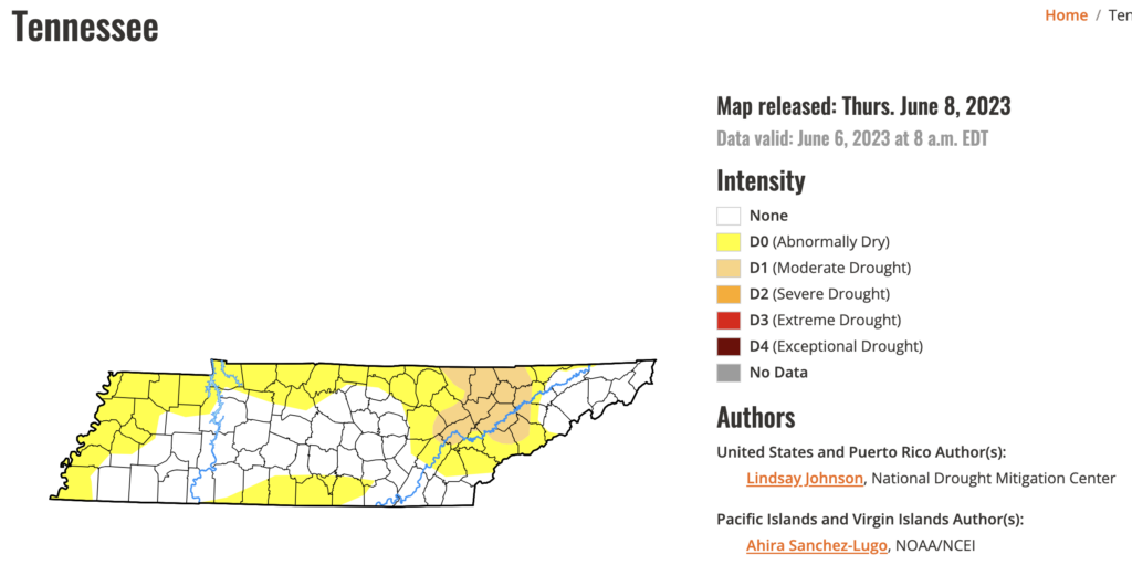
Rain will be a welcome sight to many this weekend…unless you have outdoor plans. Latest U.S. Drought Monitor has us as “abnormally dry.” Sounds right.
Hi-Res Models, which are just coming into view, generally agree that scattered showers and storms will arrive Sunday morning. That’s about all we can get from those models right now….because that’s as far out as they go. The lower-res models pick up from there and keep rain off/on all day Sunday into Sunday night.
Word is the Swifties had a late night. Our correspondents Amy and Catherine reported it was declared an official rain show. Described as “iconic” and “memorable.” All’s well that ends well.
You must be logged in to post a comment.