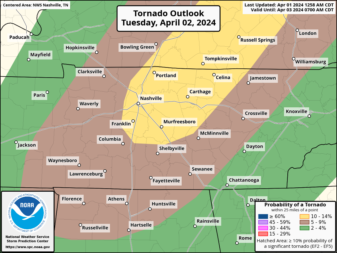
Within 25 miles of you tomorrow, the chances of “x” occurring are: tornado – 10%, damaging winds – 30%, large hail – 15%. More info throughout the day today.
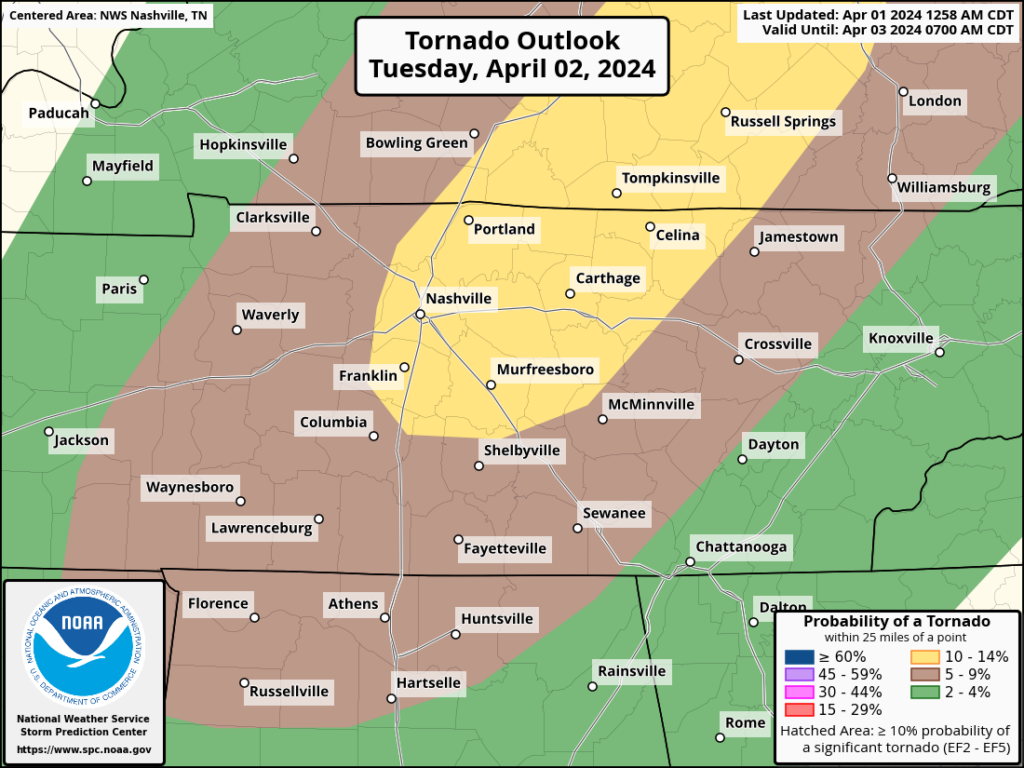
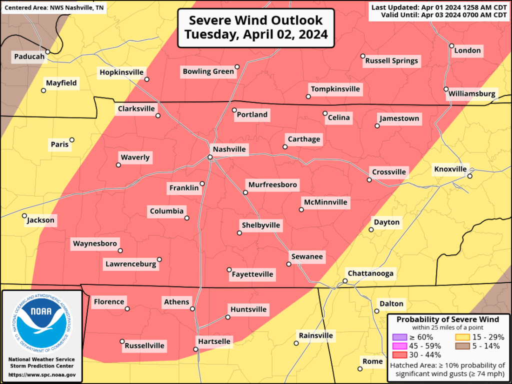
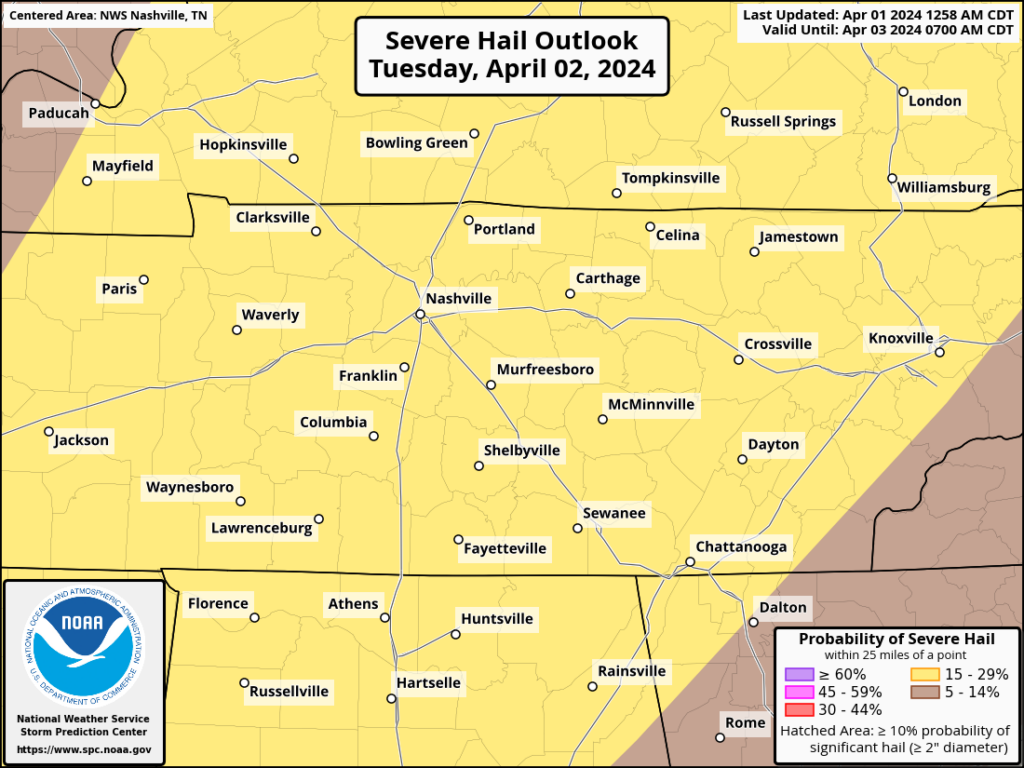

Within 25 miles of you tomorrow, the chances of “x” occurring are: tornado – 10%, damaging winds – 30%, large hail – 15%. More info throughout the day today.
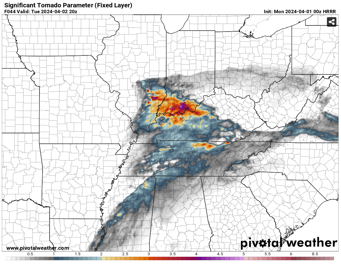
HRRR is now in range for Tuesday’s potential severe weather. It’s showing a composite “significant tornado parameter” of around 1.0-1.5 Tuesday afternoon (blue). Anything over 1.0 gets our attention. All modes of severe weather remain possible Tuesday….large hail, damaging winds and tornadoes. More tomorrow as details become more clear.
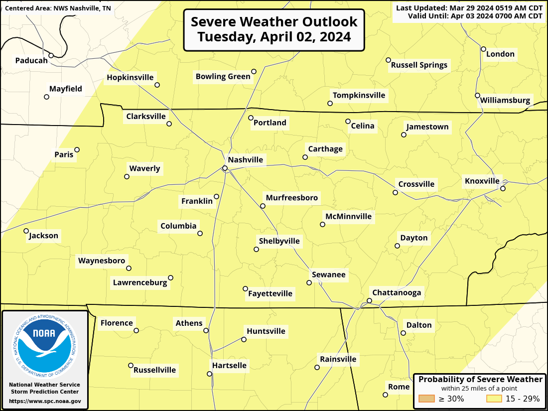
SPC continues to have us outlooked for the possibility of severe weather on Tuesday. Currently a 15% chance of severe weather within 25 miles of you. This will be revised in coming days.

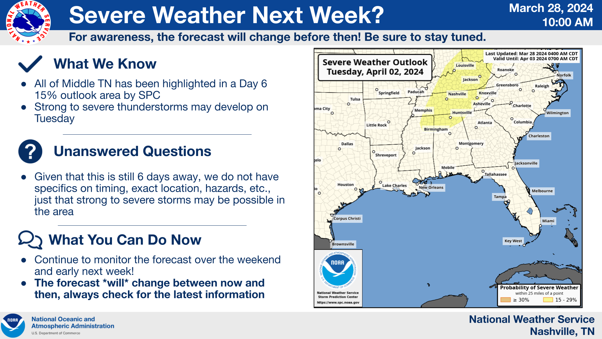
Watching early next week for some potentially bumpy weather. Few/no specifics available at this point. Currently, a 15% chance of seeing severe weather within 25 miles of you. Stay tuned.
Latest updates this evening/overnight will be over on X (Twitter) @NashSevereWx. See you there!
Next round is light rain. After that, weakening storms. No svr weather.
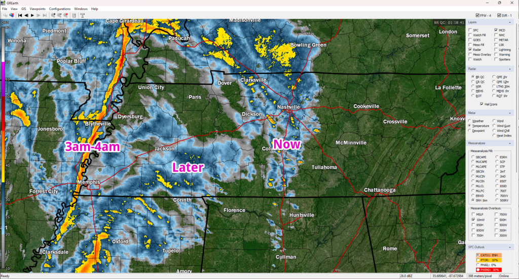
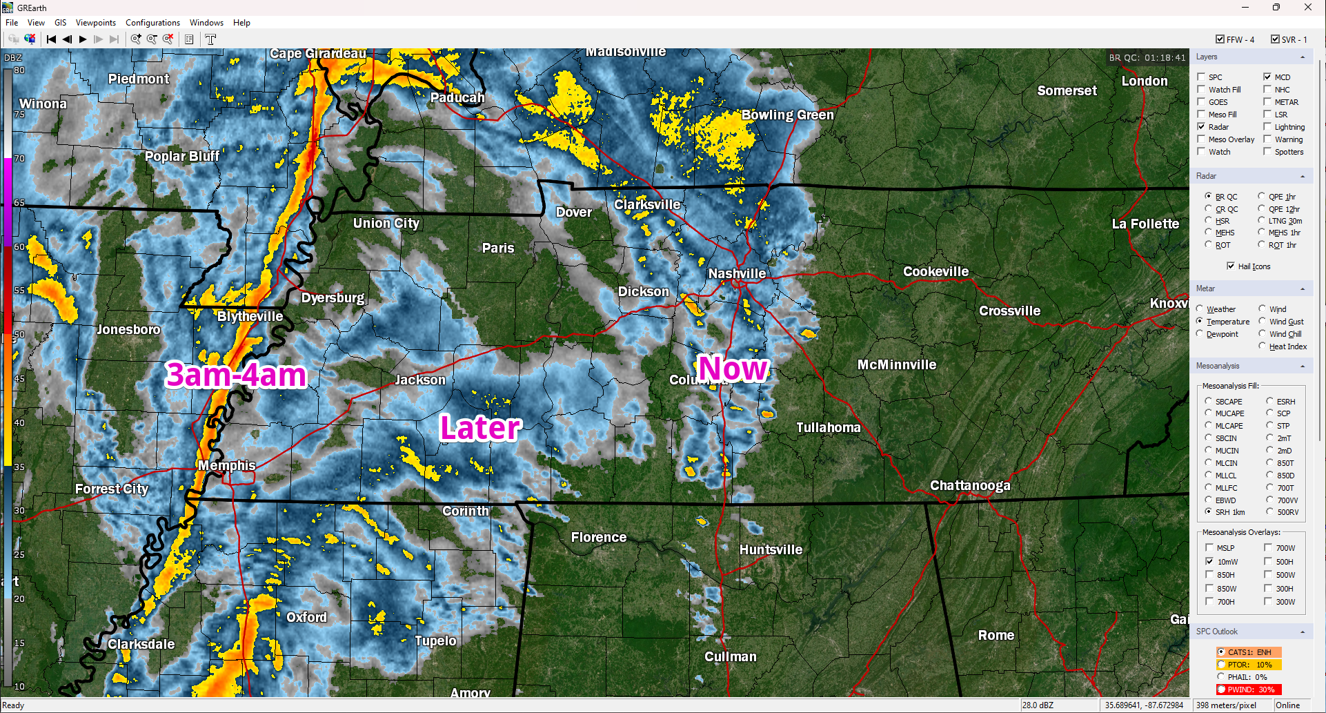
Some heavy rain coming through Franklin. Brentwood and Nolensville next. Then, a break of sorts. Still expecting additional storms later that are about to cross the MS River into W TN.
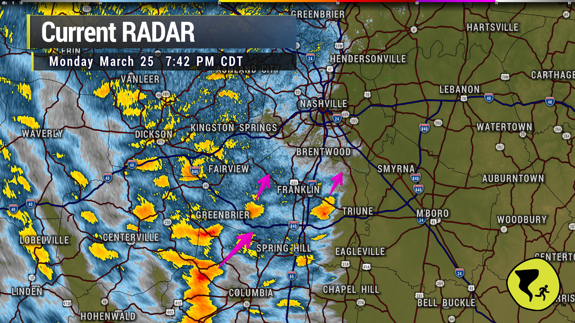
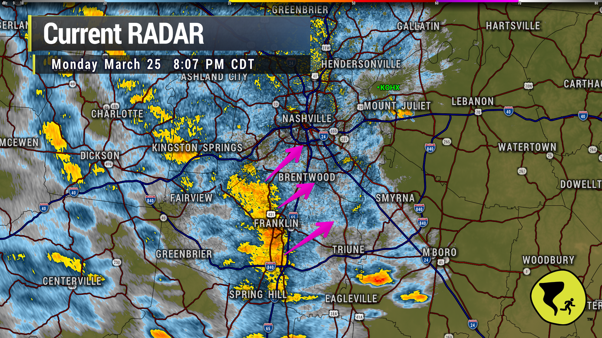
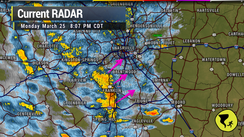
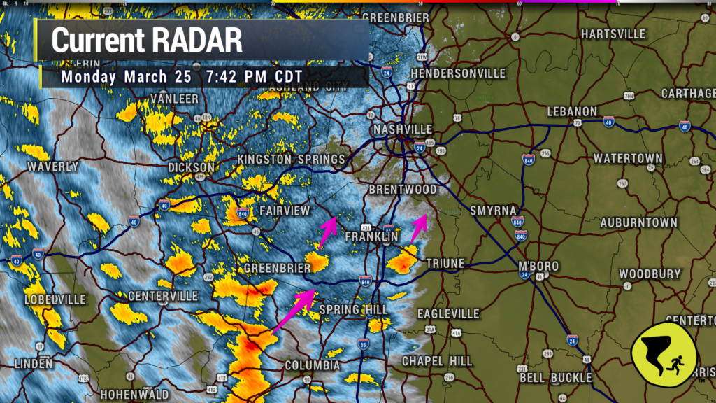
Couple of heavier downpours approaching Nolensville, Brentwood and W Franklin. Just a good ole regular thunderstorm. We like being able to say that. 7:42 pm
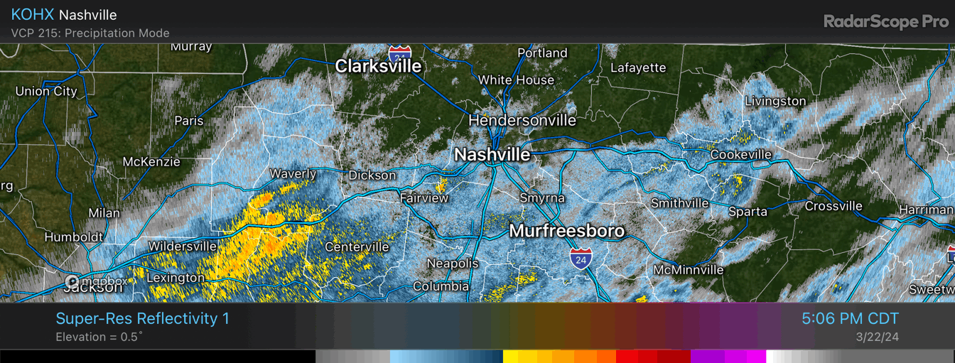
This is a slllow rain. Not falling quickly, not leaving quickly. Loop through 6:10 pm
We’ll be covering the event today/tonight over on Twitter and also YouTube Live (if a warning is issued). See you there! twitter.com/nashseverewx
You must be logged in to post a comment.