Slowly Getting Back to Normal

Current Radar 

The Forecast

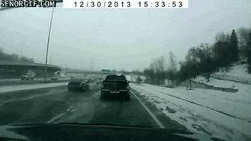
Remaining Snow/Ice will refreeze tonight. The overnight low is 30°. Secondary roads are especially vulnerable because they are often shaded and less trafficked.

We don’t know the road conditions, we can only tell you how we think the weather might be impacting them. Consult traffic sources on Twitter (such as @TrafficJamSam) and the TDOT Smartway map/cameras. read more

Final Snowstorm Stats. A Melt Update. And a Rant.

Current Radar 

When the weather balloon went up just after 5 AM, it was 14°; however, there was a large “inversion,” a fancy weather word that means it’s warmer overhead than it is down here on the ground. Temps from 5,000 feet all the way up to 10,000 feet were above freezing. Why am I boring you with that? Because it’s a good sign we’re going to warm up today.  Sunshine is on the way. High 37°. Some ice and snow will melt. read more

Some Melting Sunday, Substantial Melt Monday

Current Radar 

Measurements are still coming in (you send in yours on Twitter via #tSpotter, include photo/location, and measure from a hard, flat surface), but here’s the preliminary total from NWS-Nashville: read more

It’s Piling Up

Current Radar 

read more

Winter Storm Warning in Effect until 6:00 AM Saturday

Current Radar 

Today – WINTER STORM WARNING IN EFFECT UNTIL 6 AM SATURDAY High: 34°

Main impacts… dangerous traveling conditions and power outages. Ice accumulations up to two tenths of an inch possible with locally heavier amounts. 

The snow will continue to fall through the afternoon into the evening hours. Roadways only get worse. Try to avoid driving today! read more

3″ to 5″

Current Radar 

It’s happening!

Hit up the radar above, turn on local news, and follow along on Twitter @NashSevereWx.

Major travel impacts expected.

Temps will fall into the 20°s after noon. Stuff will freeze and hang around for the rest of the day, tonight, overnight, and with temps not forecast to get above freezing Saturday, much of Saturday too. read more

Snow Snow Snow Snow

Current Radar 

Rain is arriving from the south tonight. Consult the above radar or your favorite radar for current conditions. We may even see a few thunderstorms, but nothing severe, and no icenadoes. read more

When Will The Snow Come?

Current Radar 

TODAY – A Good Day to Run Errands, Go to the Store, Etc. – High: 40°

Before we get to tomorrow’s winter weather chances and the inevitable frenzy, let’s get you through today.

A Freezing Fog Advisory will expire at 9 AM. By mid-morning, we should see any areas of fog begin to break-up. read more

Where Will Friday’s Deformation Band Set Up?

Current Radar 

Refreeze Tonight?

Temps have hovered at and just above freezing this afternoon. After dark, we should be at or below freezing. Beware of black ice, especially on bridges and overpasses.

By midnight, we should be at 30°, where we will hold for most of the morning before dropping to 28° just before sunrise. read more

Snow Friday?

Current Radar 

Today – High: 36°

SNOW DAY!!! Many of us saw Sleet, Freezing Rain, and Snow today. We got lots of great reports. Thank You!

TweetDeck 2016-01-20 11-41-27TweetDeck 2016-01-20 11-37-49

TweetDeck 2016-01-20 11-41-01

All the snow has pushed out of our area and is now covering the Smokies. The HRRR model shows it push further east. read more