
Current Radar

Today – WINTER STORM WARNING IN EFFECT UNTIL 6 AM SATURDAY High: 34°
Main impacts… dangerous traveling conditions and power outages. Ice accumulations up to two tenths of an inch possible with locally heavier amounts.
The snow will continue to fall through the afternoon into the evening hours. Roadways only get worse. Try to avoid driving today!

The National Weather Service posted a great graphic showing forecast snow accumulations.
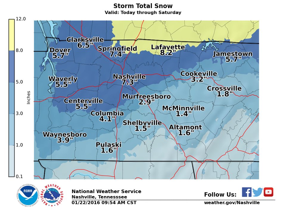
For the remainder of the day:
Thank you for your reports on Twitter! Keep them coming! We will also keep you updated on Twitter throughout the day!


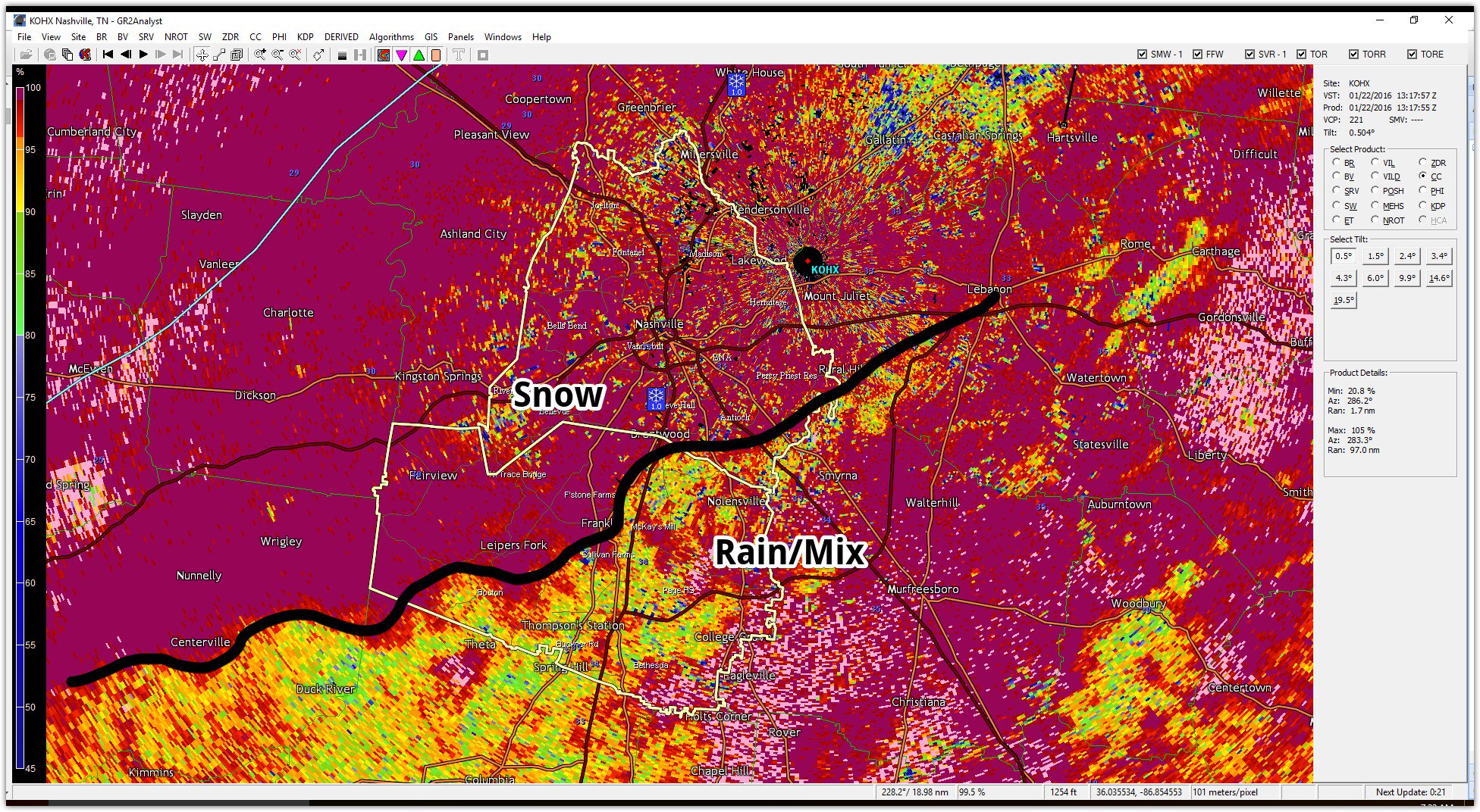
At 7:17 AM, if you were on the NW side of this line, you were winning the snow lottery. Those on the SE side, aka the Rain/Mix side, were getting left out of the huge accumulating snow due to above-freezing air sitting aloft (between 2,300 feet and 4,000 feet).
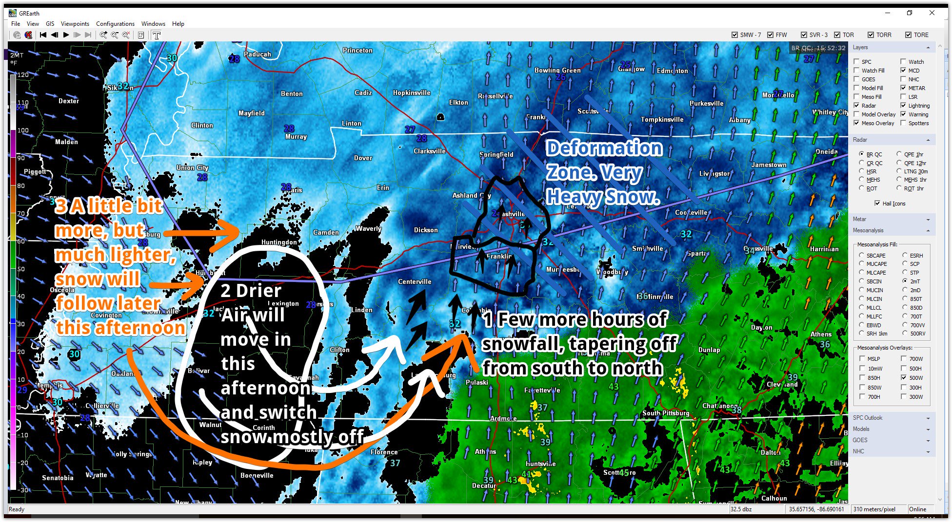
The fabled Deformation Zone was setting up along and N of I-40 into Davidson County, where, in about 5 hours, we got an entire season’s worth of snowfall.
Saturday – Colder! Waking Up: 24° High: 31°
A cold front will sweep through and reinforce the cold air into our area. It will be windy when you are waking up on Saturday. The winds should calm down late afternoon and evening.
A few light flurries may squeeze out early Saturday morning as the system moves to the northeast and buries them.
Snowmelt will be difficult because temps are forecast to stay below freezing. Roadways – especially untreated/secondary roads — will still be dangerous during the day.

Clouds will clear out Saturday evening.
High pressure will then settle in late Saturday into Sunday morning. Low temperatures will drop into the teens on Sunday morning. That is no typo! Dangerously cold conditions can be expected Sunday morning.
Sunday – A Few Clouds Waking Up: 15° High: 38°
High pressure moves in Sunday morning while temperatures warm up into the upper 30s in the afternoon. There will be a few clouds around our area on Sunday. Winds will shift from the north to out of the south on Sunday. This will help draw in some moisture and warmer air into our area form the Gulf.
Don’t get too comfortable though! We are tracking our next system currently sitting over the Pacific Ocean that will accelerate across western US then northeast ramping up rain chances for us early next week. Until then, enjoy the sunshine on Sunday!
Extended: There is that rain on Monday I was talking about! Temperatures will warm up Sunday into Monday.

This website supplements @NashSevereWx on Twitter, which you can find here.
Categories: Forecast Blogs (Legacy)
You must be logged in to post a comment.