Current Temps and Radar

Expect 20°s tonight.
Today – Clouds Arriving – High 48°

Sunday – Heavy Rain; Snow Late? – Wake Up XXX°, High LV°
A warm (for February) rain should be beginning in full force after sunrise, if not before.

Current Temps and Radar
Expect 20°s tonight.
Today – Clouds Arriving – High 48°
Sunday – Heavy Rain; Snow Late? – Wake Up XXX°, High LV°
A warm (for February) rain should be beginning in full force after sunrise, if not before.
Current Temps and Radar
Expect 20°s tonight.
Saturday – Sun to Start, then Clouding Up – Wake Up 24°, High 48°
Clouds will increase as a low pressure system races towards Nashville.

A few of the regional weather models think we may seen afternoon rain, but that’s not in the forecast until late Saturday night.
Current Temps and Radar
Tonight – Getting Much Colder
Showers moved through Middle Tennessee this morning, and as I write this, that gusty when you’re feeling is the announcement of the arrival of the cold front (at 458 PM, it was 42° and Clarksville and 56° in Smyrna).
Current Temps and Radar
Today – Partly Sunny – High 54°
Showers moved through Middle Tennessee this morning ahead of a cold front. As the front moves through today, winds will become northerly at 10mph – 15mph with 20mph wind gusts. Despite that passage of the cold front, temps will still reach the mid to upper 50’s this afternoon.
A weak disturbance coupled with a cold front will approach Middle Tennessee from the northwest overnight. The National Weather Service is giving Nashville a slight chance for showers beginning after 1 AM tonight.
Current Temps and Radar
Rest of Tuesday – Chilly, Clouds Gradually Clearing – Afternoon High 44°
The clouds should clear out after dark.
Wednesday – Warmer, Sunny – Wake Up 27°, High 49°
Tonight – Flurries
Go east for a better chance of snow. We’ll just get a trace of snow, whitening on rooftops, that kind of thing.

Looks like flurries will continue off-and-on overnight, but the main snow event is happening around 6 PM well off to our east.
Current Temps and Radar
Tonight expect a cold, intermittent rain to continue. The rain is being generated by a low pressure center moving east across Kentucky. This is the same system poised to smith the east coast with blizzard conditions.
Current Temps and Radar
Today – Rain, Thunderstorms; Overnight Snow? – High 53°
So, yeah, this is weird.
As you can see from the above radar, rain is coming. It should be here this afternoon.
Current Temps and Radar
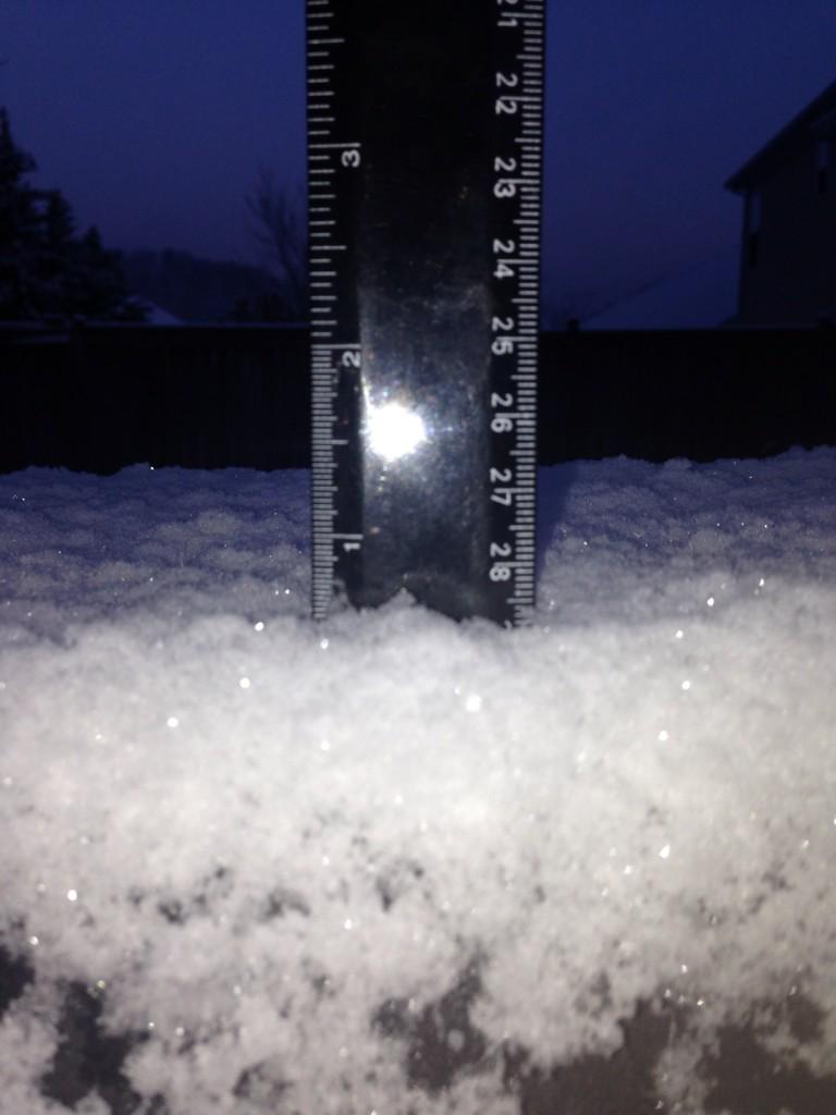
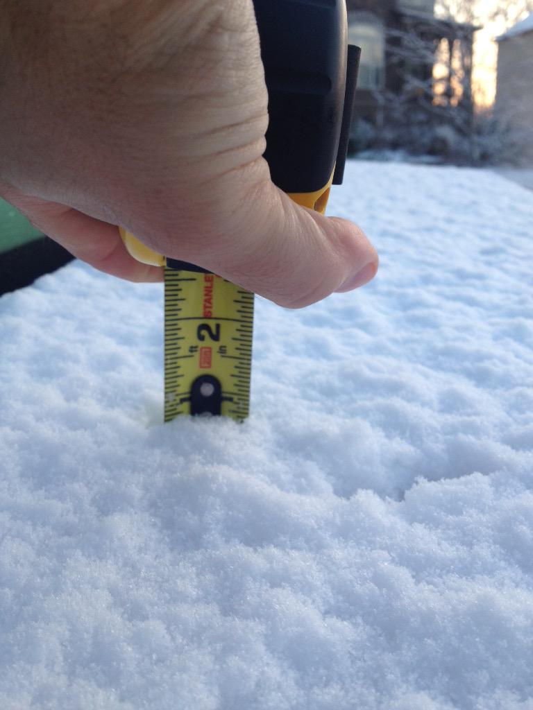
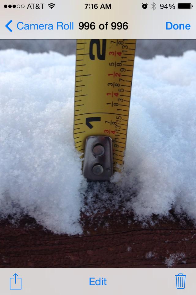
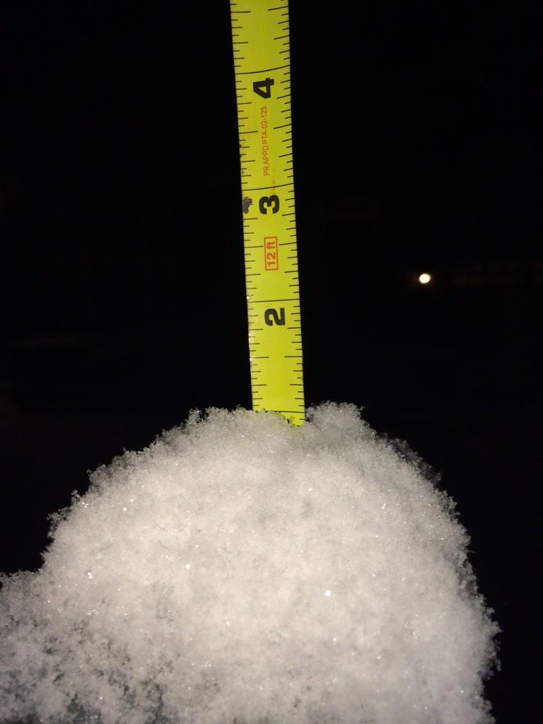
Friday night’s snow totals:
1/2″ in Bellevue:
Hermitage 3/4″:
Spring Hill got 3/4″:
Nolensville, 1″ atop a mailbox post:
Almost 1″ in Franklin (another spotter reported 1″):
You must be logged in to post a comment.