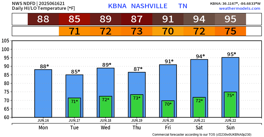
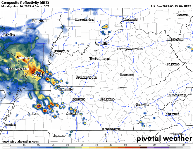
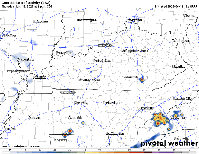
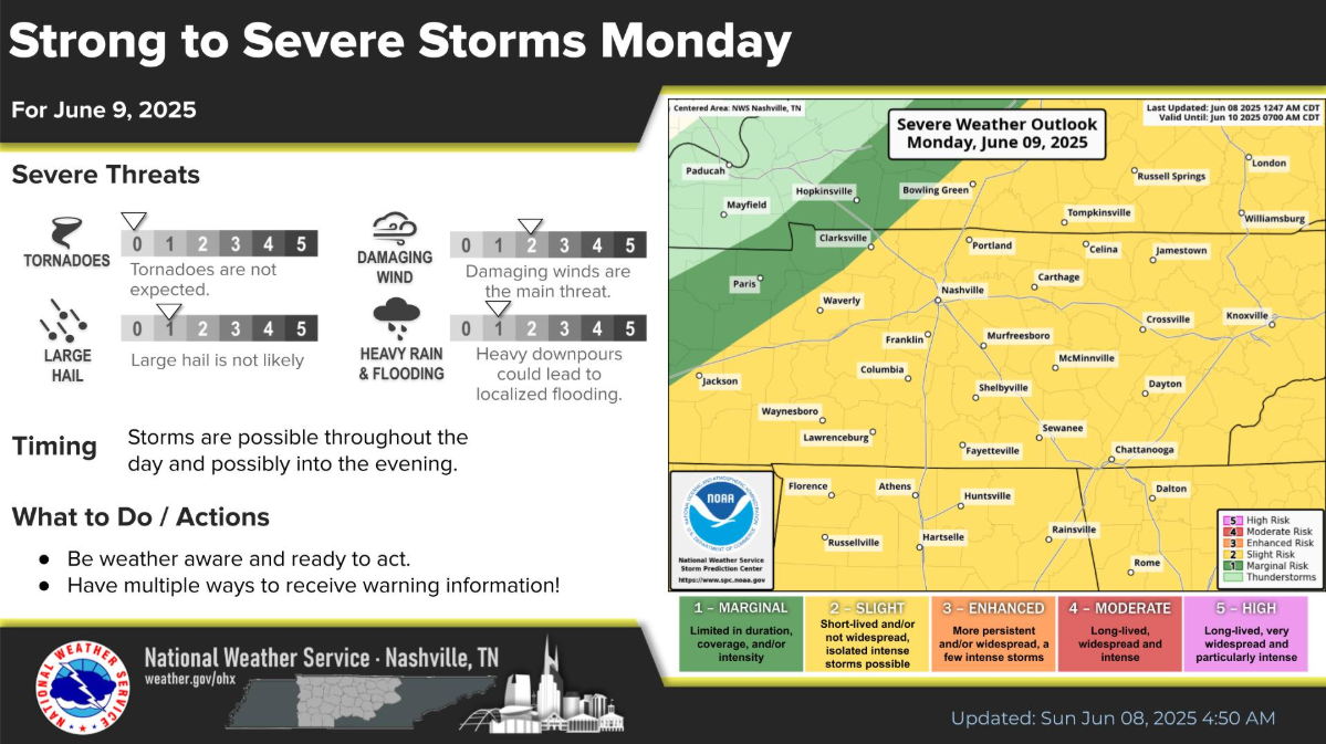
This looks absolutely nothing like what we dealt with last week. However, it still is worth keeping an eye on.
The Storm Prediction Center has slightly upped our chances for severe weather on Thursday, particularly for the afternoon and evening.
This looks absolutely nothing like what we dealt with last week. However, it still is worth keeping an eye on.
The Storm Prediction Center has slightly upped our chances for severe weather on Thursday, particularly for the afternoon and evening.
Lows tonight will yet again get down close to, if not below freezing. Cover up/bring in any loved plants!
Downtown Nash gets roughly a 50/50 shot of reaching 32°, with areas further away from the Urban Heat Island having much higher odds.
From 80s just a couple of days ago, we are looking at two straight nights of temperatures getting close to, if not below freezing…
Official lows for Nashville for tonight and Tuesday night are 33° and 34°, respectively. Although downtown is usually a few degrees warmer than everywhere else, so most of us likely will see a freeze. Cover up/bring in any plants.

There are currently no severe weather concerns for at least the next week.
Some rivers are still running high, it’ll take a little for the “big” ones to come down. Avoid flooded roadways – turn around, don’t drown.
Models continue to struggle. Forecasters are ready to fire these models into the sun.
MORNING RAIN
This was the radar at 8 AM. All this rain is supposed to move north into Ky. as shown by the red arrows. But it’s also creeping a bit east — the white arrows — right over Davidson Co. Not sure how far into town it’ll get.
Update as of 3p: The SPC did decide to include us on the very edge of a Tornado Watch until 10p. The forecast holds true. The highest severe threat is well to our west and any threat of severe weather/tornado is quite low – but not impossible. Stay weather aware!
Flooding reports have been common throughout our two counties this morning and will likely continue thru the day. If you see flooding affecting roads and/or structures, please report it with #tspotter.
Today will be one of those days that you’ll need to stay connected and weather aware throughout the day.
Frequently check back in for updates, know where to shelter if a warning is issued for you.
1049 AM UPDATE: Last two HRRR model runs show a brand new potential concern: mid afternoon supercells somewhere in Middle TN which could produce tornadoes. This was not in the forecast (or in any of the data) this morning, so take it with a grain of salt. We don’t hide data from you. Takeaway: pay attention to the weather ALL DAY, not just tonight.
No April Fools jokes here. We are about to enter an active (and very complicated) pattern that will give us the potential for severe weather and flooding everyday Wednesday through Saturday. This does not mean we will see severe weather and flooding every single day – in fact, majority of the days we might not see either. However, the chance will exist.
You must be logged in to post a comment.