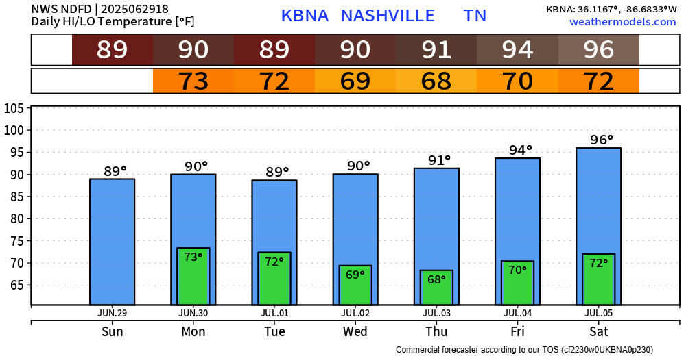
Think the Wattery has shut off for the remainder of our Sunday. Winners were mostly confined to Davidson Co., although there were only a few winners.
Forecast for this week will be fairly copy and paste.

Think the Wattery has shut off for the remainder of our Sunday. Winners were mostly confined to Davidson Co., although there were only a few winners.
Forecast for this week will be fairly copy and paste.
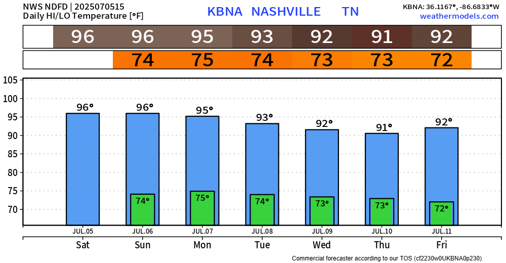
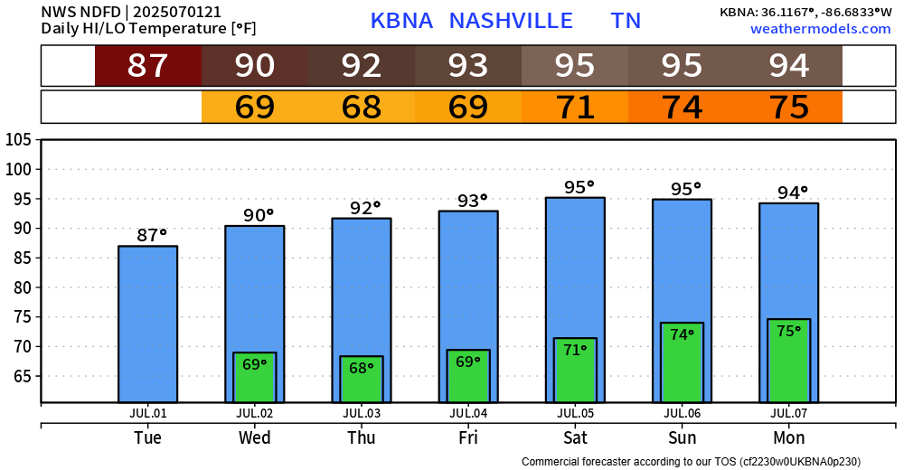
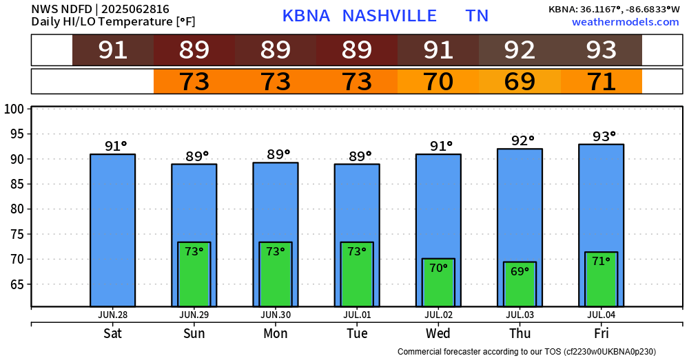
Our hot temps have returned. Although it won’t be as hot as it was a week or so ago, it’ll still be downright hot.
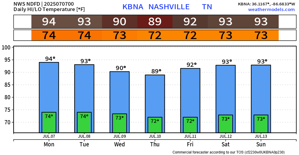
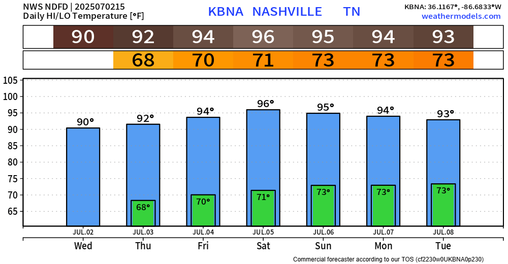
Highs will be in the mid 90s thru Monday before they taper off a bit to the low 90s for the remainder of next week.
Although it’ll be hot – we have no rain chances to worry about today.

High temps will peak in the mid 90s, with heat index values close to 100°. At least the heat index isn’t 249°.
As we get closer to firework time, models are hinting at a temperature inversion just above the surface due to surface temperatures cooling faster than temps aloft. This paired with calm winds tonight, will likely influence any smoke from fireworks to linger around – so firework shows may get pretty hazy by the end of the show, especially the “bigger” shows.
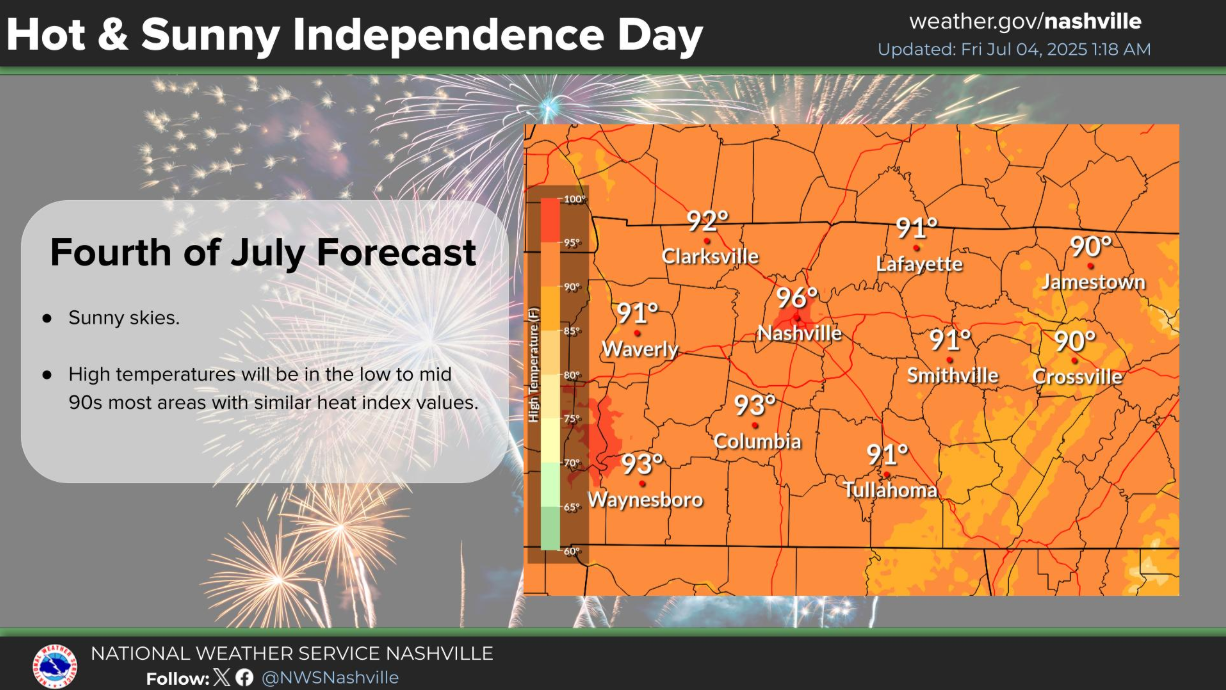
A dry – but hot 4th of July weekend lies ahead. I suppose the hot temps will be the trade-off for it being dry, which I will gladly accept.

High temps will reach into the mid 90s, with heat index values near 100° as you celebrate. I recommend being near a body of water, perhaps with a popsicle.
While it will still be hot the rest of this week, with temperatures slowly climbing – we won’t have any rain chances to worry about crashing any of our outdoor plans.
High temperatures will be in the 90s for at least the next 7 days, peaking in the mid 90s this weekend. Dewpoints won’t be as high as we saw them last week, but still enough to bring the heat index values closer to 100°.
Besides maybe a quick shower or two this evening – we are finally done with rain chances for a while. Well deserved.
Wednesday thru at least Saturday appear dry. Dewpoint will be slightly lower Wednesday and Thursday before creeping back up this weekend – and temperatures will follow the same trend.
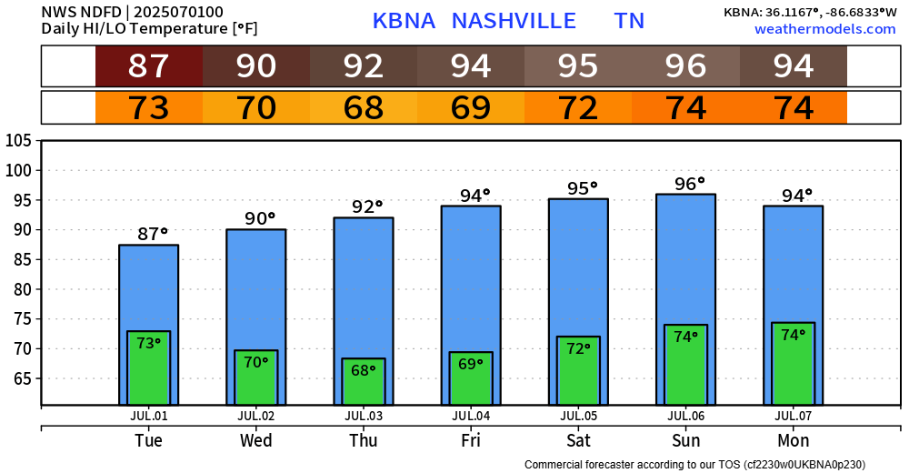
Tuesday looks to be our last day with Wattery chances for a while.
Chances will pick up late morning and continue thru the evening. Most of the activity looks to be focused E of 65, similar to today – but still, anyone could see a shower or storm.
We continue our unsettled pattern thru Tuesday.
I know I sound like a broken record, but scattered showers and storms will be possible daily, mostly confined to the afternoon and evening. Some will see some heavy rain, while others see none.
Our 12z morning sounding from BNA today looks fairly similar to yesterday’s. No coincidence – much of the same can be expected. Our atmosphere will look fairly similar each day thru Tuesday.

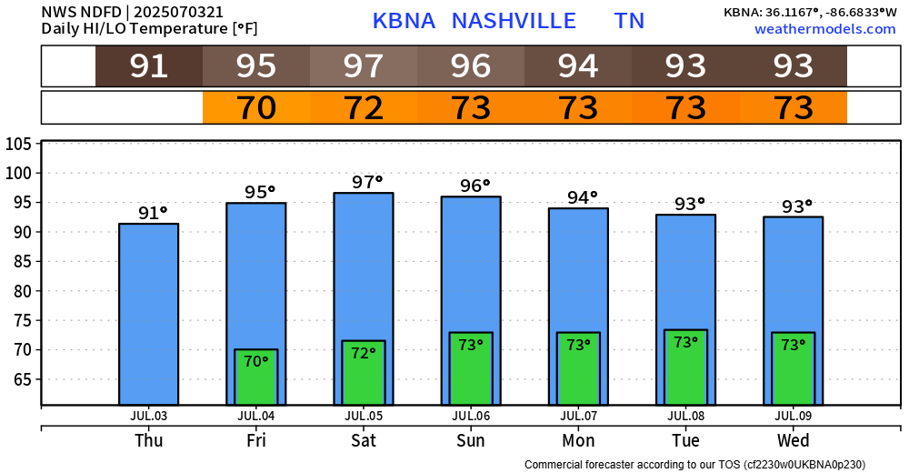
We have one more day of our Heat Advisory, which expires at 7p today. Once again, heat index values up to 105° will be possible this afternoon and evening.
Although it will still be hot this weekend and next week, it just won’t be as hot. It’s still summer, so continue to take it easy if you must be outside for long periods of time. High temperatures continue to be in the low 90s.
You must be logged in to post a comment.