Only chance today at some rain would be some sprinkles, defying the odds against the very dry air we have in place. Unlikely, but if they make it to the ground, NBD.
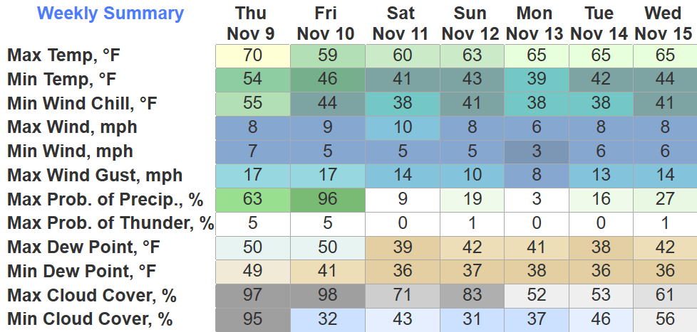
Thursday will be dry with high temps running about 15° above average.

Only chance today at some rain would be some sprinkles, defying the odds against the very dry air we have in place. Unlikely, but if they make it to the ground, NBD.
Thursday will be dry with high temps running about 15° above average.
Seems just about everyone got a great glimpse of the gorgeous sunset tonight.
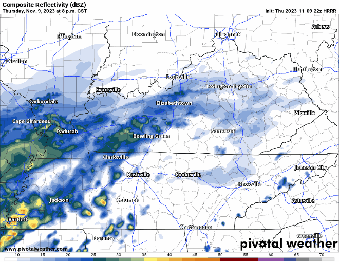
Tomorrow we mightsee some sprinkles.
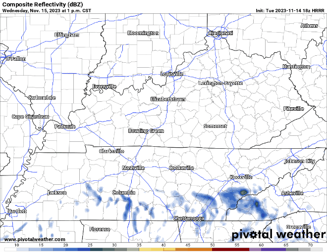
The HRRR model (above) shows some sprinkle chances tomorrow afternoon and evening. I have my doubts if any rain actually makes it to the ground, we’ll be really dry. At the most, just some sprinkles.
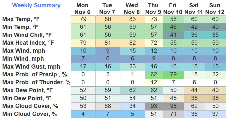
High temps will run several degrees above average for the work week, not feeling very mid-November like.
Our two “main” chances of rain this week will be Wednesday and Friday.
Wednesday:
Friday:
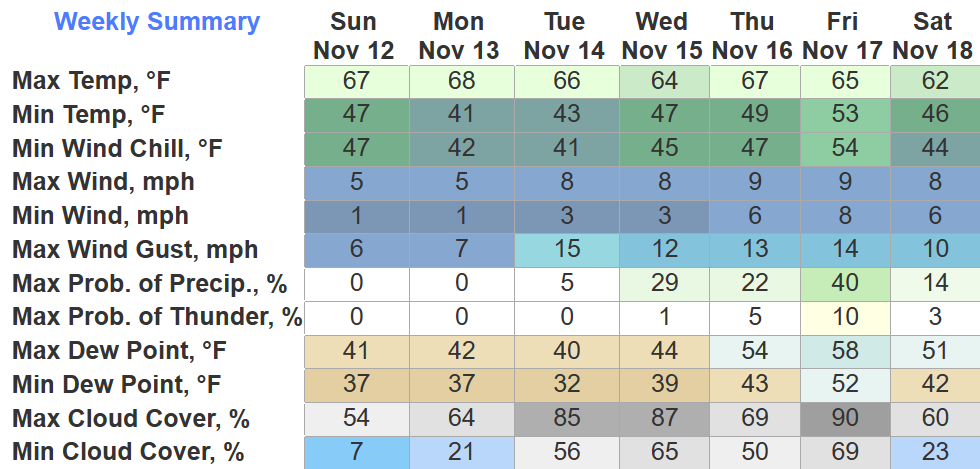
The upcoming week will fairly consistent, only “hiccup” will be some rain chances Wednesday thru Friday. I use “hiccup” lightly because we need rain – bad.
Although rain chances exist, it doesn’t look as if it would be much rain.
Low relative humidity + gusty winds + dry ground =
Burn ban in effect for both of our counties. It may be bonfire weather but just subtract the bonfire part.
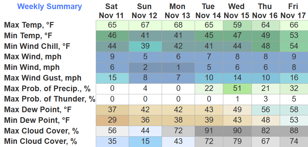
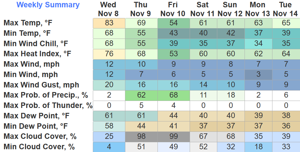
We are about 8.61″ below our average rainfall for the year. Looking ahead at the next 7 days, it doesn’t look like we’ll be making up much ground.
Something is better than nothing.
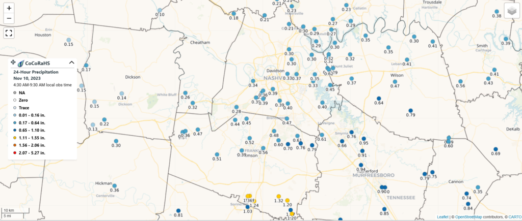
Southern WillCo. was the winner with over an inch of rainfall. Most of us only got 0.2″ – 0.7″. Again, better than nothing.
Not a ton more rain is in the forecast over the next 6 days.
Rain has finally made it and will stick around on/off overnight and into the morning.
The HRRR model shows some showers for your AM commute to work/school but ending quickly after. We should be dry by lunch.
It seems we are big on ties, as we have tied the daily record high for today with a high of 83°. Our third straight day of tying, we wouldn’t want to take the glory away from past years.
We won’t see the 80s again for a while, cold front moving thru tomorrow will knock temperatures down to where they ought to be for this time of the, and bring some very, very, much needed rain.
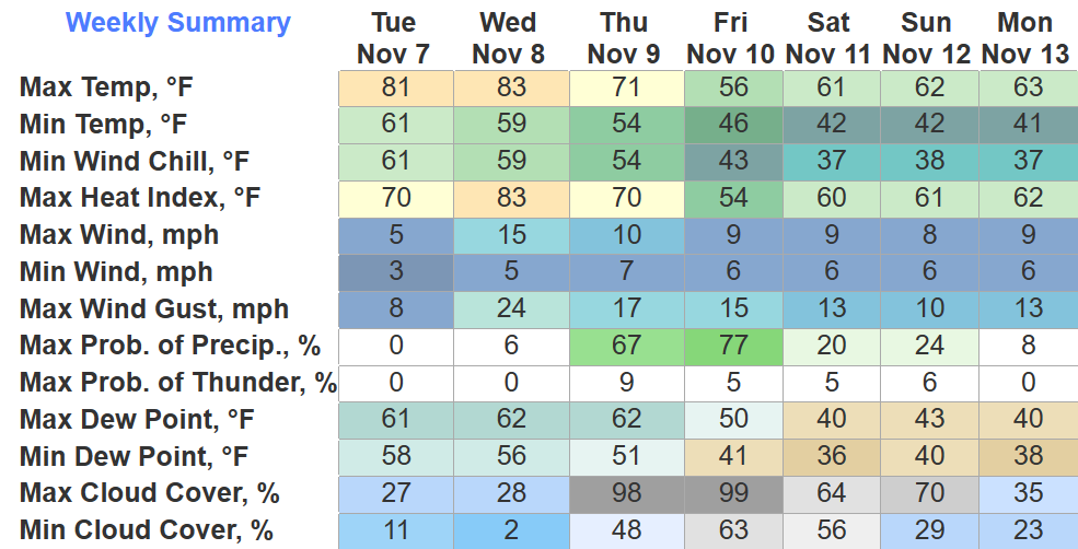
BNA made it to 80° today, tying the daily record high. Wednesday we’ll have another chance to tie/break the daily record high of 83°. Winds gusting up to 20-25mph from the south will help us get warm, and also would help spread fires, so pls don’t burn stuff.
As of 4pm, Nashville has tied the daily record high at 79°. Tuesday the record high is 80°, Wednesday it’s 83°, both days we will get close to tying/breaking that record. Is it November or April?
You must be logged in to post a comment.