
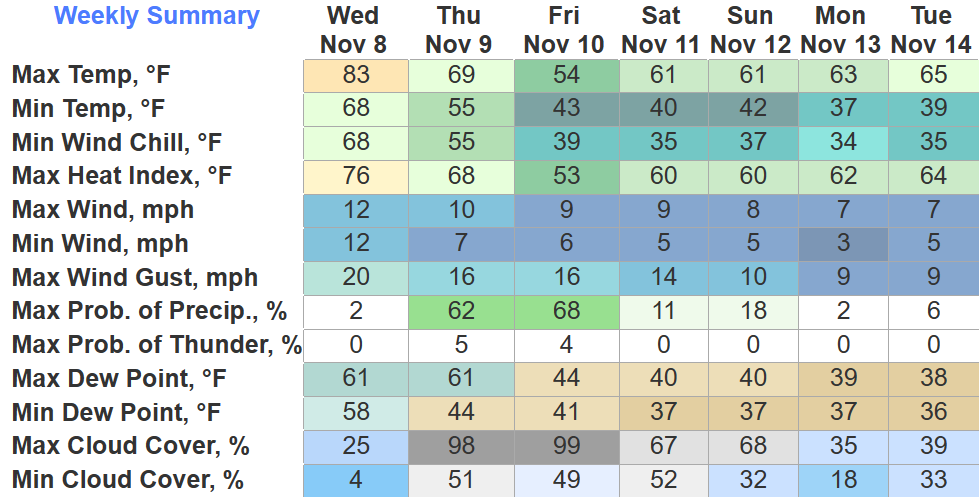
It seems we are big on ties, as we have tied the daily record high for today with a high of 83°. Our third straight day of tying, we wouldn’t want to take the glory away from past years.
We won’t see the 80s again for a while, cold front moving thru tomorrow will knock temperatures down to where they ought to be for this time of the, and bring some very, very, much needed rain.
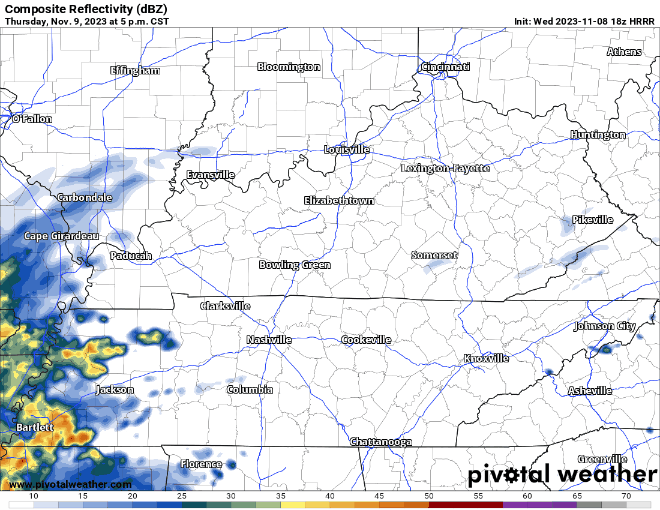
HRRR model (above) advertises some light showers moving thru Thursday morning, but holds the bulk of the rain until after sunset Thursday, steadily continuing overnight, and ending Friday AM.
No severe weather expected, maybe a rumble of thunder tho.
Total rainfall amounts look to be around 0.5″, not going to totally solve our drought situation, but it’ll help.
Models still disagree about our rain chances Saturday + Sunday, although a majority of them keep us dry.
Next week our dry trend continues, doesn’t appear to be any legit rain chances until the end of the week.

Quick References:
Weather changes constantly.
Follow @NashSevereWx on Twitter for any changes to this forecast.
Live coverage during tornado and severe thunderstorm warnings:

Look good.
Support the mission.

We are 100% community supported. No ads. No subscription fees. Keep it free for everyone.


Categories: Forecast Blogs (Legacy)
You must be logged in to post a comment.