
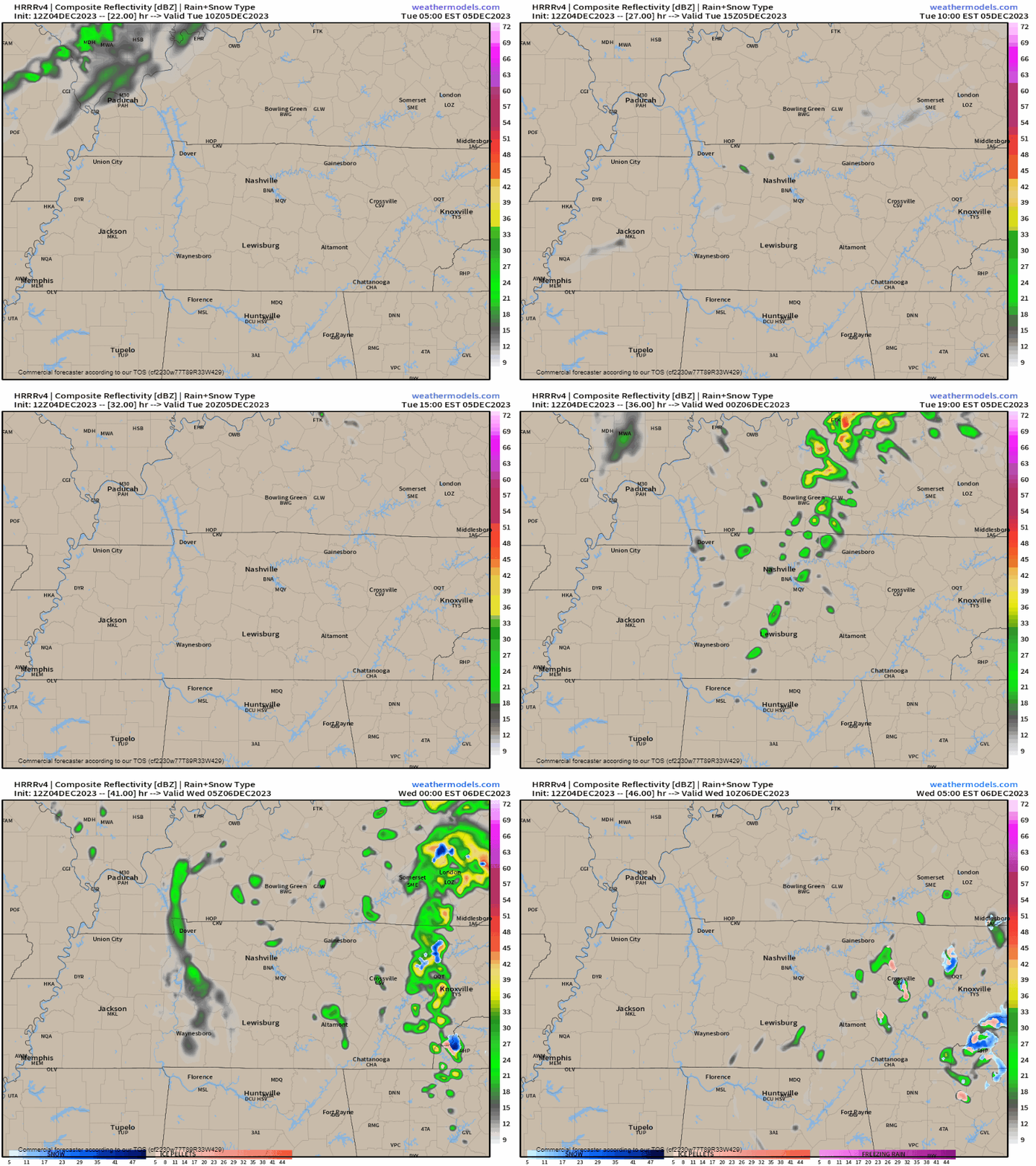
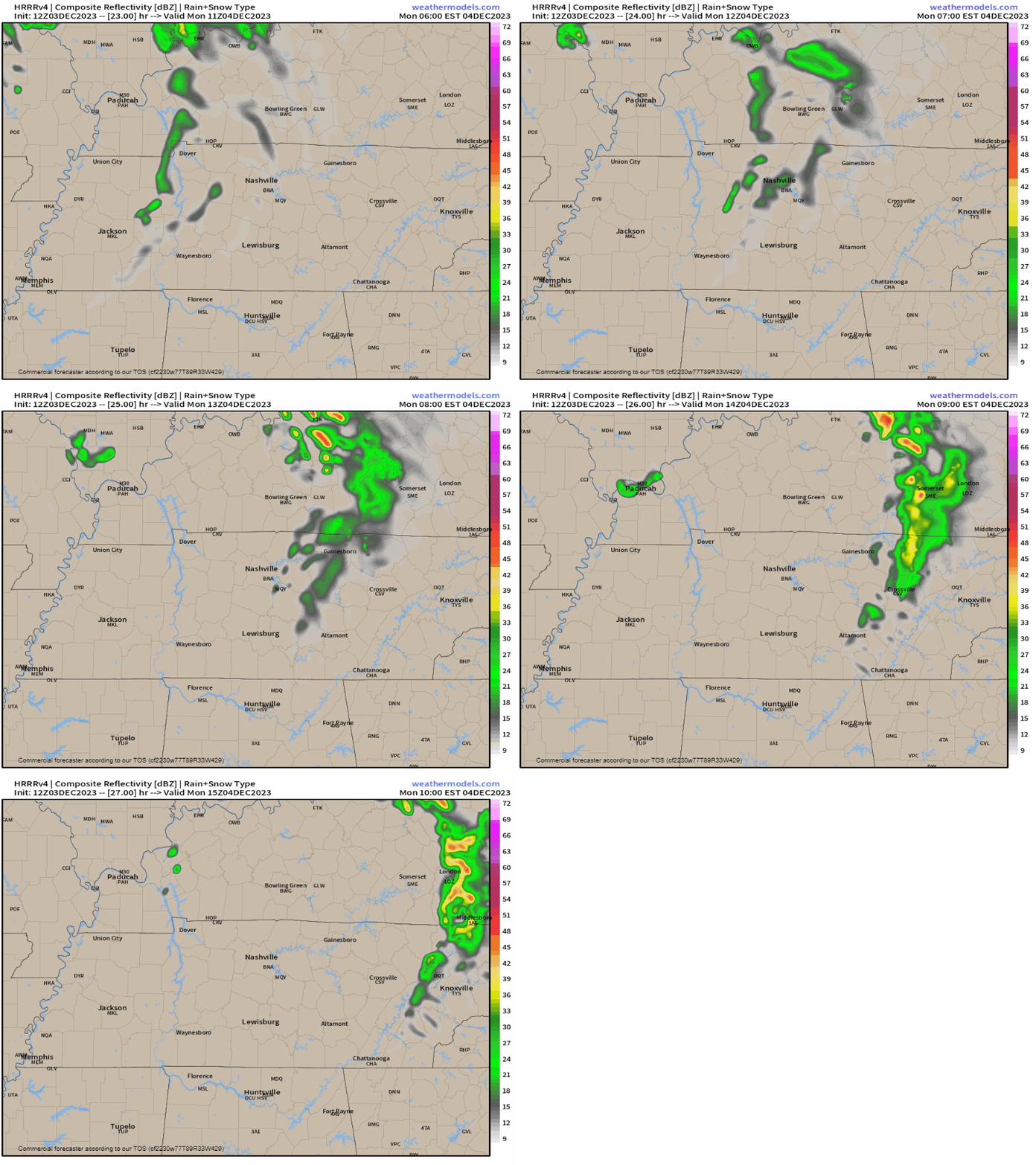
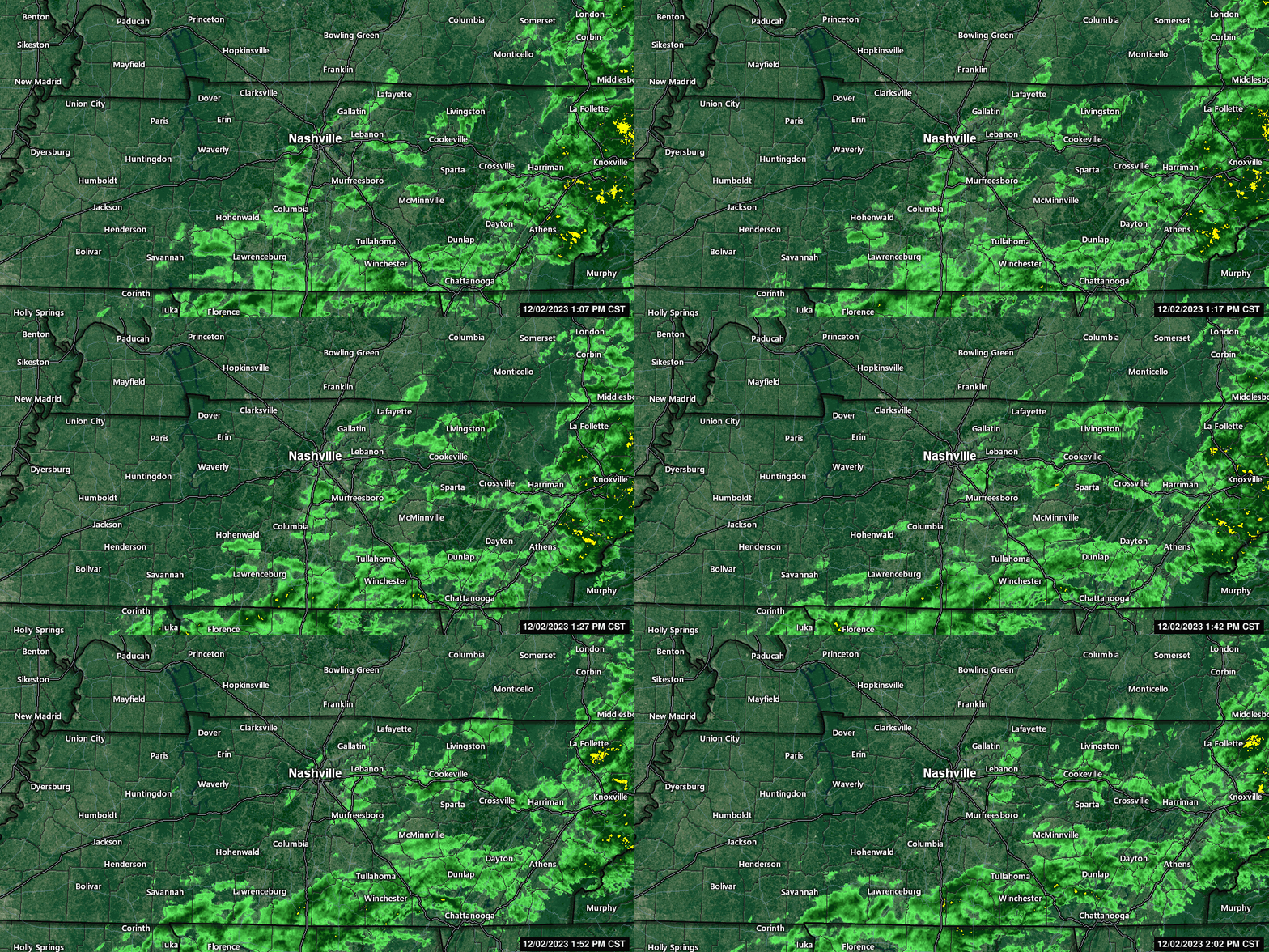
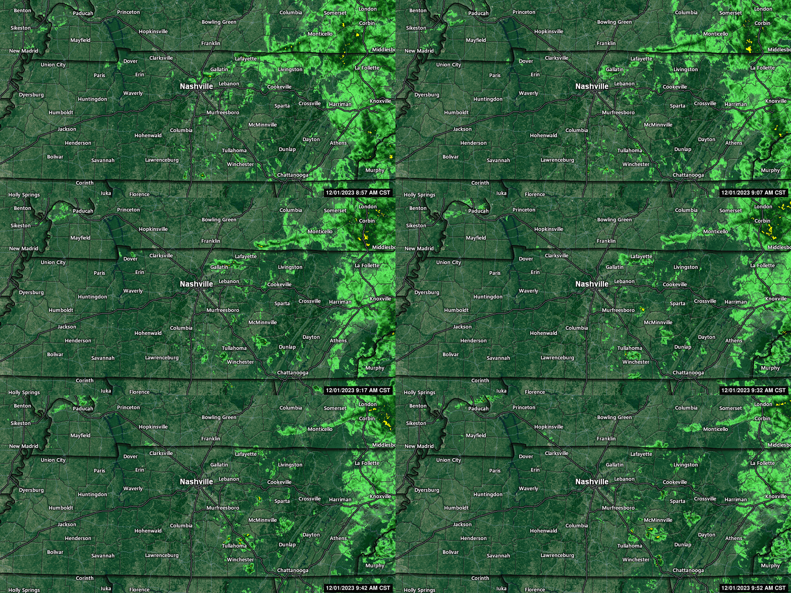
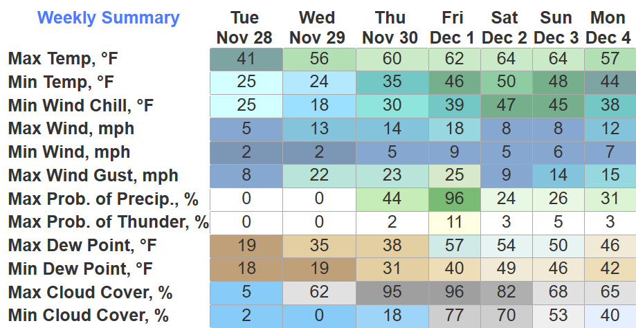
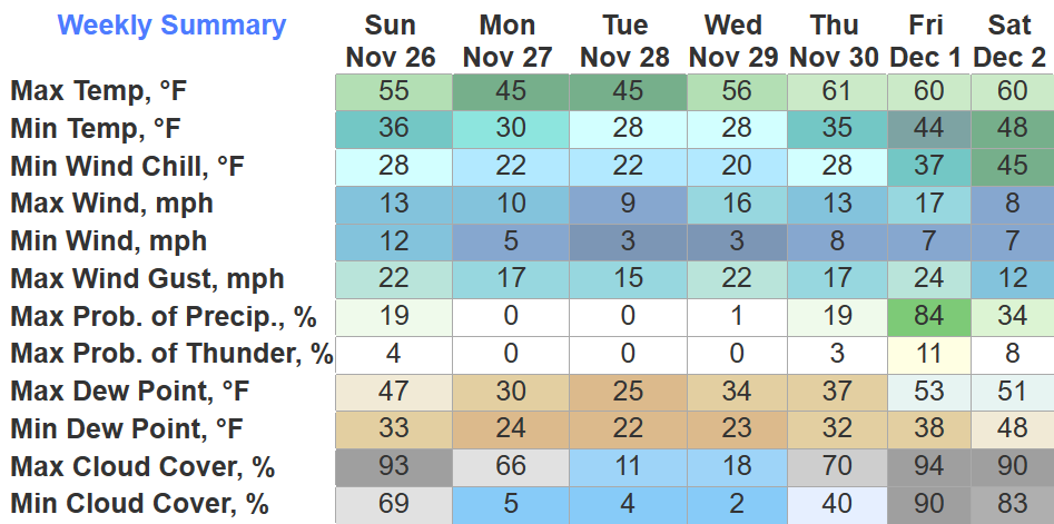
Rain showers later today/tonight.
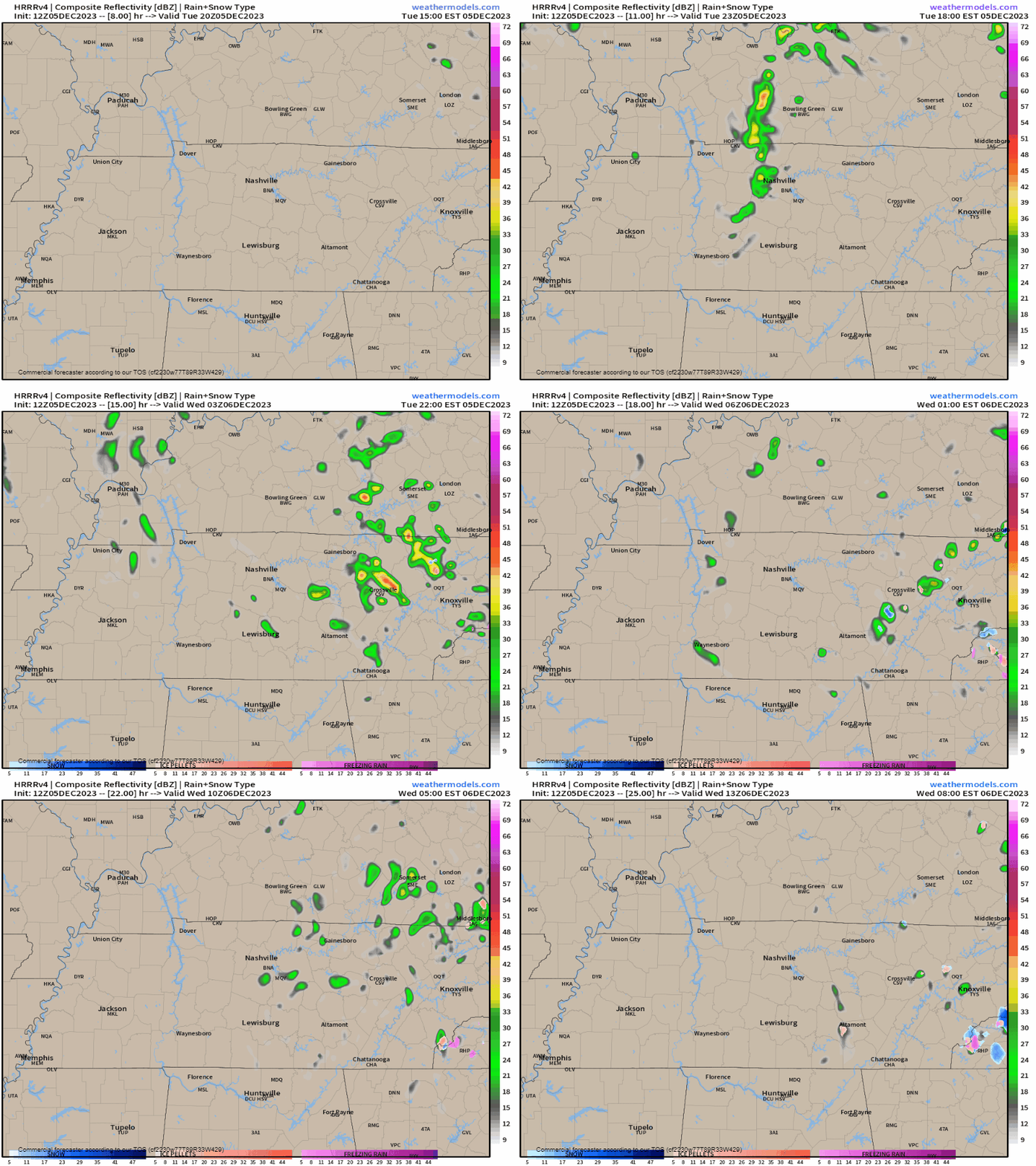
- 1. Brief, chilly, and unevenly rainfall caused by – impress coworkers at holiday parties with a well timed – this “is common for these clipper systems.”
- 2. Rainout/Washout unlikely.
- 3. You may hear talk of “snow” — that’s for non-accumulating snow potential on the plateau.
- 4. GEO ICYMI: The plateau is east of us – think between Cookeville and Crossville – they’re at higher elevation – easier for them to snow than us.
Near/Freezing Morning Temps & Thursday’s Marginal Fire Danger
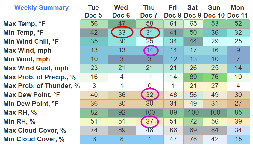
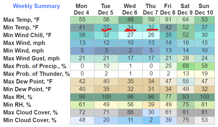
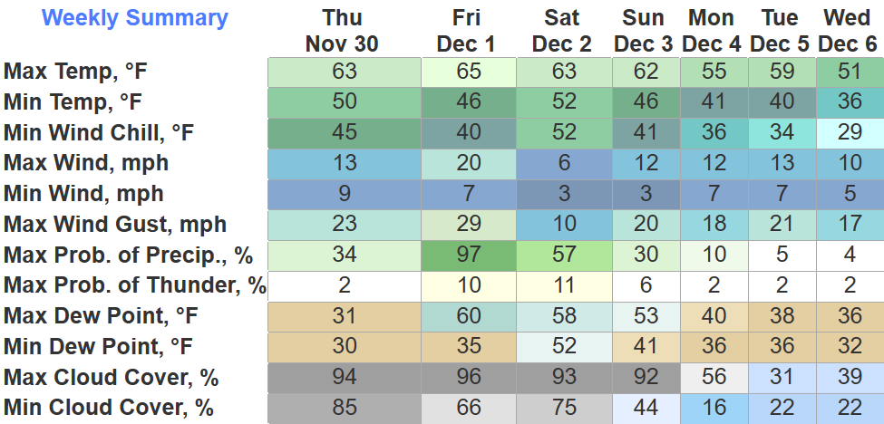
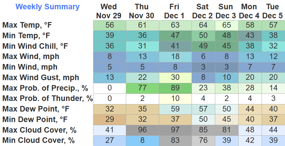
- 1. Ice may form where fog develops on bridges and overpasses Weds & Thurs mornings.
- 2. A marginal fire danger Thursday afternoon will discourage outdoor burning – dry airmass with low relative humidity + winds in the low teens = may cause fire containment problems.
Big Rainmaker Coming This Weekend
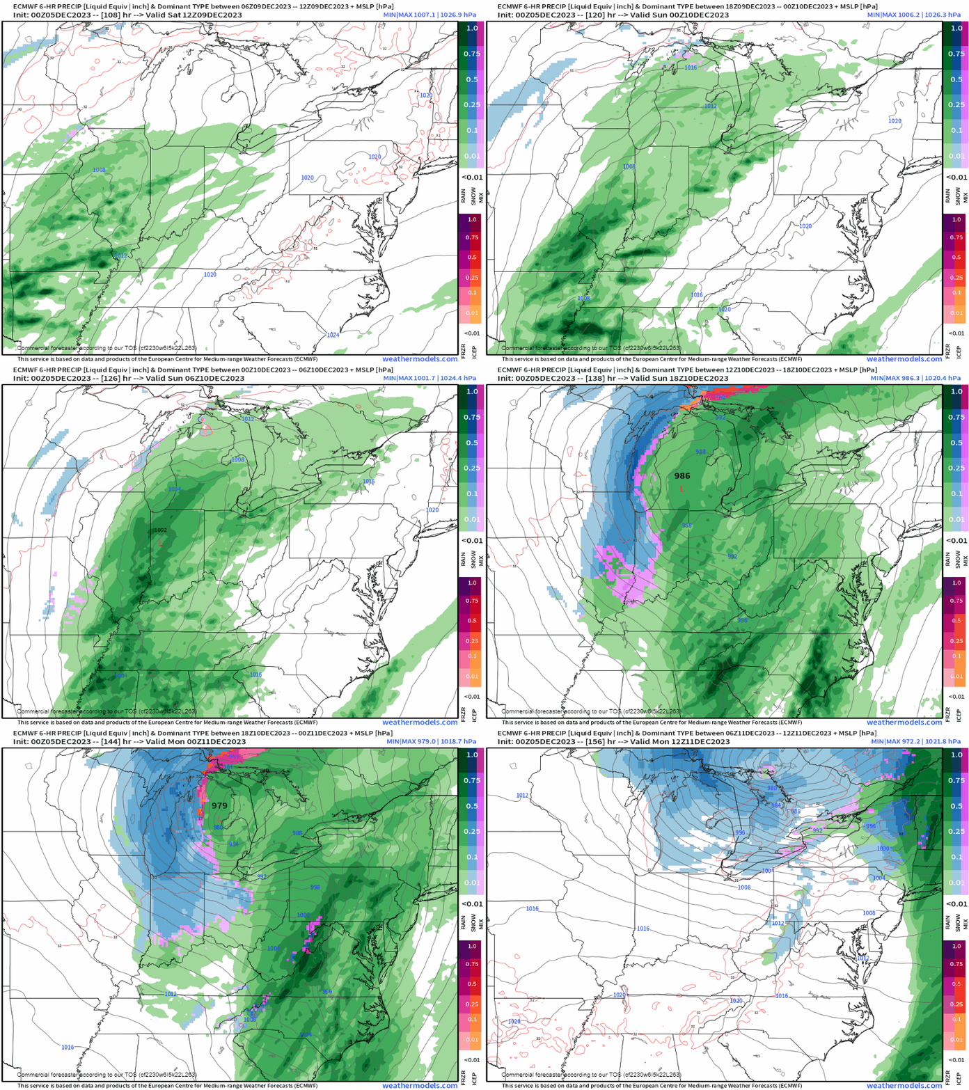
- 1. TIMING: best guess right now arriving Saturday night and departing around lunch Sunday – timing will probably change.
- 2. RAIN: on average 1″ to 1.5″ – this too may change either way – models diverge in key areas – this reduces forecast confidence.
- 3. STORMS: again our confidence is shaky here due to model disagreement – the path of the storm favors thunderstorms – but other essential ingredients (instability, lapse rates) are very weak in the models – SPC excluded us from severe weather risk – no risk will be introduced unless and until models develop agreement – more to follow later with new data.
- 4. SNOW: not for us – our ground will be way too warm – unreceptive to ice – models at this range routinely advertise snow that never happens – even the Euro (above) pulls the colder air columns way too far north of us.
Quick References:

Weather changes constantly.
Follow @NashSevereWx on Twitter for any changes to this forecast.






You must be logged in to post a comment.