
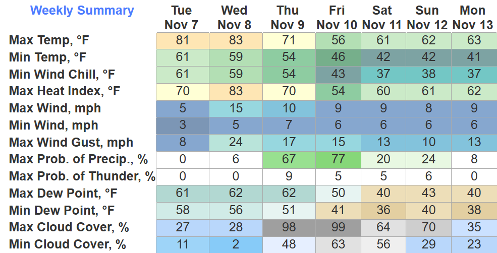
BNA made it to 80° today, tying the daily record high. Wednesday we’ll have another chance to tie/break the daily record high of 83°. Winds gusting up to 20-25mph from the south will help us get warm, and also would help spread fires, so pls don’t burn stuff.
Thursday, we get some good news as a cold front comes in and bring some much-needed rain chances.
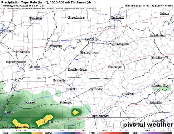
The EURO model (above) shows the bulk of the rain moving thru Thursday evening into early Friday morning. Rainfall totals look to be 0.5″ – 1″. This won’t bust up the drought, but it’s something.
No severe weather is expected with this, a rumble of thunder cannot be ruled out for Thursday night tho.
Dry weather looks to return for Friday PM and Saturday. A few models suggest some rain on Sunday, but others disagree, we’ll have to wait and until they talk it over and come to a decision. Temps much more seasonal Friday thru early next week.
Quick References:
Weather changes constantly.
Follow @NashSevereWx on Twitter for any changes to this forecast.
Live coverage during tornado and severe thunderstorm warnings:

Look good.
Support the mission.

We are 100% community supported. No ads. No subscription fees. Keep it free for everyone.


Categories: Forecast Blogs (Legacy)
You must be logged in to post a comment.