Drought continues. A new seasonal drought forecast from the Climate Prediction Center isn’t encouraging. They forecast the drought to continue for us and continue to develop over the rest of the Southeast.

Drought continues. A new seasonal drought forecast from the Climate Prediction Center isn’t encouraging. They forecast the drought to continue for us and continue to develop over the rest of the Southeast.

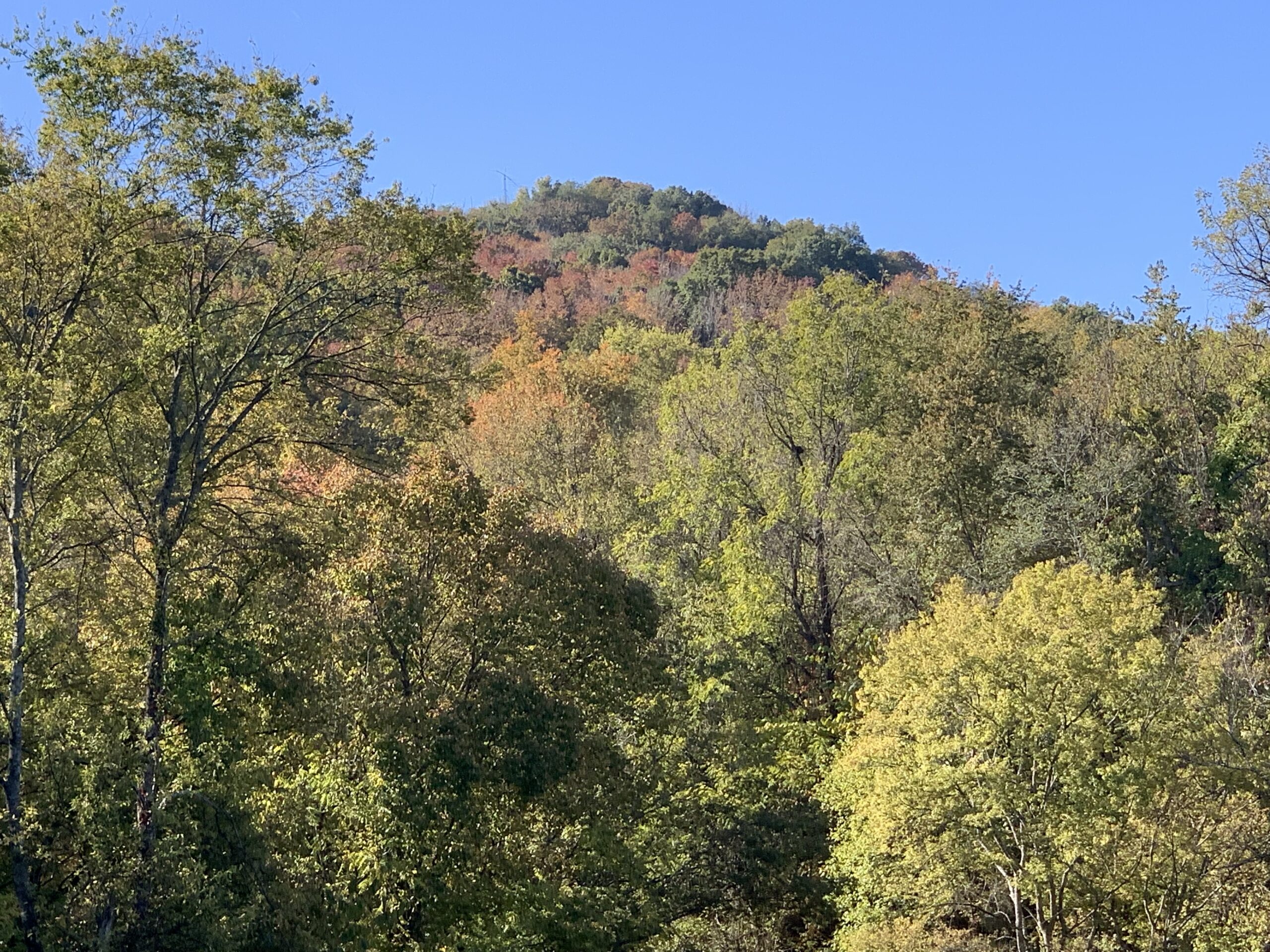
Growing szn is “effectively” over. No more Frost or Freeze Warnings. We’ll freeze again this fall/winter for sure. It’s just that there will be no more official frost or freeze warnings from NWS until next fall 👇🏽
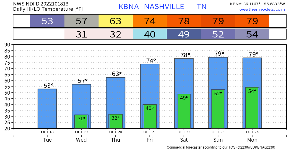
BNA did not hit freezing this morning but BNA runs hot. Most dropped unburrrr1️⃣ 30°. My backyard went sub 29°. Expect a repeat Thursday morning then temps rise 👇🏽
Rain?
Tuesday Oct 25 to Weds Oct 26 begins next rain chance. Euro mean says around 0.5″ or so total by late next week.
BNA should hit freezing Wednesday morning.
Warm up weekend, near eighty.
No rain in sight. The Mississippi River at Memphis is at its lowest depth since 1954.
Drought isn’t just local. Much worse west. Mississippi River receiving little water.
A Freeze Warning is in effect officially from 1 AM to 9 AM Tuesday. Coldest temps will happen around sunrise.
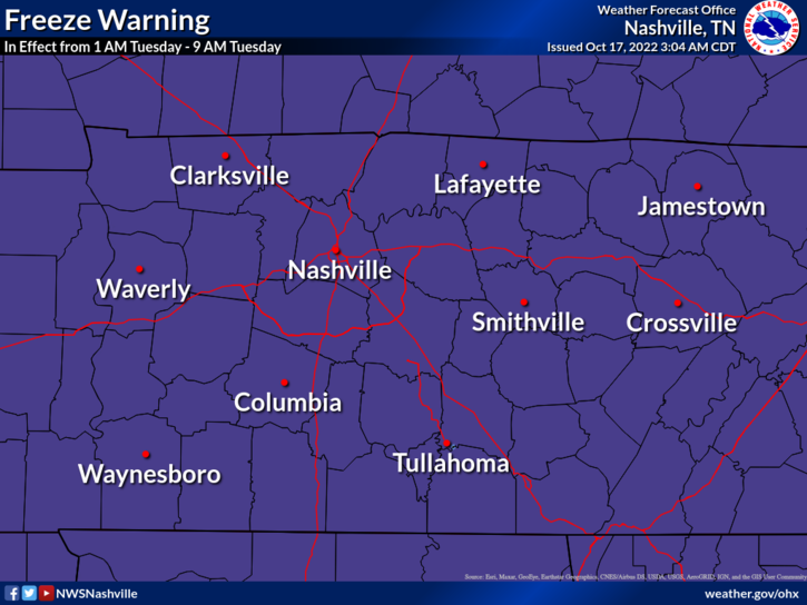
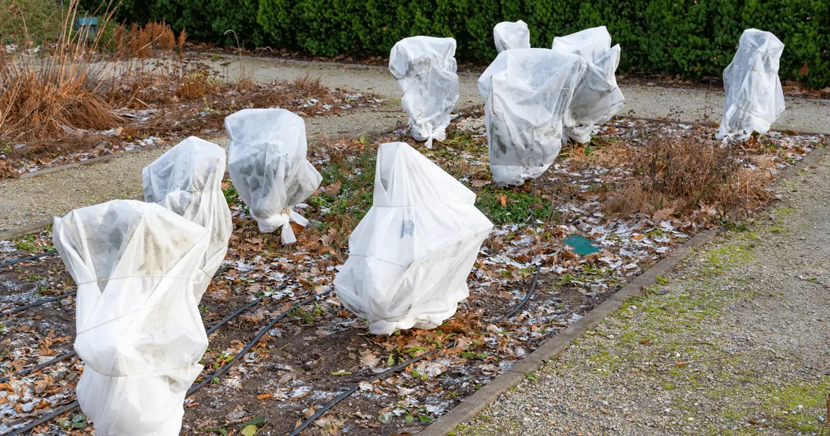
Frost and freeze conditions will kill crops, other sensitive vegetation and possibly damage unprotected outdoor plumbing.
Little bit of rain coming today, meh.
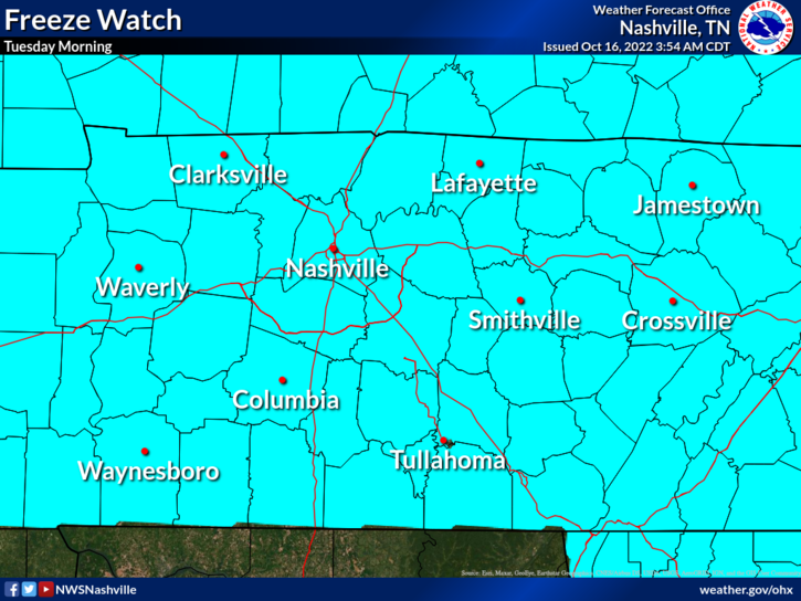
⚠️ Early Tuesday morning Freeze Watch . . .
Frost and freeze conditions could kill crops, other sensitive vegetation, and possibly damage unprotected outdoor plumbing.
Probably won’t rain today. Not totes sure about that but I’m keeping my outdoor plans.
Rain expected Sunday.
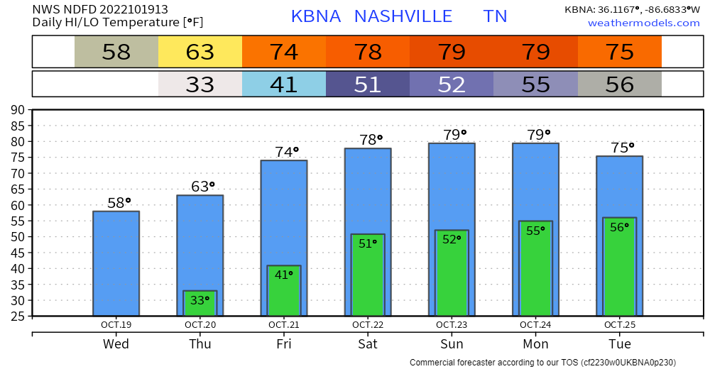
Frozen Tuesday-Wednesday-Thursday mornings incoming. Below chart shows lows around freezing. Most local backyards get a bit colder than official lows so expect below freezing temps 👇🏽:
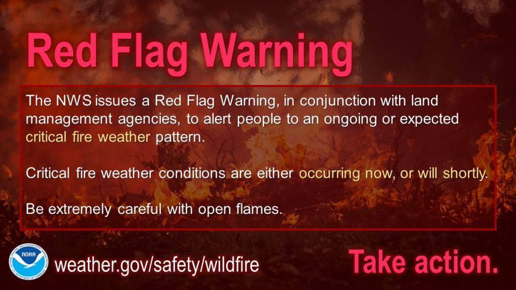
Fires may spread quickly out of control because
The Warning expires at 7 PM.

Late Saturday into Sunday rain looks meh, off and on. Total under 0.20″ won’t dent drought.
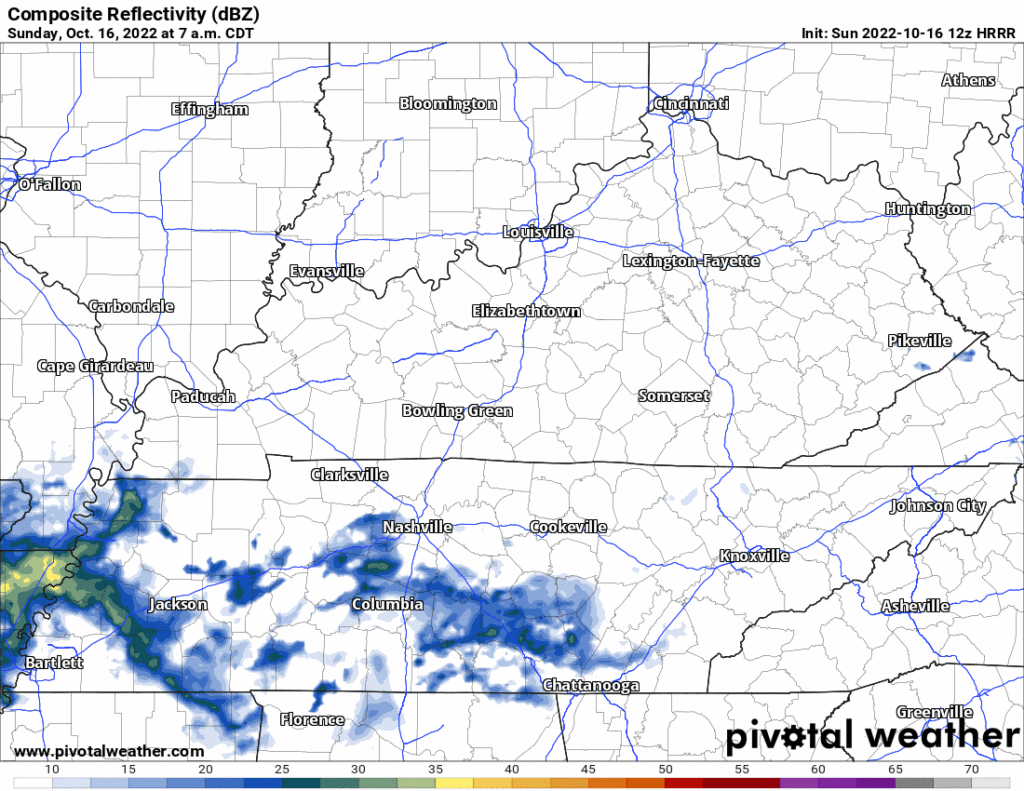
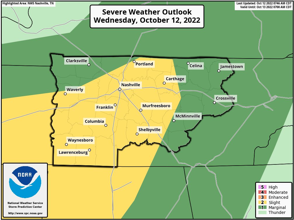
🌩️ Few thunderstorms possible Saturday but the meh severe risk is in that dark green way west of us Saturday 👇🏽

It’s been a while since we’ve had rain chances so close to each other, but don’t get your hopes up, this next chance doesn’t look to be much.
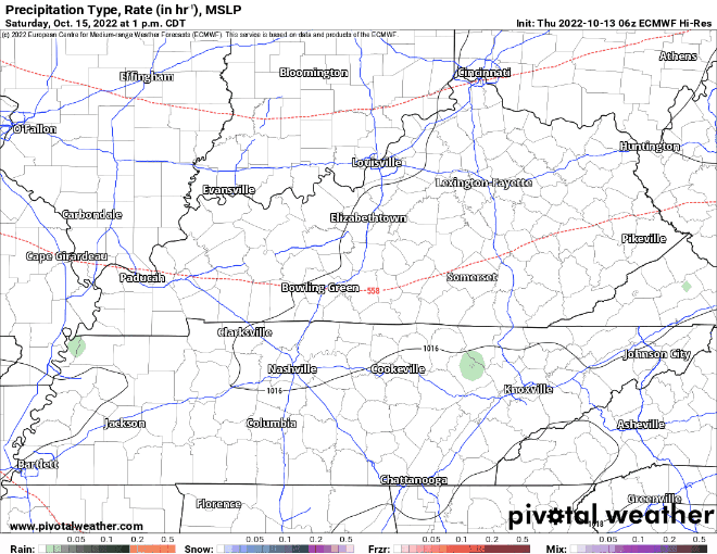
🌧️The Euro model above shows rain chances Saturday thru Sunday.
Some light showers this morning – no worries with these.
🕜 General ETA for main line of storms is 4-7 PM –> HRRR model thinks 5-6 PM (This could very easily change, stay connected!)
🕜 NAM3k model thinks storms in front of the line arrive 6-7 PM, while the main line gets here around 10-11 PM. (Majority of models lean toward the HRRR solution, ETA of 4-7PM is more likely, but it is unwise to discount any model).
You must be logged in to post a comment.