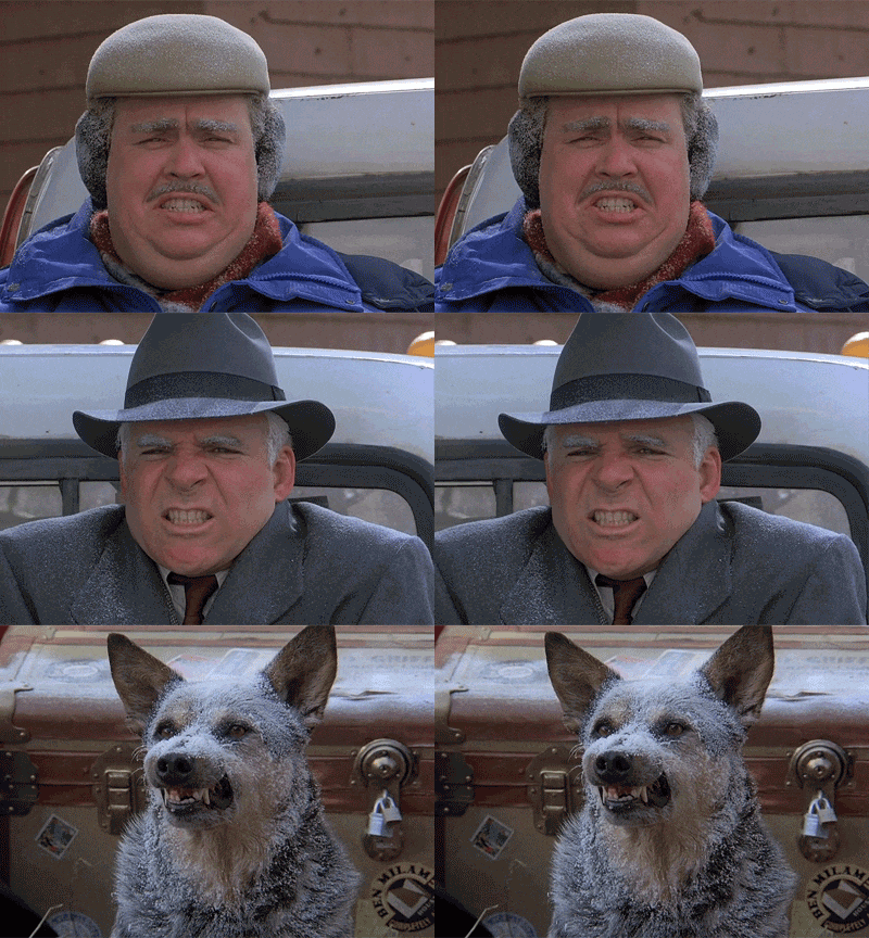
Not. Even. Close.

Current Official Hourly Observation (taken at :53 on the hour)

Current Radar Loop

Temps Next 24 Hours (auto-updating)

Tonight – Mostly Cloudy

We were supposed to hit 52 today. We. Were. Not. Even. Close.

We made it to . . . 41.

Here’s why:  A temperature inversion — a cooler layer of air underneath a warmer layer of air — trapped fog and clouds this morning. Cool air does not rise, especially not through a warmer layer on top. The fog and clouds prevented sunlight, which kept temps way down.

Visible Satellite image from 1:45 this afternoon:

Intellicast - Visible Satellite in Nashville, Tennessee 2014-03-05 14-05-01 2014-03-05 14-12-57

We don’t think that clearing line will reach Nashville before the sun sets. Without the sunlight, we didn’t make it to our high temp, and we’ll have another chilly evening.

Thursday – Mostly Cloudy  Morning Low 30 / Afternoon High 50

We think the inversion will resolve itself and we’ll see some warmer temps. We will make another run at 50. There’s a small chance of light rain clipping us from the south, but that’s unlikely.

Friday – Mostly Sunny   Morning Low 31 / Afternoon High 60

That’s better.

Official Extended NWS Forecast:

Screen Shot 2014-03-05 at 2.01.19 PM

This makes me feel better:

The Climate Prediction Center still expects below average temps for next week (March 11-15) …


610temp.new

… and, generally, things will be dry. Precip chances are below average (March 11-15):

610prcp.new

If you look even further forward (March 13-19), you’ll see even more cooler temps …


814temp.new

… with below-average rainfall (March 13-19):

814prcp.new

Additional information can be found on Twitter @NashSevereWx.

Trending Warmer…Slowly

Current Official Hourly Observation (taken at :53 on the hour)

Current Radar Loop

Tonight – Mostly Cloudy

Temps Next 24 Hours (auto-updating)

Clouds, sent here by an overachieving low pressure system in the Gulf, held down temps today.

image11

Wednesday – Partly Sunny  Morning Low 27 / Afternoon High 53

National Weather Service Text Product Display 2014-03-04 15-25-34 2014-03-04 15-27-12

Any lingering ice will be smote by higher temps Wednesday.

Hey Snoop, are temps only 5° below average?

Really? Thanks, Snoop!

Thursday – Mostly Cloudy; Slight Chance of AM Shower   Morning Low 32 / Afternoon High 50

National Weather Service Text Product Display 2014-03-04 15-27-42 2014-03-04 15-29-08

There is a teeny, tiny chance of freezing rain Thursday morning, but it’s too remote of a possibility to dig in to. If it happened, it would have very little to no impact.

Not expecting any meaningful rain. Our NWS is only giving us a 20% chance.

Official Extended NWS Forecast:

Screen Shot 2014-03-04 at 3.50.54 PM

The Climate Prediction Center still expects below average temps for next week (March 10-14):

610temp.new

Additional information can be found on Twitter @NashSevereWx.

Should I Drive Tonight/Tomorrow?

Current Official Hourly Observation (taken at :53 on the hour)

Current Radar Loop

Editor’s Note: Reviewing Last Night

We saw about 12 hours of rain, totaling 2.39″ between 3 PM Sunday and 3 AM Monday. We spent the day and most of last night wondering when temps would hit freezing at the surface, setting off an ice storm.

Last night’s weather models predicted all of Davidson & Williamson Counties would be at or below freezing by midnight.

Instead,

the freezing temps didn’t settle in until 2 AM. I’ll spare you my theory why, because I bet 99.49% of you don’t care. Let’s just say the models tripped over their collective dress, but mostly they got to where they needed to go.

At 3 AM, as the rain was starting to pull away, the official temp was 32. At 4 AM, the temp was 30. You need more than a few hours to make ice at those temps, especially considering less than 18 hours before, the temp was 65.

I was up at 4:30 AM, and everyone from law enforcement to the poor souls out driving reported few, if any problems.

At 5 AM, temps plummeted 4 degrees to 26. The almost 2.5″ of rain that had just fallen had nothing better to do than freeze. By 6 AM, temps hit 24, and by 7 AM we hit 23. All the roads iced over, and it was wreck-a-palooza.

Then the snow started. It was heaviest in Williamson County. Many surfaces turned white (others didn’t, such as Hermitage). I declared the end of #SnowDome.

Will put together a pretty good Storify. Check it out.

The afternoon brought a steady wind and sunlight prying through the clouds. This helped clear some of the snow. Many roads – especially main roads — turned just-wet, and a lot of the moisture evaporated. The March sun angle is good at melting snow.

The icing threat is not over. More on this below.

Tonight – No More Precip; Partly Cloudy

Temps Next 24 Hours (auto-updating)

Temps today stayed stuck in the low 20s, and it’ll drop into the teens overnight.

Wind chill values overnight will be in the single digits. 

(Another Editor’s Note: Some roads, mostly main roads, are largely passable. However, any and all remaining moisture is going to freeze hard overnight. Roads which were “fine” this afternoon may still be OK after dark. Others may no longer be in good shape after dark.

Secondary roads, especially those tree-lined and shaded from sunlight, will still be treacherous. Williamson County Schools have already canceled, for good reason. Davidson County’s roads should be better as a whole, but they’re certainly not clear.

Here’s the NWS Statement:

Many of you have asked if it’s safe to drive from Point A to Point B tonight or tomorrow morning. I’m uncomfortable answering those questions. Let me explain.

I estimate twelve million potential routes in and through Davidson and Williamson County. The truth is that unless you drive a route, you really don’t know if it’s safe, and I haven’t gone anywhere today. Every route is unique, traversing different altitudes, with different surfaces, some with bridges/overpasses, exposed to varying levels of sunlight and variable traffic patterns, etc. All these factors impact road conditions, which are subject to constantly changing weather conditions.

So, when you ask us “Can I Go Here or There?” I want to help you, but I just can’t. The last thing I want to do is suggest a route is safe when I don’t really know it’s safe. I always prefer you stay put and stay safe. I get that you’re not asking us for a guarantee, you just want an opinion, but I prefer not to influence your decision when it comes to this topic. I hope you understand.

Thanks : )

Tuesday – Mostly Clear  Morning Low 13 / Afternoon High 43

National Weather Service Text Product Display 2014-03-03 15-47-12 2014-03-03 15-48-43

We expect all the ice and snow to melt, except in really shady areas.

Wednesday – Sunny & Chilly  Morning Low 25 / Afternoon High 54

National Weather Service Text Product Display 2014-03-03 15-48-57 2014-03-03 15-50-40

Clouds arrive late, bringing a slight chance of rain overnight.

As some of you know, I drove up from Starkville to work for the NWS-Nashville, assisting them in with Severe Weather Awareness Day 2014. I really enjoyed meeting so many of you. I really appreciate your support. (Editor’s Note: The Intern and The Intern’s Friend [Hayden Nix] did a fantastic job at SWAD. They were professional and responsible. The Intern even did a good job waxing Will’s Jeep with his tie).

Official Extended NWS Forecast:

Screen Shot 2014-03-03 at 3.28.04 PM

Additional information can be found on Twitter @NashSevereWx.

Sun Peeking Out

Current Official Hourly Observation (taken at :53 on the hour):

Current Radar Loop 

Temps Next 24 Hours:

From @GatorCarrie 13:

Although snow is exiting stage East, travel hazards remain. From the NWS 11 AM Conference Call:

The Winter Storm Warning, originally set to expire at noon, has been cancelled. Current Advisories:

Strong winds will cause snow to blow around, spreading snow where it would otherwise just melt.

The good news is that the sun is peeking through and helping melt the snow . . . a little. Keep in mind, it won’t melt things completely, and it’ll refreeze tonight.

Some ice should linger in the morning, but the melting process will begin in full-force mid-morning tomorrow.

Hazardous Travel

What Happened Overnight

The freezing line covered all of Davidson County at 1 AM. It reached Franklin at 1:40 AM, and the rest of Williamson County by 2:30 AM.

The heaviest precip started to pull away between 3 AM and 4 AM.

This Morning

We now look to the west, where a band of light snow is forecast to arrive near the morning rush hour, mostly to areas along and N of I-40. NWS thinks this will fall as freezing drizzle, but don’t be fooled, that stuff slicks up the roads:

The freezing line was slow to arrive, but it made it. We’ve seen several tweets from those who’ve been driving. Earlier this morning, experiences varied from “totally fine,” to “some ice, not as bad as I thought,” to reports of power outages (suggesting icing). Starting at 5 AM, we started seeing reports like these:

Temps dropped from 30 to 24 in a few hours (4 AM to 6 AM). Conditions rapidly deteriorated as ice quickly developed.

There are several more of these. I think you all get the picture.

For road conditions, turn on local news and search the #tSpotter hashtag on Twitter.

We’ll be updating the weather throughout the morning on Twitter @NashSevereWx.

Our Winter Storm Warning continues until noon.

Current Official Hourly Observation (taken at :53 on the hour):

Current Radar Loop (the precip data is good, but ignore all the blue [snow]; this radar is very snow-happy)

Temps Next 24 Hours:

Winter Storm Warning Now Through Noon Monday

7 PM — No real changes to the forecast below. Everything seems to be on track. The weather balloon that went up a few hours ago returned data confirming freezing rain/ice will be the initial mode of wintry precip.

The RAP and HRRR weather models predict the freezing rain (beginning of the ice storm) will reach

  • Joelton and Fairview: started around 8 PM.
  • Rivergate/Madison/Bellevue/Downtown/Fairview: right around freezing now.
  • almost all of Davidson Co + Brentwood/Cool Springs near 10 PM
  • Spring Hill/Franklin/Nolensville around 11 PM, and
  • College Grove by Midnight.

Remember, once the icing begins, it’ll take a few hours for it to accrue. Just don’t be the first person to find out “Well, that was all ice.”

These models predict freezing rain to continue until about 3 AM, followed by a one-to-three-hour lull in the precip, and behind that, a blast of snow.

By 6 AM, temps should be in the low 20s. Whatever freezes is going to freeze hard, and hang around most of Monday. Monday’s high: 30.

This website is a supplement to @NashSevereWx on Twitter, where you can find more information.

3:26 PM — Here’s the NWS Conference Call video for all of Middle TN:

2:48 PM Update

Two years ago today, a supercell thunderstorm dropped hail along I-40, causing millions in damage.

From Belle Meade, March 2, 2012:

Today, exactly two years later, we are under a Winter Storm Warning, effective from 6 PM tonight until noon Monday.

Current Official Hourly Observation (taken at :53 on the hour):

Look over toward Memphis. All that will arrive in Middle Tennessee tonight (the algorithm on this map is a little off. It tends to “go blue” [snow] a little too soon. That said, much of this is freezing rain/ice/snow):

As the rain arrives, temps will drop to, then well below, freezing. Our overnight low is 22 (twenty-two).

Winter Storm Warning

Technically, a Winter Storm Warning means:

This warning was issued mainly for ice accumulation.

Ice

As early as 6 PM, rain will be falling, but ground temps will fall to, then quickly below, freezing. Temps next 24 hours (this is auto updating):

Rain will hit the ground, then freeze. This is an Ice Storm.

Freezing rain should begin first in NW Davidson County (Joelton) by late afternoon. This looks like a bad storm for Joelton. The rest of us are forecast to see freezing rain beginning at 6 PM.

Icing will begin at higher elevations first, then spread NW to SE as the night continues.

The NWS expects a total of 0.25″ and 0.40″ of ice.

Those at higher elevations are particularly vulnerable. NW Davidson County (looking at you, Joelton & Fairview), could be on the high side of that total.

If we get this much ice, it will be a significant event. Travel is nearly impossible in 0.25″ of ice.

Power lines and tree branches, weighed down by the weight of the ice, often topple over in these conditions. Prepare for any power interruption. Emotionally ready yourself for the potential we may miss part of the Oscars.

We may also get lightning and thunder with the freezing rain overnight. Yes. ThunderIce.

Once we hit freezing tonight, we won’t get above freezing until noon Tuesday.

Snow

Cold temps will continue to filter into all levels of the atmosphere overnight. During overnight hours, the freezing rain will briefly changeover to sleet, then snow. Sleet (the little noisy pellets) is a good thing, because it will help limit ice accumulation on trees and power lines (but it’ll still contribute to travel problems).

Up to 1″ of snow is expected to fall on top of the ice, all before noon Monday.

Travel

Once temps hit 32, impacts to travel will take a few hours to occur. Because you never want to be the first to say, “Well, that was ice,” I do not recommend travel during the Warning (begins at 6 PM tonight).

Your reports of ice, sleet, snow, and road conditions will be important today. Radar does not see what’s happening on the ground. Tweet in your report simply by including the hashtag “#tSpotter.”

We are uncomfortable giving specific travel advice, and especially uncomfortable on days like this.  Click on this for the TDOT Smartmap for all road condition information. They also have a terrific app.

Any travel north and northwest of Middle TN is discouraged. Even though ice will take a few hours to develop, I would plan to be off the road by 6 PM tonight. Those at elevation will be impacted first and worst. Bridges and overpasses will freeze before “regular” roads. Worst of all, this will happen in the dark. Your built-tough truck cannot handle ice.

We will pass along county/metro school closings, but we find out about those when you do.

Winds

Very strong tonight: 30+ mph gusts are possible, especially tonight. This will enhance/worsen icing impacts, helping to push over any wobbly branches and power lines. Wind chills in the morning will be as low as 9.

After tonight, we are not forecast to rise above freezing until noon Tuesday.  The ice and snow will be around until then.

As always, you can get more/updated info on Twitter @NashSevereWx. Monitor multiple reliable (HINT: not a crap app) weather sources throughout the day.

Legit Ice Storm Concerns (Sunday Night/Monday Morning)

Current Official Hourly Observation (taken at :53 on the hour)

Current Radar Loop

Blog updated at 4:15 PM

Tonight – Cloudy

Temps Next 24 Hours (auto-updating)

SundayWinter Weather Advisory – AM Low 46, PM High 59

Rain will be off and on in the morning and early afternoon. Then, a steady, soaking rain moves in.  As the rain is moving through, temps will crash, and create potential for an ice storm.

Below is fresh data from the NWS Conference Call.

Summary

Watches and Advisories

NWS suggests these Watches and Advisories may expand tonight or early tomorrow.

Possible Ice Totals

ETA

Models definitely see some wintry precip shenanigans through Monday morning (mostly ice):

NWS Freezing Rain Probabilities

Of ANY Freezing Rain:

Of Freezing Rain Greater Than 1/10″

Of 1/4″ Freezing Rain (which would be a legit mess)

Needless to say, Travel may be a mess Monday morning.

Glue yourself to reliable sources of weather information tonight & tomorrow. We will update this site when new information arrives. You can always find current and additional information on Twitter @NashSevereWx.

It’s Meteorological Spring! So Let’s Discuss Freezing Rain!

Current Official Hourly Observation (taken at :53 on the hour)

Current Radar Loop

Saturday  Cloudy

Temps Next 24 Hours (auto-updating)

Today is the first day of Meteorological Spring (a/k/a Fake Spring)! So, of course, most of this update will be about Freezing Rain.

Looking back at February, it was wetter and colder than normal. Snow fell on 4 days, for a grand snowfall total of 0.1″. Yes, you read that right. Zero-Point-One Inches. It took four days for us to get:

Only a slight chance of rain very late tonight. Otherwise, expect an overcast Saturday.

Sunday – Rain + Cold Front = Late Freezing Rain & Wintry Shenanigans?  Morning Low 46 / Afternoon High 58

National Weather Service Text Product Display 2014-03-01 06-25-49 2014-03-01 06-27-28

There is a major winter storm brewing . . . to our Northwest. Predictably, the edge of this winter storm will be close enough to us to warrant discussion, but the big impacts are likely to miss us. We think.

Here’s the weather warning/watches/advisories map as of 6:30 Saturday morning. Notice we are not included in any winter watches or warnings. This may change later.

National Weather Service 2014-03-01 06-31-01 2014-03-01 06-35-48

Sunday Rain

Off & On (mostly “off”) rain is likely Sunday morning into early afternoon.

By mid-afternoon, heavy rain will arrive, and last through the night. The Hi-Res NAM at 6 PM has a good illustration:

Wintry Precip

Most of the time, the freezing line is behind all the rain, meaning the rain pushes through, then the temps drop under freezing.

Late Sunday night or early Monday morning, some models think the freezing line may be in the middle of the rain. Stated another way, we think the temp may drop below freezing while the precip is still here. Check out the Hi-Res NAM Sunday night at midnight:

Don’t fixate just on the freezing line (drawn in white, above). It will have been almost 60 Sunday afternoon, so for any ice shenanigans to happen, we’ll have to get well under freezing, likely 27 or 28 degrees. Rain and 31 or 32 degrees will slick up your deck, mailbox, garden gnome/pink flamingo, a few bridges/overpasses, and areas at elevation (poor Joelton), but it shouldn’t cause a giant mess on the roads.

Here is the GFS Ice/Freezing Rain/Rain/Snow model through Monday at 6 AM:

Because temps overhead are expected to be warmer than temps on the ground, we think we’ll see freezing rain (falls as rain, hits the ground, then freezes).

What we said yesterday is still true today. An ice storm requires a precise alignment of several atmospheric conditions. It is extremely difficult to exactly forecast this event 36+ hours in advance.

Stay tuned. This could become a big deal, or nothing at all.

Currently, we think extreme N and NW Davidson County may see an ice storm. The SPIA Damage Index measures the potential impact of an ice storm on the utility grid:

SPIA Sunday Night:

SPIA Monday Morning:

Fun Fact: Sunday’s storm system is the same one that brought Tornado Warnings to southern California Friday.

Monday – Snow?  Morning Low 25 / Afternoon High 34

National Weather Service Text Product Display 2014-03-01 06-27-42 2014-03-01 06-28-36 

The storm system will be exiting the Middle Tennessee in the morning. A few snow showers may develop on the back side of it, but no meaningful accumulation is currently expected.

Official Extended NWS Forecast:

Screen Shot 2014-03-01 at 6.29.46 AM

Additional information can be found on Twitter @NashSevereWx.

Wintry Shenanigans Late Sun/Early Mon? #BlameSears

Current Official Hourly Observation (taken at :53 on the hour)

Current Radar Loop

Tonight – Increasing Clouds Late & Cold

Temps Next 24 Hours (auto-updating)

Tonight — Light Rain (See Above Radar) – 9 PM 43

We still think we’ll only see about 0.12″ from tonight’s rain.

SaturdayOvercast — AM Low 39, PM High 55

We’ll be between two weather systems (Friday’s Rain, Sunday’s Rain/Mix/Whatever). Most of the day will be cloudy and mild, but we may see a few showers in spots. The day will not be a washout.

Sunday/Early Monday – Steady Rain, Changing to Ice/Mix? — AM Low 49, PM High 53

Rain chances will increase as we move through the day. Expect a washout Sunday night. The potential for wintry shenanigans increases late Sunday/overnight Monday.

Two nights ago, I got this email from Sears:

At the time, the weather models were relatively quiet.

Last night, I had a long conversation about soccer with a Sears employee, who mentioned in passing the Sears “liquidation sale” this weekend.

(Note: I wish I was making this up).

So, to review:

1.  Sears warned us all about an ice storm and offered to sell us generators and chain saws, then

2.  Sears started “liquidating” inventory.

Then, the models starting doing stuff like this:

At 3 AM Monday morning, the NAM model predicts Ice/Freezing Rain:

The GFS model predicts rain changing to a wintry mix/freezing rain event in the wee hours of Monday morning:

The Euro (not pictured) predicts accumulating wintry precipitation, most likely freezing rain/ice.

Even the Canadian model is calling for wintry/icy shenanigans during Monday morning’s wee hours:

Sears, y’all. Of all places, SEARS! If our #SnowDome is breached, #BlameSears.

Officially, our chances of ice are around 50%:

Here is the afternoon Hazardous Weather Outlook from NWS-Nashville:

The risk is greater to our NW. Higher-elevation locations (Joelton: Home of the Wooly Mammoth, and Fairview — I’m especially looking at you) are at higher risk:

Now, before you go all @PanicCatfish, consider:

1.  We’re still a long way away from the event. Ice storms require precise atmospheric conditions to occur. Our ability to forecast those conditions more than 48 hours away is *cough* suspect.

2.  Warm Sunday temps will make ice accumulation difficult.

3.  Temps are forecast to rise above freezing Monday afternoon (but not by much).

More details to come tomorrow.

We will be at Severe Weather Awareness Day Saturday at Trevecca. There are a few spots left. It’s free, but you need to register.

Cold Morning, Then A Warmer, Wetter Weekend

Current Official Hourly Observation (taken at :53 on the hour)

Current Radar Loop

Tonight – Increasing Clouds Late & Cold

Temps Next 24 Hours (auto-updating)

image11

Friday – Cloudy; Increasing Chance of PM Rain  Morning Low 17 / Afternoon High 51

National Weather Service Text Product Display 2014-02-27 15-47-46 2014-02-27 15-49-28

A quick blast of rain is in Friday night’s forecast. We expect a total of 0.12″ of rain. Most models predict a very light wave of rain to move through.

The weather model (Hi-Res NAM, Friday 3 pm – Midnight) below is probably overstating how much rain we will see. We include it to illustrate how fast the rain will move through:

Saturday – Cloudy, Warmer & Maybe Sprinkles?  Morning Low 37 / Afternoon High 57

National Weather Service Text Product Display 2014-02-27 15-19-33 2014-02-27 15-21-24 

Freezing temps are at bay, for now. The trade off is clouds teasing us with a very small chance of rain. I would not worry about it.

Official Extended NWS Forecast:

Screen Shot 2014-02-27 at 4.00.00 PM

We expect over one inch of rain Sunday night through Tuesday night:

After that, temps will dip below average yet again.

Additional information can be found on Twitter @NashSevereWx.