Note: Today is the first Saturday of the month, so you can expect the usual tornado siren tests in Metro at noon and Williamson County at 1:00 pm. With today’s rain, they may opt not to test, but if they do, that’s what’s up.

Note: Today is the first Saturday of the month, so you can expect the usual tornado siren tests in Metro at noon and Williamson County at 1:00 pm. With today’s rain, they may opt not to test, but if they do, that’s what’s up.
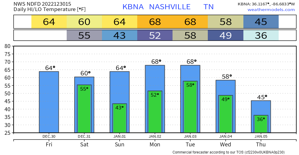
We have two opportunities for rain in this forecast. One begins early tomorrow morning and ends sometime Sunday. The other comes late next week, say Thursday.
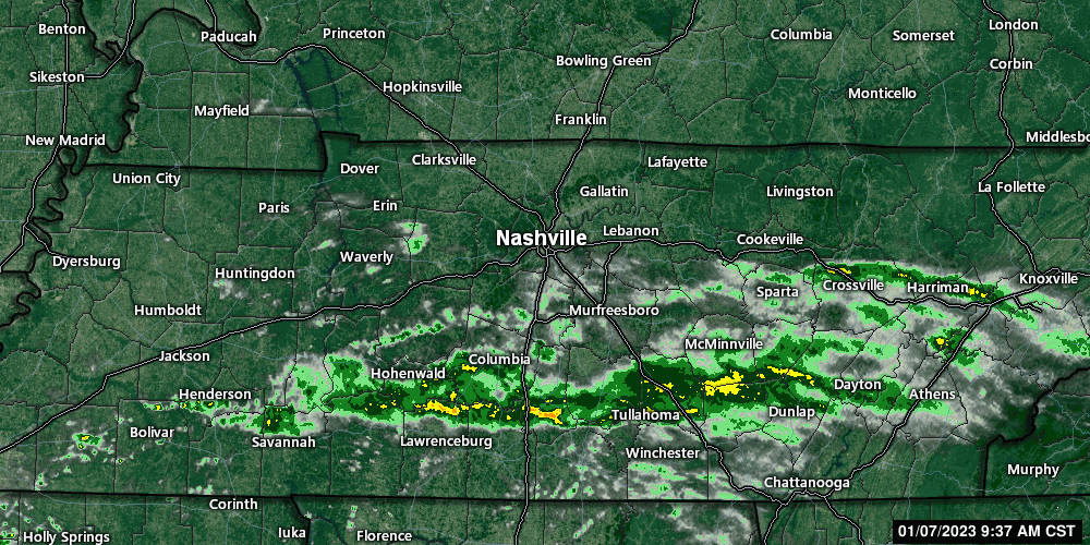
Early tomorrow morning, showers should be approaching us. Initially, the rain will be light and scattered. The rain will likely fill in at various times and drop periods of moderate rain. It’s hard at this juncture to pin down exactly when the more solid rounds of rain will come through. If you have outdoor plans, just keep an eye on radar. https://nashvillesevereweather.com/radar/
It’s a bit of a relief to not have much to write about. No severe weather with this forecast and no flood threat. Just….the usual.
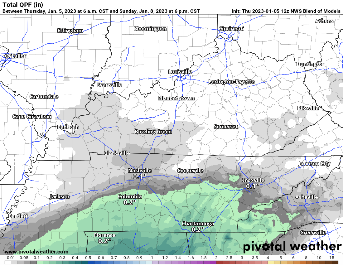
A window for rain chances opens Friday night and closes Sunday morning. Rain chances are fairly low each day, and total rainfall amounts through Sunday night are expected to be wellll below half an inch, maybe not even a quarter inch, according to the blend of models. This could change. But, this is what we’re aiming for as of today.

We are experiencing some beautiful weather today in our two counties. After storms the last few days, a crisp blue sky is a welcome sight.

Beyond today, expect temps during the day in the 50s and lows overnight in the mid 30s. Leading into the weekend, things change.
The Tornado Watch has been canceled for both of our counties.
The severe portion of Round One has moved through, leaving us with some rain for a few more hours. Flood Advisories are out for both of our counites, turn around, don’t drown! We may see the sun come out for a little after the rain moves out.
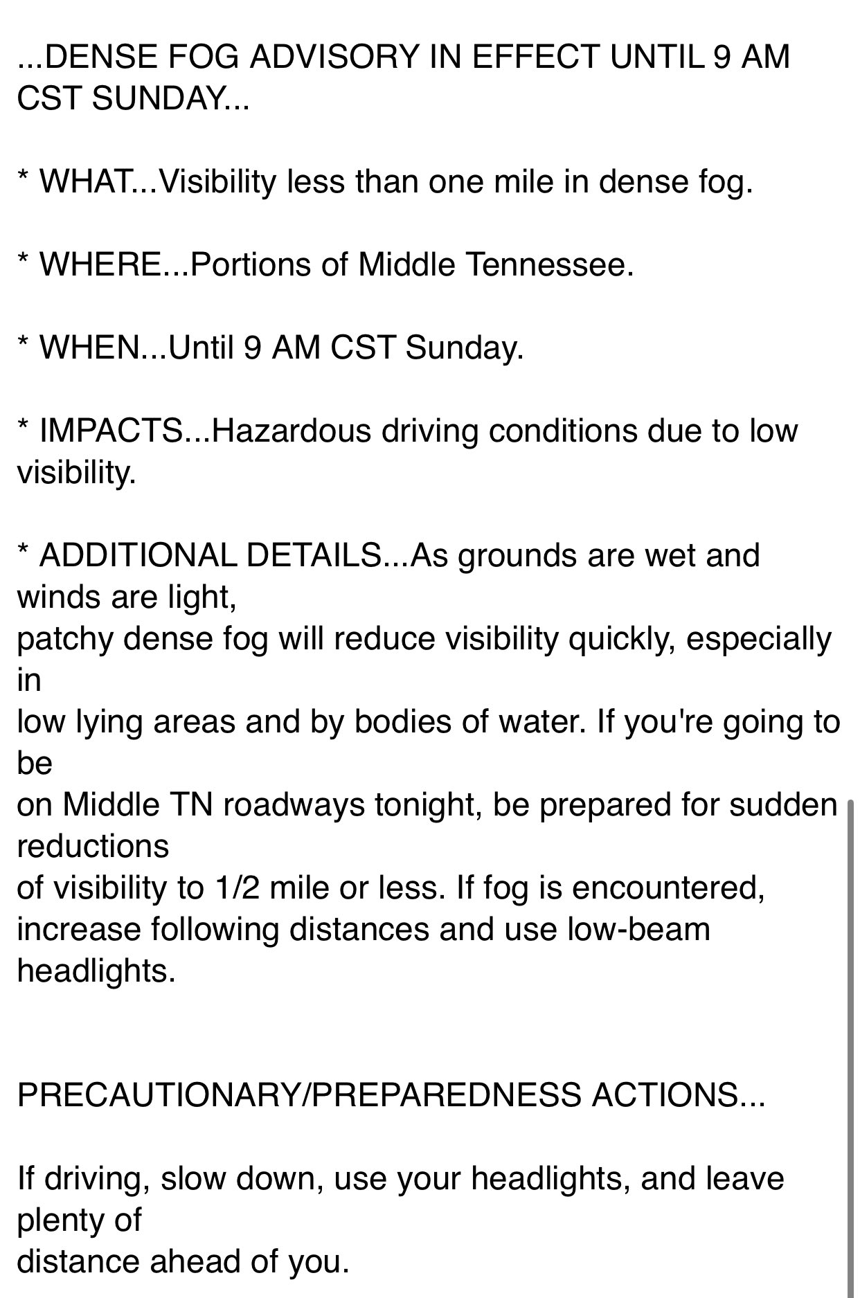
The Weather Radio Broadcast in Nashville is down and will NOT be restored until AFTER this event. Your Weather Radio will NOT go off if there is a warning issued for you. Find alternatives such as the StormWatch+ app or another wake-me-up app.
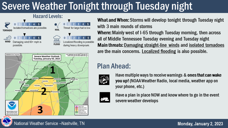
We are looking at three possible rounds of severe weather. Let’s break them each down. BTW, none of these looks like “slam dunk” chances.
First Chance:
We may see some scattered showers this afternoon – these should not be severe.
Today, temperatures will be above average and after some fog (both literal and figurative) this morning, a sunny day is in store for most of us. Enjoy it!
Monday begins a wet pattern. By the time rain is done late Tuesday, we could see up to 2″ over the next few days.

Two weather makers are going to pass by in the next few days. One today, one on Monday. Let’s dive into it.
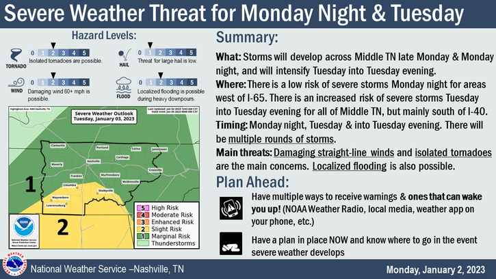
The Main Thing: The main thing we’re watching in this forecast is the potential for strong storms overnight Monday night into Tuesday morning. More below.
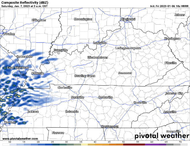
Rain moves back in during the day today. HRRR thinks it’ll be light/scattered, then pick up overnight tonight. Loop through 1 am.
You must be logged in to post a comment.