

The HRRR model isn’t exactly sure what will happen this afternoon but the latest HRRR model run wants football.
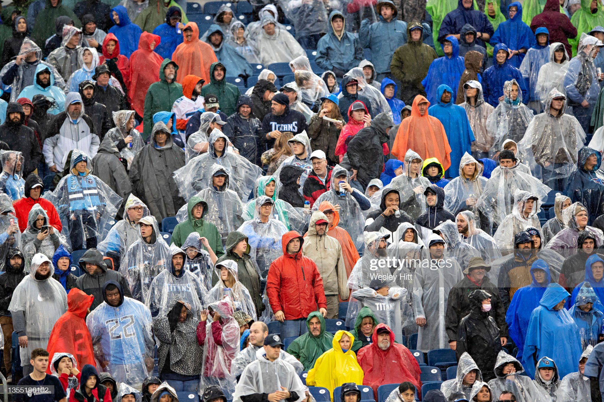
HRRR Model Noon – 3 PM, tailgating off/on rain with a few lightning strikes possible:

The HRRR model isn’t exactly sure what will happen this afternoon but the latest HRRR model run wants football.
HRRR Model Noon – 3 PM, tailgating off/on rain with a few lightning strikes possible:

Ongoing showers looks to wane away at some point this afternoon, as shown by the HRRR model below.
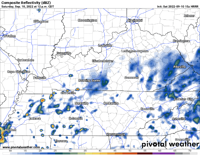
HRRR model thinks it is possible that more showers develop this afternoon. Unsure if this will actually happen, but even if it does, they look very scattered in nature, and you may stay dry. Looks as if evening plans are good to go but having rain gear close by for the NSC game or other activities wouldn’t be a horrible idea.

Mother nature thought one day of nice weather was all we deserved, as dewpoints creep back up into the mid 60s.
Rain chances are a thing today, but the HRRR thinks most of us end up dry today. If the model is right, Friday night football looks good to go.

Today and the majority of Friday you’ll probably catch yourself saying…

Mid 80’s for high temperatures, with dewpoints in the mid 50’s will have you feeling great. By Friday dewpoints will creep back up into the mid 60’s as a developing upper low brings in moisture, raising rain chances.
Today and Thursday should be fairly nice days, as high temps only reach the mid 80’s and dewpoints gradually fall into the mid 50’s. Only a very small rain chance today, as only one or two of you may see rain.

Muggy day with dewpoints in the upper 60’s and high temps in the upper 80’s. With a soupy airmass in place, more Wattery showers/lightningstorms will be possible today, but it’s more than likely you stay dry, but maybe not.

/Most of us were supposed to see rain yesterday. A majority of the models thought the coverage of rain would be widespread. Instead, it was not, and only very few people saw any. NWS Nashville said there two very nerdy scientific reasons to why the coverage of rain was so scattered (“either the forcing didn’t materialize or the cloud cover stymied instability to the point of stunting any growth. Or both,” in case you were wondering.) This is why embracing uncertainty is always so important. Weather loves curveballs, very few times are you going to get a lob right down the middle. The shrug emoji really says it all. We have a good idea of what is going to happen, but we have zero way of knowing exactly what will. ¯\_(ツ)_/¯/
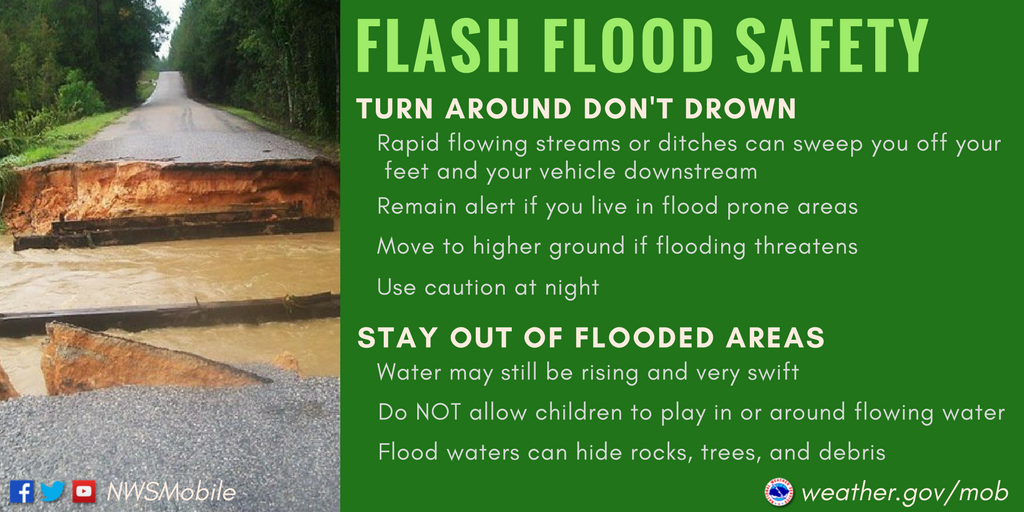
Overnight NWS Nashville issued a Flood Watch for both of our counties. Reason being is we are expected to get more rain on top of already saturated grounds. This may lead to rivers swelling up and as well as flash flooding in vulnerable spots. If you live near a river, keep an eye on it, you can always check the level of rivers here.

Your morning walk or visit to the farmers market will be dry this morning, although it’s muggy with dewpoints in the low 70’s.
I’ll go ahead and start with the good news, and it’s just about the only good news in this – temperatures will be slightly below average for the next week or so. Got to focus on the positives, right?

High today of 91°, dewpoints will increase throughout the day from the low 60’s to the upper 60’s, which will make it feel gross.
The HRRR model is continuing the show the possibility, not promise, of rain tonight, which could possibly impact your football game.
You must be logged in to post a comment.