
Rain amounts over the last 24 hours came in right around forecast amounts; generally somewhere around two tenths of an inch. Probably didn’t get your local creek flowing, but every little bit helps add moisture to the soil under our feet. As trees and grass go dormant for the winter, rain will be able to make it to our waterways more easily.
On and Off Rain Today. Find A Spooky Poncho?
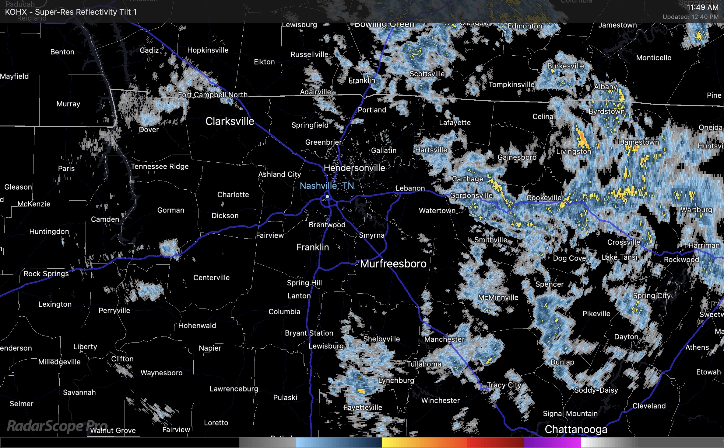
Radar shows some thin rain bands are spinning in today. Some of us will see more than others. We have a chance for more rain this afternoon and evening. Low end chance for thunder and heavy showers. Below is a mid day radar loop. Live radar can be found here https://nashvillesevereweather.com/radar/ .
Today Looks Like A Treat, Sunday and Monday May Have Tricks

Really nice late October Saturday. Looks like the rain should hold off all day, so outdoor Halloween activities look to have the green light. Worst case scenario, there’s a quick lil’ shower, doubt it though.
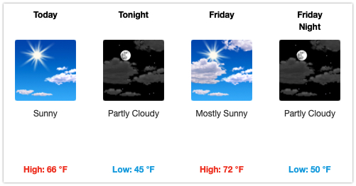
Warm and Sunny Today and Most of Saturday

A north wind kept us cool yesterday. Today we warm up into the low 70s and we’ll see very little cloud cover. Clouds begin building in on Saturday around noon. After that, our weather takes a bit of a turn.
Dry Through Friday Night, Then Rain Returns
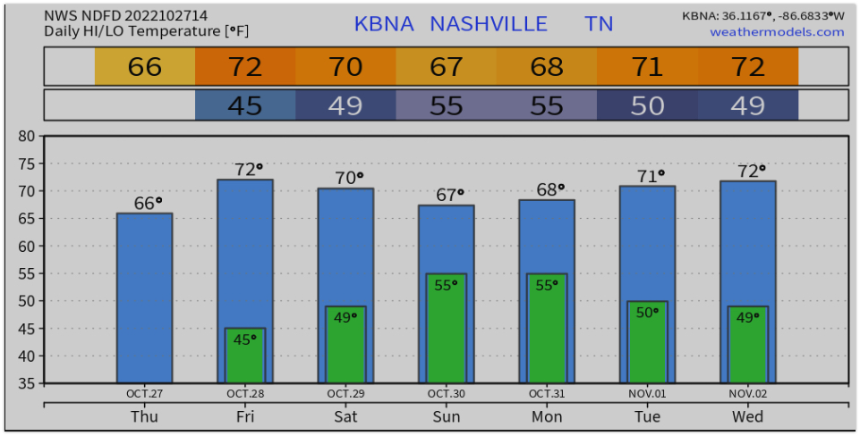
Ahead is a fantastic couple of weather days with sunny skies and warming temperatures through Friday. Highs in the upper 60s to low 70s will make for a nice end to the work week.
Saturday, things start to change. Rain comes in on a low pressure system along with a chance for thunder storms. Nothing severe is expected at this point and rain won’t be constant. The Euro Hi Res (below) is estimating about an inch of rain through Sunday night.
Cooler Today, Rain Returns for the Weekend
We got a decent rain yesterday, which was great. Best of all, no severe weather. Rain amounts were generally around a half inch. Officially .51″ at BNA. We’ll take it! Cocorahs rain reports below.
Low Probability Of Severe Weather Today, Look At Halloween Weekend
Some showers of no consequence moving through this morning, only will help water the grass a little.
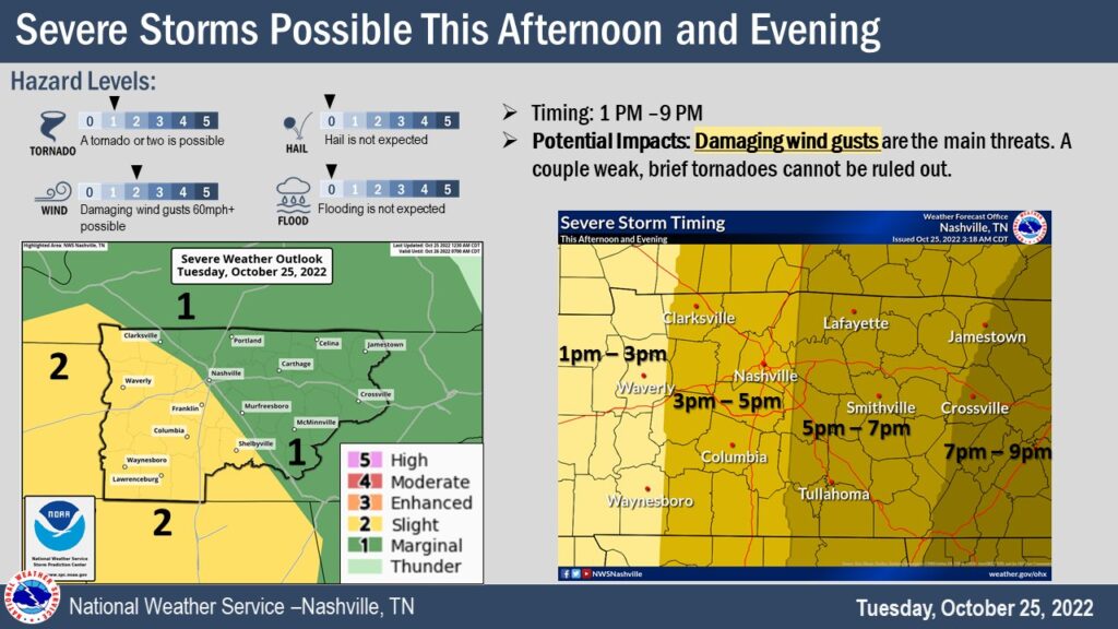
🍃Before the main line of storms arrive, it will be windy. We are under a Wind Advisory until 7pm for sustained winds 15-25 mph, with gusts up to 40mph. That could bring down a few tree limbs before the storms arrive. Also, may make it difficult for high-profile vehicles, especially on I-40. Would be a good idea to move Halloween decor inside and make sure trampolines are tied down so they don’t become frisbees.
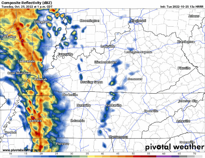
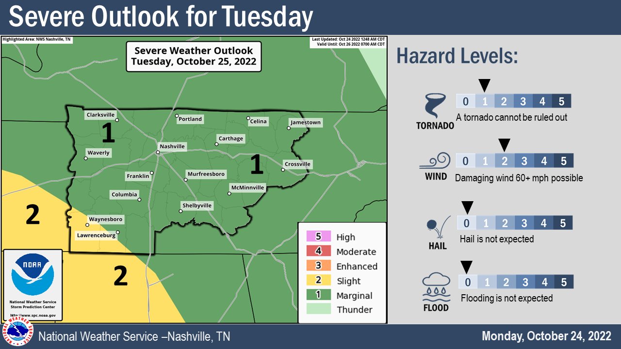
Severe Storm Potential Tuesday

Nice today with a high temp getting all the way up to 80° (record is 85° set in 2000).
Looking ahead to tomorrow, the Storm Prediction Center has outlooked us for ⚠️severe weather, specifically:
- 5% chance within 25 miles of damaging straight-line winds 💨 and severe hail (1″+)
- 2% chance of a tornado 🌪️ within 25 miles
- higher risk exists to our south and west
Before the storms arrive, tomorrow during the day will be windy and a Wind Advisory may be issued. Tie down Halloween decor, trampolines, light aunts, etc.
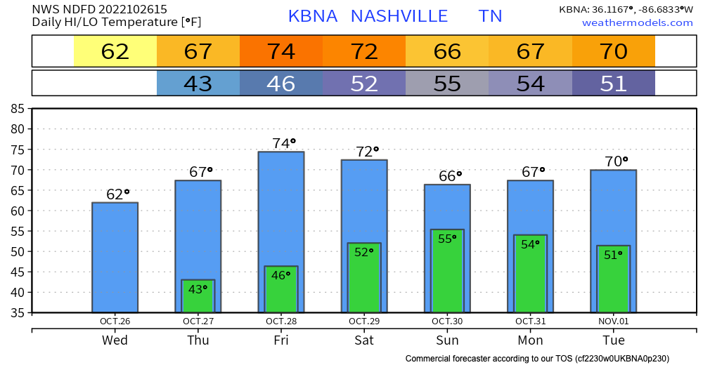
A Few Warm and Breezy Days Then Rain Returns
Today and tomorrow look like beautiful days with highs in the low 70s to even 80. Abundant sunshine and even a touch of humidity will remind you of the the best days we had this summer.
This beautiful weather gets interrupted on Tuesday by an approaching cold front. It brings our temperatures down and also brings a chance of rain for Tuesday and Tuesday night. Storm chances are meh, but a rumble of thunder isn’t out of the question.
Fall Leaves + Wind = Leaf Blower

I got a very generous birthday present yesterday. My very own Ego 650 CFM battery powered leaf blower….a perfect gift for an October birthday. It’s going straight to use.
Today, the breeze will almost surely drop some leaves. But, at least it will be a warm breeze. Temps up to 78° this afternoon.
You must be logged in to post a comment.