Current Temps and Radar

A weak disturbance coupled with a cold front will approach Middle Tennessee from the northwest overnight. The National Weather Service is giving Nashville a slight chance for showers beginning after 1 AM tonight.

A weak disturbance coupled with a cold front will approach Middle Tennessee from the northwest overnight. The National Weather Service is giving Nashville a slight chance for showers beginning after 1 AM tonight.
Current Temps and Radar
Rest of Tuesday – Chilly, Clouds Gradually Clearing – Afternoon High 44°
The clouds should clear out after dark.
Wednesday – Warmer, Sunny – Wake Up 27°, High 49°
Tonight – Flurries
Go east for a better chance of snow. We’ll just get a trace of snow, whitening on rooftops, that kind of thing.

Looks like flurries will continue off-and-on overnight, but the main snow event is happening around 6 PM well off to our east.
Current Temps and Radar
Tonight expect a cold, intermittent rain to continue. The rain is being generated by a low pressure center moving east across Kentucky. This is the same system poised to smith the east coast with blizzard conditions.
Current Temps and Radar
Today – Rain, Thunderstorms; Overnight Snow? – High 53°
So, yeah, this is weird.
As you can see from the above radar, rain is coming. It should be here this afternoon.
Current Temps and Radar
Friday night’s snow totals:
1/2″ in Bellevue:
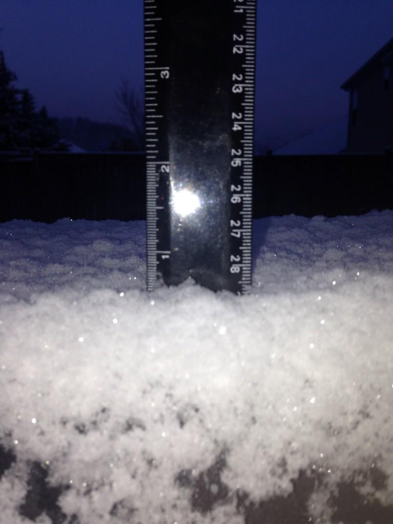
Hermitage 3/4″:
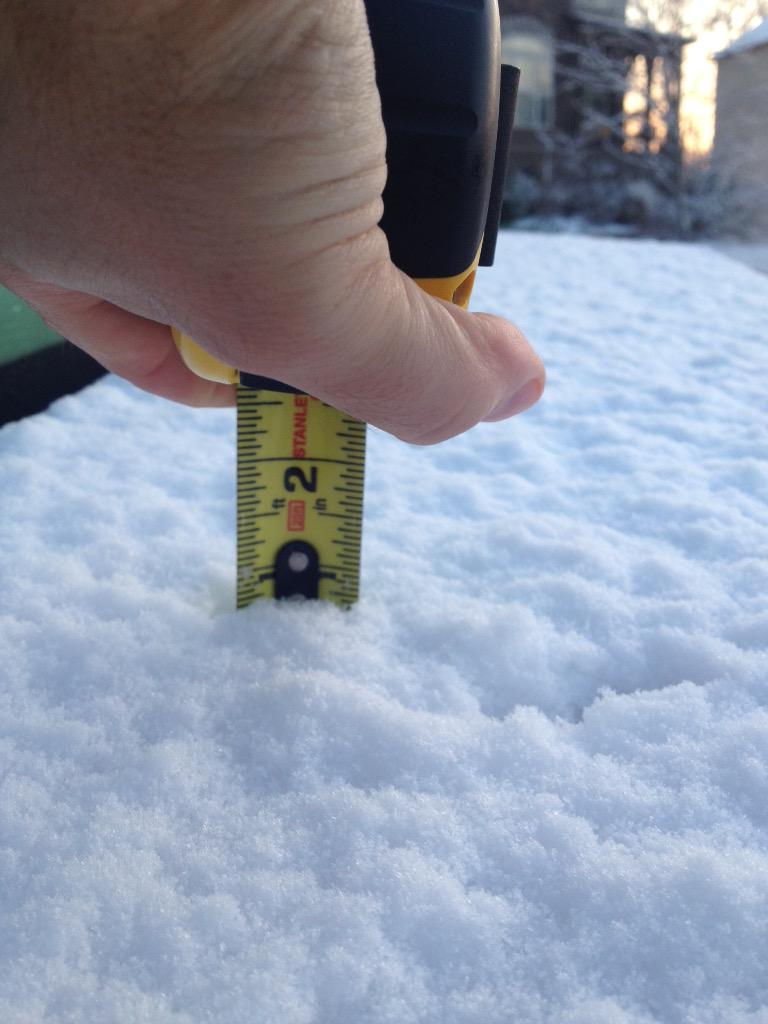
Spring Hill got 3/4″:
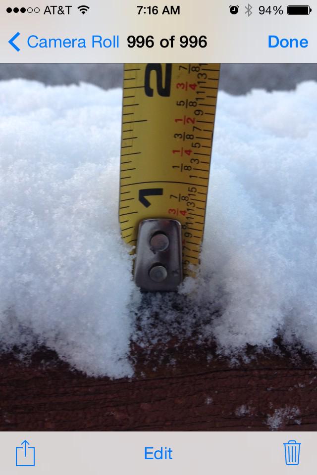
Nolensville, 1″ atop a mailbox post:
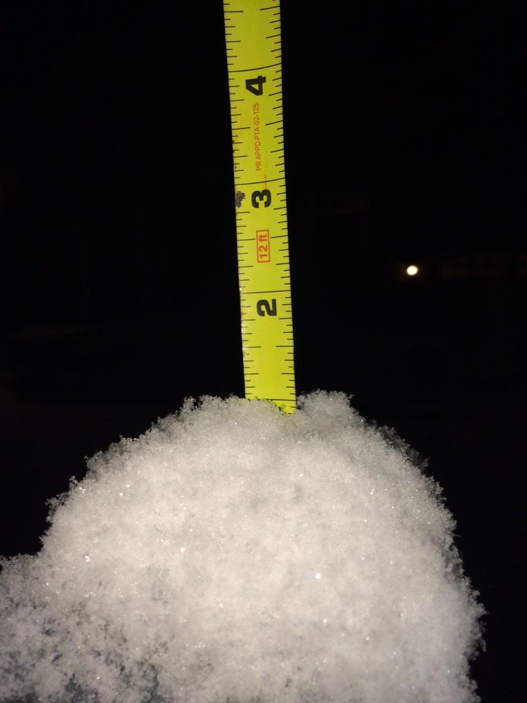
Almost 1″ in Franklin (another spotter reported 1″):
Current Temps and Radar
You’re getting two forecasts with this post. (1) One I wrote, and (2) a video by the Intern 2.0, who by the way is a real person.
Friday Night – Rain, Sleet & Snow
Current Temps and Radar
Friday – Rain, Sleet & Snow. Mostly Rain. – High 38°
Note: this forecast can change rapidly. Follow us on Twitter @NashSevereWx, and consult other reliable weather sources. This website is not constantly updated the way @NashSevereWx is.
Current Temps and Radar
Friday — Rain. Snow? — Wake Up 35°, High 40°
As you can see from the above radar images, rain is approaching from the SW. We might see a few light showers south of I-40 overnight. By sunrise, precip is expected to arrive, continuing on and off, but mostly “on,” most of the day.
Current Temps and Radar
Today – Mostly Cloudy – High 49°
We will remain mostly cloudy and rain-free despite an approaching low pressure system spreading a few light showers in our general direction. We think the air will be too dry aloft for us to see rain today. Most of the showers will stay south near Tennessee’s border with Alabama and Mississippi.
You must be logged in to post a comment.