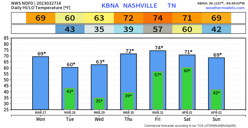
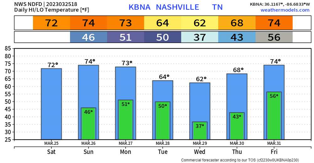
Nice temps during the day, but the next two mornings will be pretty cold as temps dip down to the low 30’s. Some areas may briefly dip below freezing. Cover up plants you love. Still expected to stay dry until Friday.

Nice temps during the day, but the next two mornings will be pretty cold as temps dip down to the low 30’s. Some areas may briefly dip below freezing. Cover up plants you love. Still expected to stay dry until Friday.
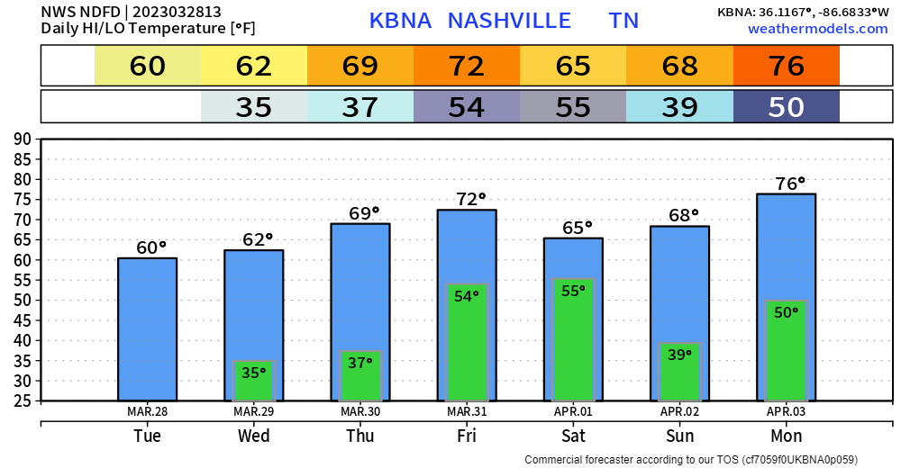
Temperatures will run around average pretty much all week. Wednesday morning we’ll probably wake up to some frost, some rural areas may dip below freezing. Not worried about any rain until Friday.

Overnight and before sunrise Monday a few showers may try to sneak through but meh, probs not. No big deal if they do.
Weds morning before sunrise we may see freezing temps with frost in local rural spots.
Models are having a hard time with rain chances over the next few days, but it appears there are two windows of opportunity for rain next week.
We’re going to keep an eye on the end of the work week. A somewhat organized system could come together to our west and come through here late week. Way too early for details, but we 👀 any system that can get organized this time of year.
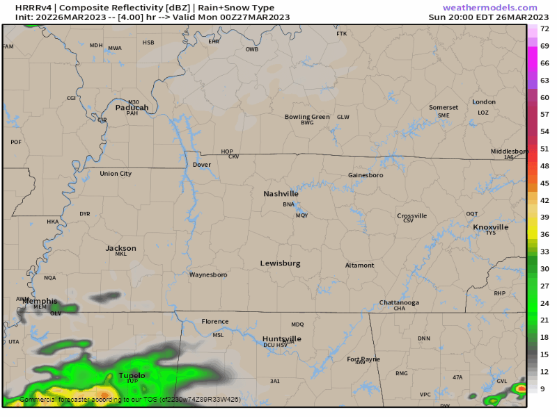
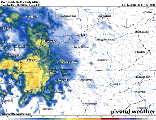
Some showers are moving in as we speak, these may bring a rumble of thunder or two, but this is NOT the main event. Rain may last on/off for a few hours. Davidson Co. will see more than WillCo. You can always check the radar here: Radar – Nashville Severe Weather
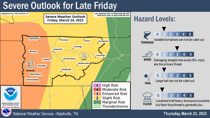
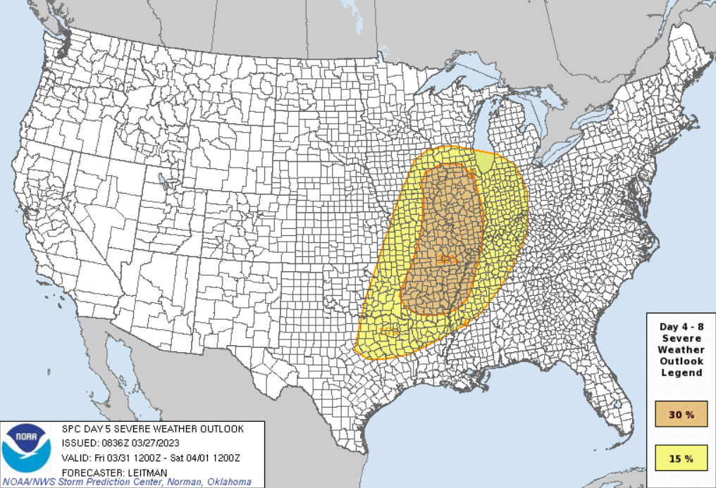
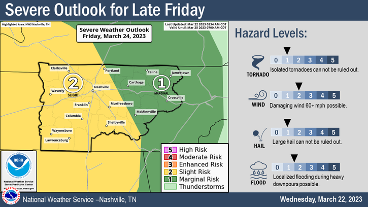
First things first, if you’ve seen new graphics, like the one above and see the new colors and think “Uh oh, are we more concerned now?” The short answer is no. Our messaging is still the same and hasn’t changed – we are still looking at a chance of severe weather overnight Friday with the main concern being damaging straight-line winds. Let’s take a deeper dive.
Rain should clear out in the next few hours; clouds will stick around all day to keep our temperatures somewhat down.
Tomorrow we get warm, some may consider it hot. High temperature pushing 80°.
We maintain our 15% chance of severe weather within 25 miles on Friday.
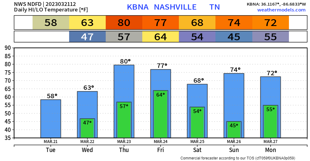
Now it is safe to say it is Spring, as at least for the foreseeable future, we won’t wake up to freezing temps.

Unfourtunately, rain chances pick up later today.
On/off rain chances begin this evening and will last through Wednesday afternoon. No flooding, severe weather, or really lightning concerns.
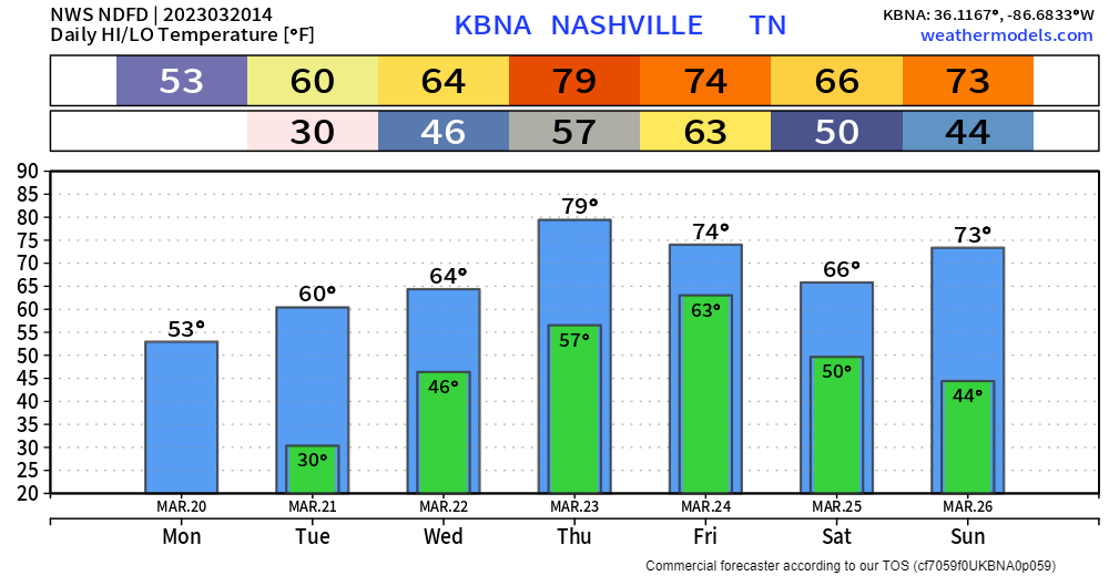
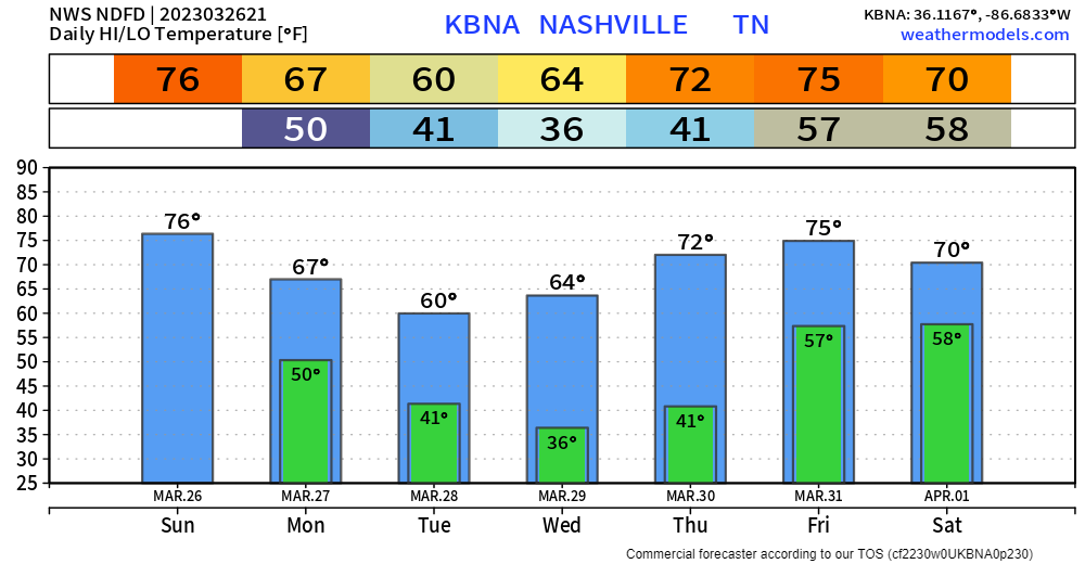
Spring officially begins at 4:24pm and it will feel like anything but spring today. BNA got down to 16° last night. Are we sure it’s supposed to be spring?
Tonight we’ll freeze again, but not so bad, official low is “only” 31°, although rural places will probably get into the upper 20’s. Last night below freezing for at least the next week. By no means am I calling it the last freeze of the season. Too early to call that. We can reevaluate…later.
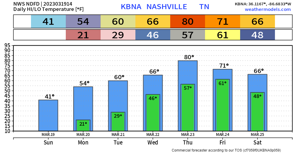
One more Hard Freeze tonight into Monday morning, Just a normal freeze Monday night into Tuesday morning.
We finally begin a warming trend starting Tuesday. Rain chances will also return Wednesday.
It’s six days out, but the Storm Prediction Center has outlooked both our counites with a 15% chance of severe weather for Friday.
You must be logged in to post a comment.