
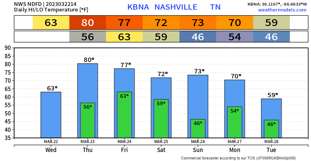
Rain should clear out in the next few hours; clouds will stick around all day to keep our temperatures somewhat down.
Tomorrow we get warm, some may consider it hot. High temperature pushing 80°.
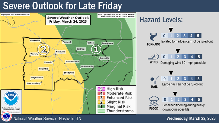
We maintain our 15% chance of severe weather within 25 miles on Friday.
Timing wise, it looks increasingly likely that the severe risk will arrive overnight Friday into the early hours of Saturday. The Storm Prediction Center does not release probabilities for the individual storm modes until tomorrow, but it looks like the main concern will be damaging straight-line winds and isolated flash flooding (rainfall totals look to be 1-2″). A tornado and large hail cannot be ruled out. High-resolution models will come into range later today and tomorrow, giving us a better idea.
With the threat being overnight, like it always seems to be, it’ll be important to be weather aware. Having multiple ways to wake up if a warning is issued for you is important – like a weather radio, wake-me-up app, or both! A cup of coffee and just hanging out works too. Sirens are not a reliable source, as they are not meant to be heard indoors, or to wake you up.
Good news, Saturday and the majority of Sunday look warm and dry. Rain chances hold off until Sunday night into Monday, and those don’t look all too impressive right now.
Quick References:
Weather changes constantly.
Follow @NashSevereWx on Twitter for any changes to this forecast.
Live coverage during tornado and severe thunderstorm warnings:

Look good.
Support the mission.

We are 100% community supported. No ads. No subscription fees. Keep it free for everyone.


Categories: Forecast Blogs (Legacy)
You must be logged in to post a comment.