No rest for the weary as we dealt with another round of severe storms today, and have two more chances before we finally get a break.
Rest of the night will be dry, but that won’t last long.

Monday we have been outlooked with a:

No rest for the weary as we dealt with another round of severe storms today, and have two more chances before we finally get a break.
Rest of the night will be dry, but that won’t last long.
Monday we have been outlooked with a:
An approaching cold front will bring us a cool down, but first it will threaten us with severe weather.
Currently, the hot and humid air and abundant sunshine are adding instability to our atmosphere. A severe thunderstorm watch has been issued by the storm prediction center.
Quite the active morning we had. If you have any storm reports, be sure to tweet them at us with #tspotter. We’ll have a quiet and dry rest of our Saturday night.
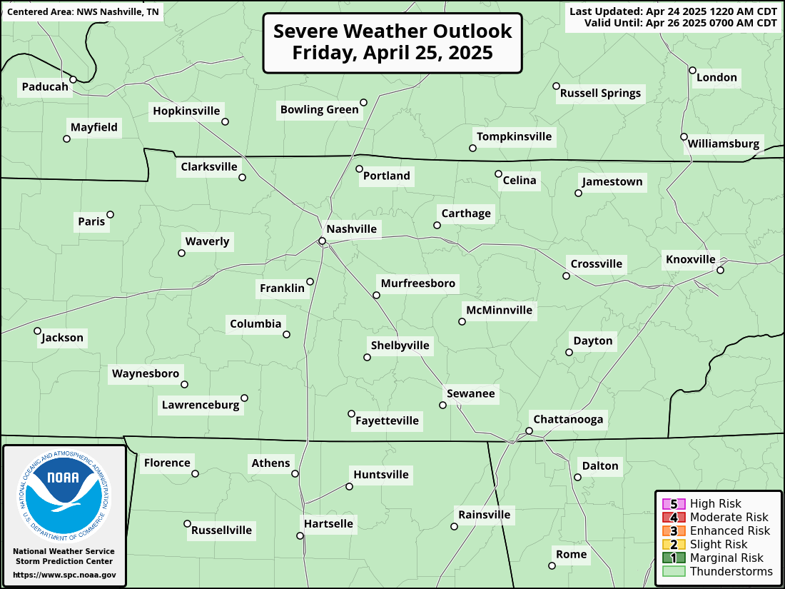
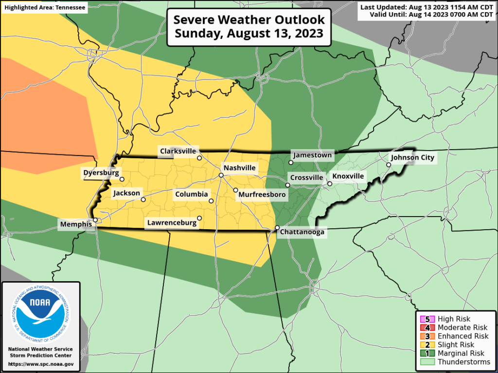
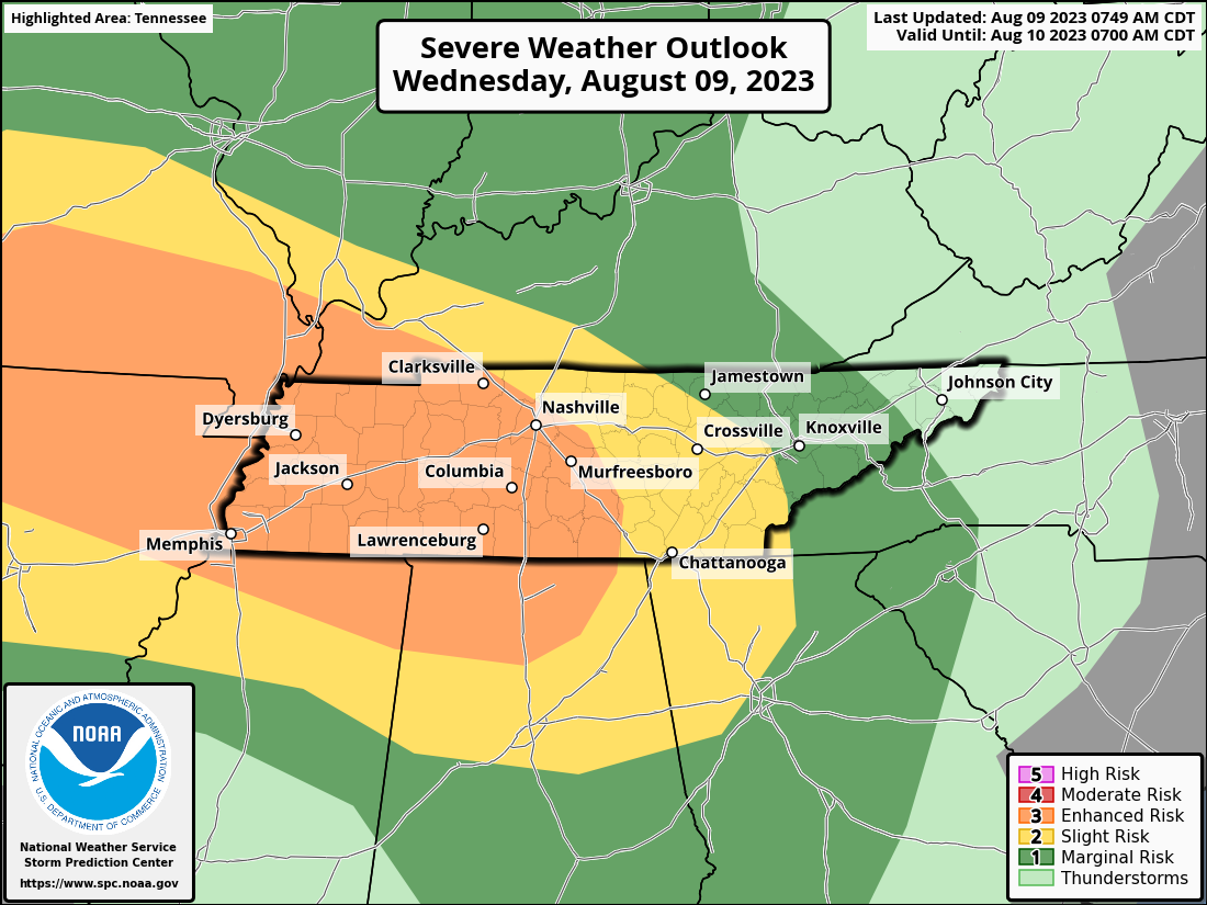
The Storm Prediction Center has outlooked both of our counties with a:
Nice calm Friday night. Just what the doctor ordered.
The Storm Prediction Center has all of Middle TN outlooked with a 5% chance of damaging straight-line winds and/or severe hail within 25 miles.
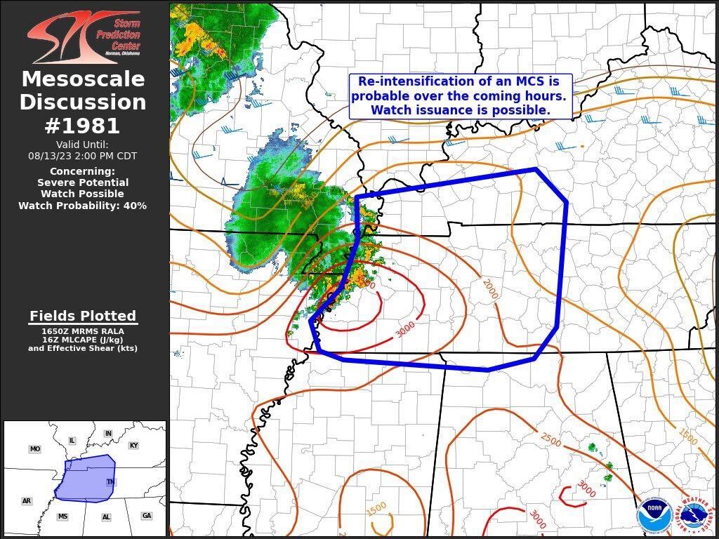
Our chance for severe weather will likely arrive in the form of a MCS, AKA Mesoscale Convective Systems. For us, these often come down I-24 and tomorrow looks like it’ll follow suit.
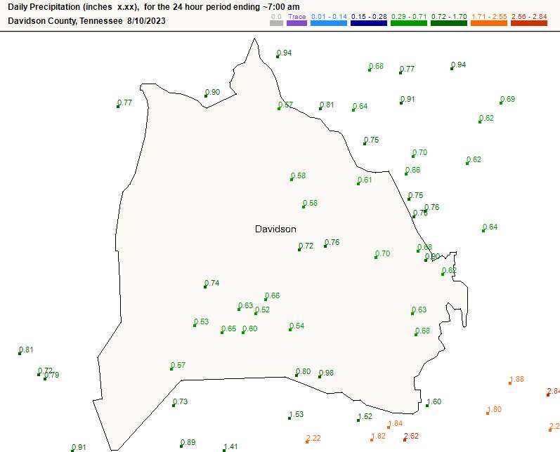
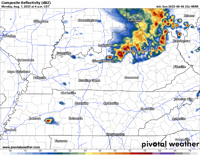
If you slept through the storms early this morning, grats. The lightning output was pretty incredible, and we saw a brief wind gust that damaged a tree or two in S Brentwood.
Decent rain amounts too, especially in central Williamson Co.
The convective outlook for today places most of Davidson and Williamson Counties in an area of enhanced risk. There is an enhanced risk for brief spinup tornadoes and damaging straight line wind. Let’s get into the details.
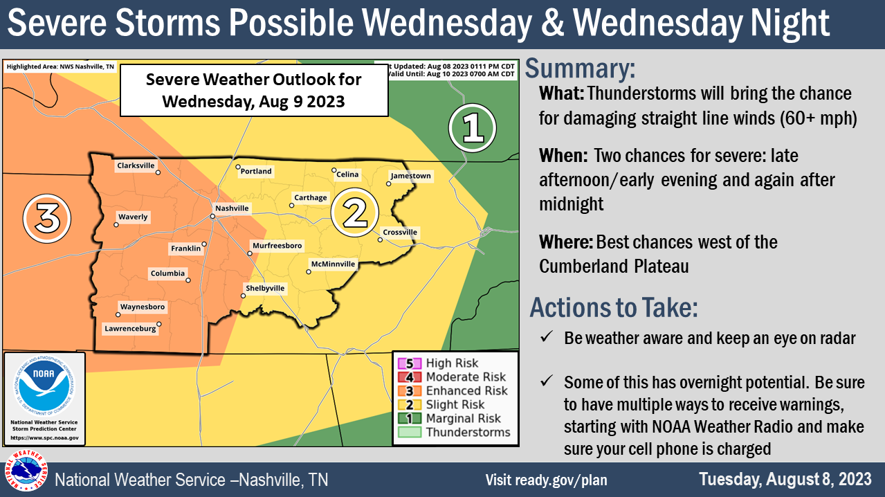

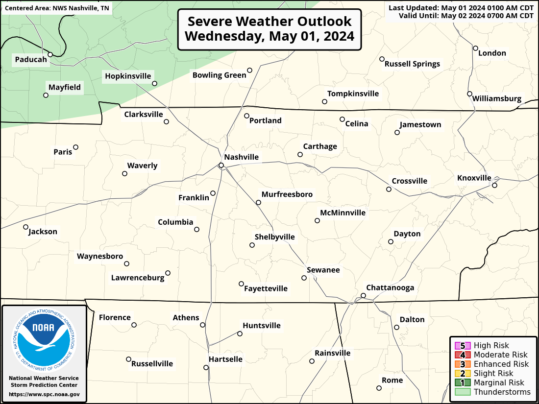
Rest of today and Wednesday morning will be calm. Let’s dive into the severe threat.
The Storm Prediction Center has outlooked us with probabilities of “x” within 25 miles tomorrow.
There is also a 15% chance of flash flooding within 25 miles.
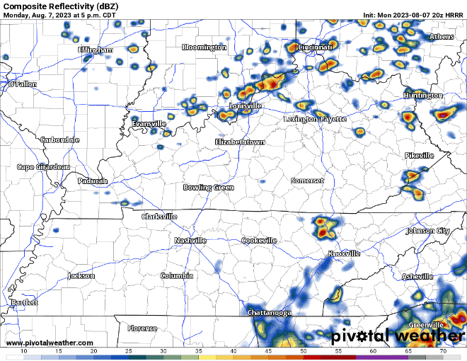
Probably a dry rest of the evening, HRRR (below) thinks a few showers could slide in. They’d be quick and no big deal.
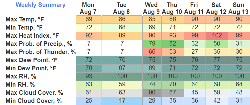
Percentage wise, rain chances appear pretty low tomorrow. However, the HRRR disagrees.
Storms thankfully missed us to the south today, leaving us with a dry evening.
We’ve been outlooked with a
Tomorrow will be a conditional threat AKA there are more “ifs” than normal.
The latest HRRR model (above) has the storms forming on top of us Monday morning. Where these storms form will be very important.
Tonight we have been outlooked with a 5% chance of damaging straight-line winds within 25 miles.
HRRR has been back and forth about tonight. Earlier runs showed a cluster of storms moving in around 8 or 9. Now, thinks we stay dry.
You must be logged in to post a comment.