1–Severe weather requires four things. Today we had moisture ✅, instability ✅, shear ✅, but no trigger/lifting mechanism ❌.

We dodged the daytime threat. Had we had lift, very bad things would have happened somewhere in Middle TN.

1–Severe weather requires four things. Today we had moisture ✅, instability ✅, shear ✅, but no trigger/lifting mechanism ❌.
We dodged the daytime threat. Had we had lift, very bad things would have happened somewhere in Middle TN.
Tuesday aka today
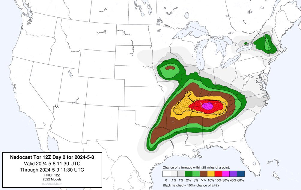
1–This Afternoon.
A few lightningstorms will be around Middle TN. Not sure exactly where and when. There should not be many of them. Not everyone will get stormed. Those storms that get going will have plenty of fuel to tap. Those could be bad storms.
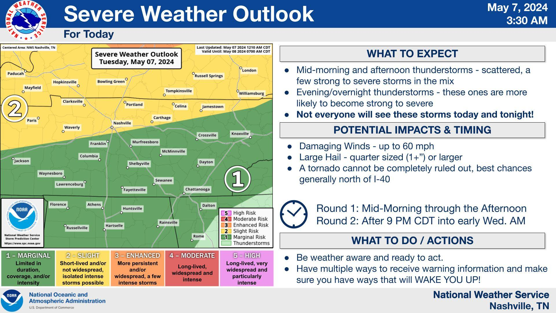
In this blog: 1. Website/X change. 2. Storms tonight. 3. Severe storms outlooked this week.
1–Website change.
As you probably know, we’ve made recent attempts to become less dependent on Twitter and instead create a website from the ground up that would serve as our main timeline and push to social media platforms secondarily. The site would serve as a one stop shop. Pull it up, let it sit there, and be fed all NashSevereWx content automatically. While our developers have done amazing things with this concept under the hood of the site – and it works well most of the time for most people – none of us think it’s quite ready for us to depend on during a week when potentially severe, storms are forecast. We’re committed to getting it perfect. In the meantime, we’ll be posting our updates to Twitter (X), and only long-form blogs like this one to the website like we used to. We’ll be on our YouTube channel covering any warnings. Cool things are coming. We’ll keep you updated!

Isolated non-severe thunderstorms are possible throughout the evening. Most of us should stay dry, but a few unlucky folks may get caught in the rain.
The HRRR model gives its’ best guess at what we could be dealing with tonight, but models have a tough time handling these situations very well.
Non-severe shower + storms will move into our area tonight and stick around throughout the day Friday.
HRRR model (above) shows a break for most of us by around lunchtime Friday. However…
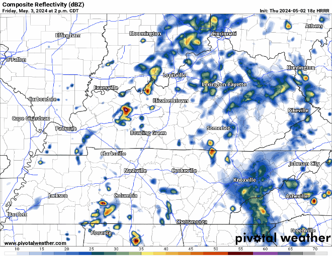
More showers + non-severe storms are expected to develop Friday afternoon and evening. This particular run of the HRRR model shows a majority of the activity dodging us. Now this would be super cool if it does, but I’m pretty sus on that. If going to one of the many, many available outdoor activities tomorrow, not a bad idea to have rain gear + a back-up indoor plan in case a shower/storm decides to make its way to you. If you are downtown tomorrow, you may end up having to dodge some storms and chairs.

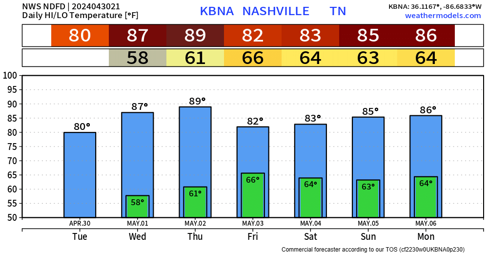
Temps will yet again return to the upper 80s Thursday, getting close to the 90° mark.
An unsettled pattern will settle in for the weekend, with rain chances beginning late Thursday night.
HRRR model above shows rain entering our region late Thursday night continuing thru Friday morning. A break Friday midday, with more rain/storm chances Friday afternoon/evening. Fingers crossed we can be dry before all of our Friday evening outdoor activities (which there is a lot of). Still too much uncertainty to try to nail down any ETA/ETD, we’ll keep you updated. No severe weather expected.
As we wrap up April and begin May, we’ll be dry and temps will be well above average. Hopefully our showers last night can bring May flowers.

Wednesday and Thursday, high temperatures are expected to reach up into the upper 80s. Thursday looks like the best chance to hit the 90° mark, which would tie the daily record high set back in 1901.
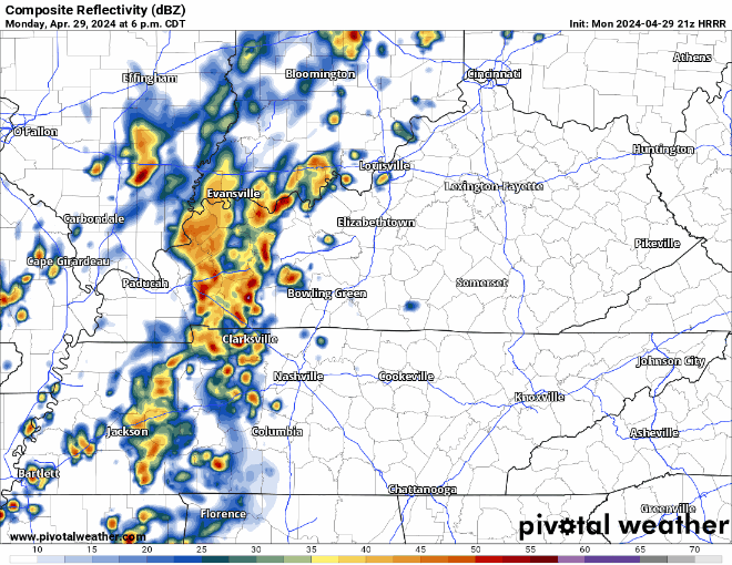
Activity should ramp up over the next couple hours, bringing in some showers and sub-severe storms. Maybe a few rumbles of thunder and some gusty winds, but nothing of concern. HRRR model below shows the story.
High temperatures will get into the low 80s Monday before some rain/storm chances arrive.
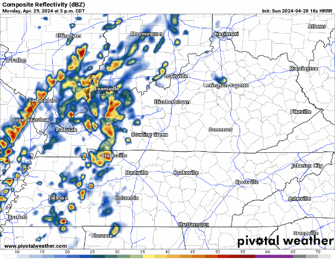
HRRR model (above) has a rough ETA of 7-9 pm Monday. A few rumbles of thunder are possible, but no severe weather is expected. Majority of the activity should be to our east by rush hour Tuesday morning.

Windy yet very warm day today. Wind gusts up to 25 – 30 mph will be possible throughout the day but expected to stay below Wind Advisory levels.
Sunday will be very similar, a tad less windy though. Good viewing weather for the Preds bounce back game.
You must be logged in to post a comment.