
1–Severe weather requires four things. Today we had moisture ✅, instability ✅, shear ✅, but no trigger/lifting mechanism ❌.

We dodged the daytime threat. Had we had lift, very bad things would have happened somewhere in Middle TN.
Keep reading.
2–A Tornado Watch was recently issued in Kentucky.
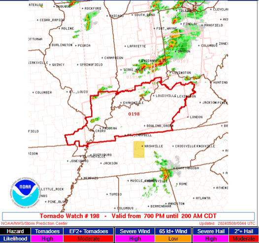
Storms should form near the Ohio River and drop south and get into Middle Tennessee. Those storms will be powered by an airmass capable of cloud to ground lightning, potentially large hail, and damaging straight line winds. If they’re producing tornadoes in KY, they may produce them here, too, during the overnight or early morning hours.
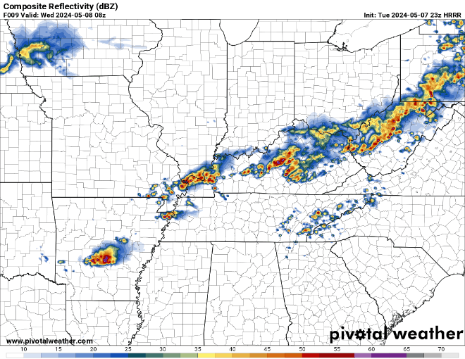
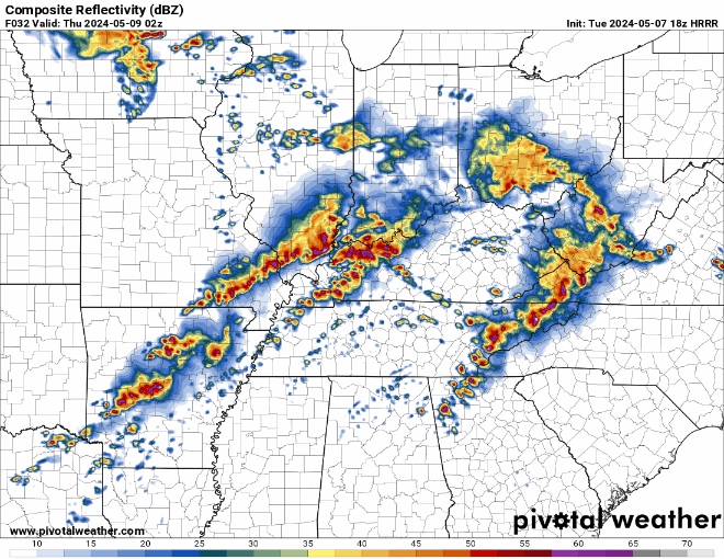
3–Models disagree on timing! Several models think storms will drop south from Kentucky and cross the KY/TN state line before midnight. Other models – including the HRRR – keep us quiet overnight and drive those storms into our area around sunrise tomorrow morning, causing a wild morning commute. Other models think the overnight event sorta fizzles out. Inconclusive data is as frustrating for us as it is for you.
Example: below are 10 different models attempting to predict what our radar will look like at 2 AM. Look how different they are.
⚠️ Check with us on Twitter/X before you go to bed for updates/changes. If/When you go to sleep tonight, have multiple ways to wake up if a warning is issued: double check your NOAA weather radio, enable your native phone alerts, and purchase a wake-me-up app like StormWatchPlus.
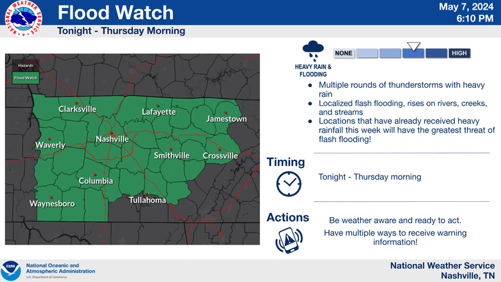
4–There is potential for big event(s) Wednesday. A warm front will sink south and drape over us, then during the day Wednesday, the warm front will lift back north, leaving us with an unstable, moist airmass supportive of severe weather. We may see very heavy rain and lightningstorms with a Wednesday morning event, when flash flooding will be a concern. NWS-Nashville issued a Flood Watch to account for this threat Weds AM and especially Weds night.
5–Once the rain clears out Weds AM, scattered storms may develop late AM through the afternoon. Any of these could produce large hail, damaging straight line winds, and/or a tornado, along with that flash flood threat.
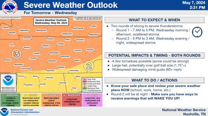
6–Then, models show a gnarly, strong line of powerful storms arriving some time Weds night. We do not know exactly what time. Current arrival guess is after dark to midnight. This line will have hail, wind, and tornado potential. It could also push flood prone areas into flooded areas.
7–The list of six things above is like a chain, one link depends on the other. Break one link, and the entire forecast has to be redone. For example, if we get socked in with rain and storms tomorrow morning, the atmosphere may not have the time to recharge to power up bad storms later. Or, if the morning is quiet, we may see powerful supercells develop in the afternoon (that would be the main event). Or, if very little happens tomorrow during the daylight hours, Weds night could be pretty bad. The lack of consistent model guidance makes all of these conditional and therefore uncertain.
But we expect big storms, potentially severe, some of which may be threatening, at some point during the next 30 hours.
⚠️ The forecast may change quickly. Stay connected!
⚠️ Know your safe place. Review your severe weather plans now. Be sure you have ways to be woken up in the event of a warning.
We will be with you during this entire event. Follow @NashSevereWx on Twitter/X and, in case of a warning, subscribe to our YouTube Live channel for “during the storm” coverage for Nashville/Davidson Co & Williamson Co.
Categories: Featured Blog