
A couple of showers are possible thru this evening, but I think most of the activity stays to our west. Outdoor activities should be okay besides maybe a quick shower. You can always check the radar on our website: Radar | Nashville Severe Weather

A couple of showers are possible thru this evening, but I think most of the activity stays to our west. Outdoor activities should be okay besides maybe a quick shower. You can always check the radar on our website: Radar | Nashville Severe Weather

A Severe Thunderstorm Watch will be in effect until 8pm tonight.
We’ll be covering this on X/IG. If either part of our county is included in a warning, we’ll go live on our YouTube channel. You can always view the radar on our website by using this link. Lightning + heavy rain will also be possible with any storm – could lead to some rainouts, depending on where the heaviest rain falls.

Some showers and storms are possible today, chances are higher along and N of I-40, but anywhere in our two counties could see some rain today.
One or two storms could briefly reach severe limits with damaging straight-line winds and maybe some small hail, no tornado concerns. The Storm Prediction Center has both our counties outlooked with a 5% chance of damaging straight-line winds and/or hail within 25 miles.

Fall officially began at 7:44am this morning, but it certainly has not felt like it today with high temps in the low 90s.
Scattered showers, maybe a storm possible thru this evening, but most of us will stay dry.

Hot this weekend with temps in the low 90s. Fall officially arrives at 7:43p on Sunday, but it won’t feel like it. “Fall-like” temps hold off until middle of next week.
Low chance of a shower this weekend. Most of us stay dry, but a few of us could get a quick shower. NBD – no need to alter outdoor plans.

Above-average temperatures will continue thru the weekend, getting back to around average by the middle of next week.
The transition of seasons never goes smoothly around here.
Some of the CAMs have introduced a very low chance of a stray shower passing this weekend, most likely in the afternoon and evening. I see no need to alter any outdoor plans, but just more of a heads up – majority of us will stay dry and hot.
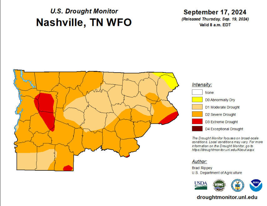

No improvement with today’s drought monitor update, as both our counties continue with a Moderate to Severe Drought.
Drought conditions are expected to worsen as very little rain is in the forecast.

While the temps haven’t been just unbearable, it just doesn’t quite feel like Fall just yet. And it won’t over the next several days.
Starting tomorrow (Thursday), we should see afternoon high temps reach 90° several days, including this weekend, adding onto our already above-average total of 90°+ days in 2024.

High temps slowly climbing to the low 90s by this weekend, about 10° above average for this time of year (82°).
Dewpoints will be in the low to mid 60s, so those low 90s won’t be unbearable.
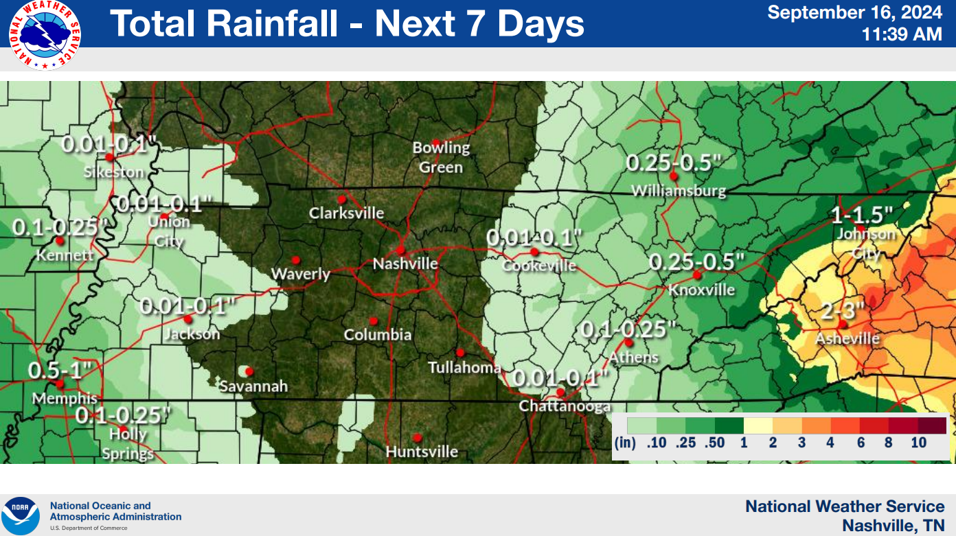
Unfortunately, still no meaningful rain chances to talk about. Rain might come back in the forecast by early to mid next week, but too soon to tell.
The entire blog could really be summarized into: warm & dry. I could just leave it at that – but I won’t.
No measurable rainfall is expected over the next 7 days. Can’t totally rule out a quick sprinkle on Tuesday or Wednesday, but think those chances stay confined to the Plateau.
You must be logged in to post a comment.