
All things considered, not a bad night to ring in the New Year. Dry, but will be chilly. Jackets needed tonight for any outdoor celebrations.
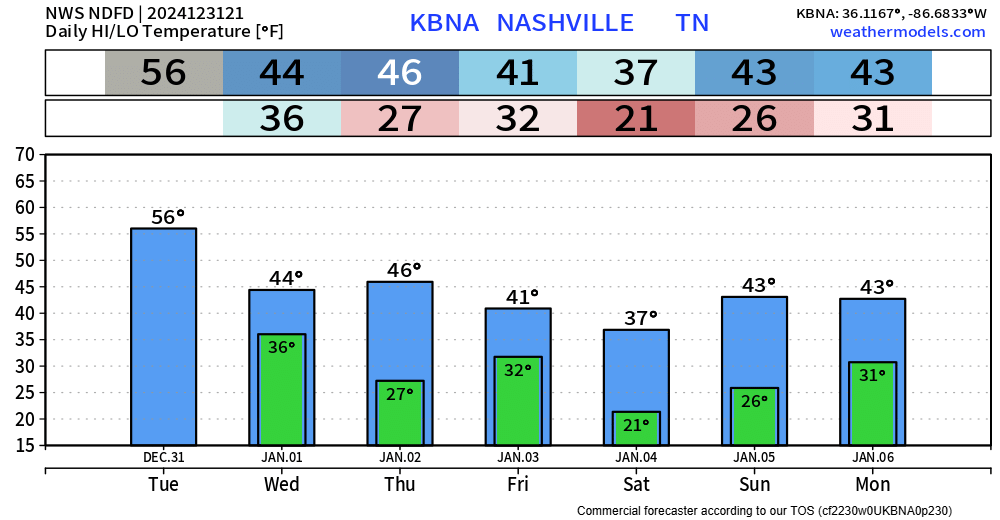
The first few days of 2025 will be dry but cold – however temps will be pretty close to normal…for now.

All things considered, not a bad night to ring in the New Year. Dry, but will be chilly. Jackets needed tonight for any outdoor celebrations.
The first few days of 2025 will be dry but cold – however temps will be pretty close to normal…for now.

Some light showers possible tomorrow (Tuesday) during the AM hours, but these are expected to be few and far between and mostly staying to our north – HRRR model gives its best guess below.
Temperatures Tuesday afternoon will be in the low 50s but will fall to the low 40s with a decent NW breeze overnight. If headed out for New Year celebrations, layers will be your friend.
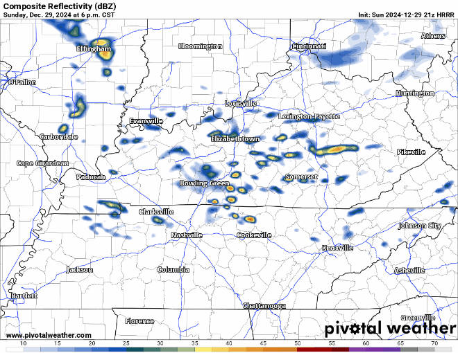
A few showers will be possible this evening, maybe even a rumble of thunder – but most models (including the HRRR shown below) think majority of the activity will stay to our north.
Weather for the Music City Bowl and any other plans you may have for Monday look great weather-wise.

Most of the thinking regarding tonight’s relatively low chance for a strong to severe storm remains the same, however the main timeframe for severe weather has changed.
Our timeframe for strong to severe storms looks to be 5p – 2a.
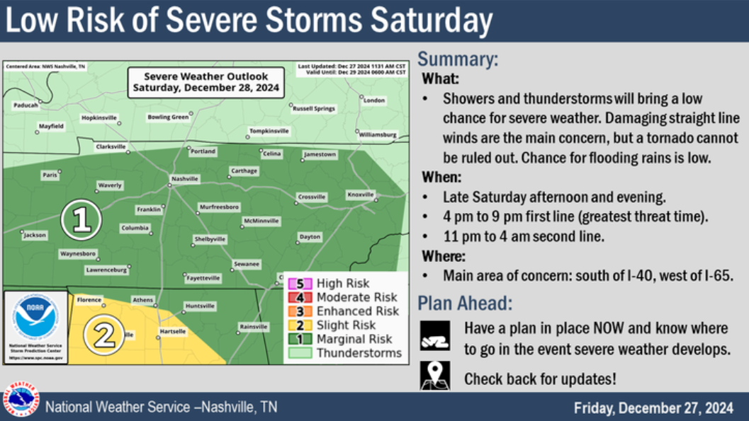
Not much has changed from yesterday. Here’s the current thinking:
For Saturday, we are still outlooked with:
– a 5% chance of damaging straight-line winds and/or severe hail within 25 miles
– a 5% chance of flash flooding within 25 miles
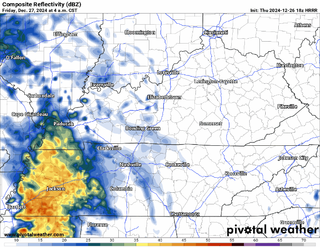
First, a line of heavier showers is expected to move thru the area Friday morning. No severe weather expected, just some rain.
HRRR model gives a guess below:
Majority of the rain should be gone by noon. Maybe a stray shower in the afternoon/evening, but majority of plans should be dry.
Merry Christmas! It’s not a White Christmas, but it does feel real nice outside.

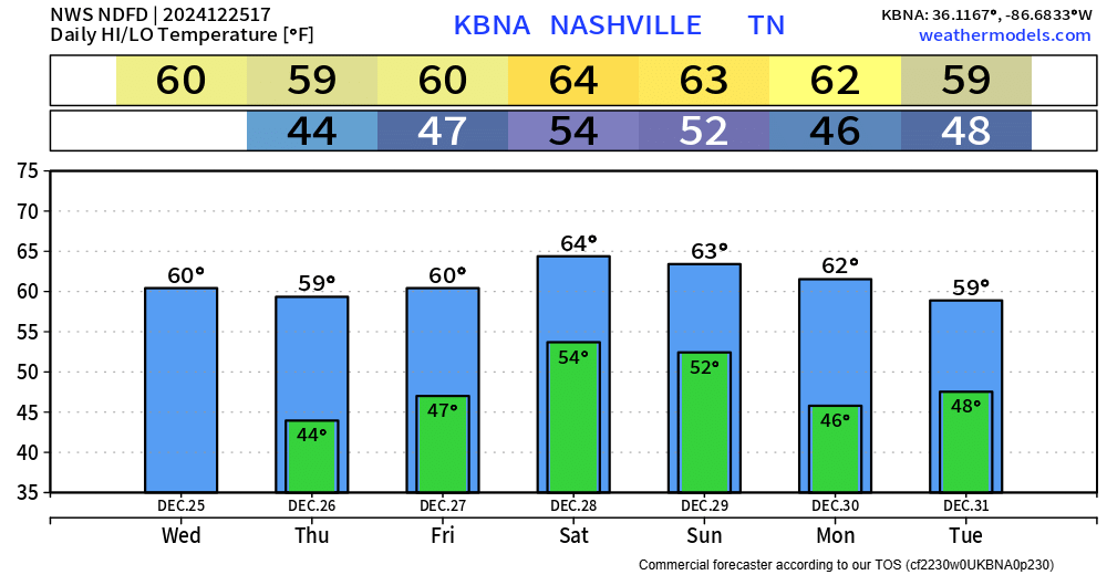
Our average high for Christmas Day is 47°, we’ll get all the way up to near 60° today. Great weather to try out any new toys, as long as it isn’t a sled. No rain expected today.
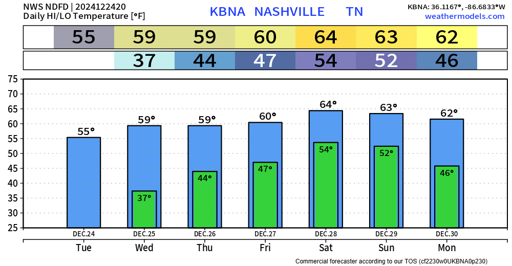
Santa should have no problem delivering gifts tonight, light winds, partly cloudy skies – the red nose won’t need to guide any sleigh tonight.
Christmas Day looks nice weather-wise. High temps near 60°, can’t totally rule out a quick shower – but the overwhelming majority of us will likely stay dry.
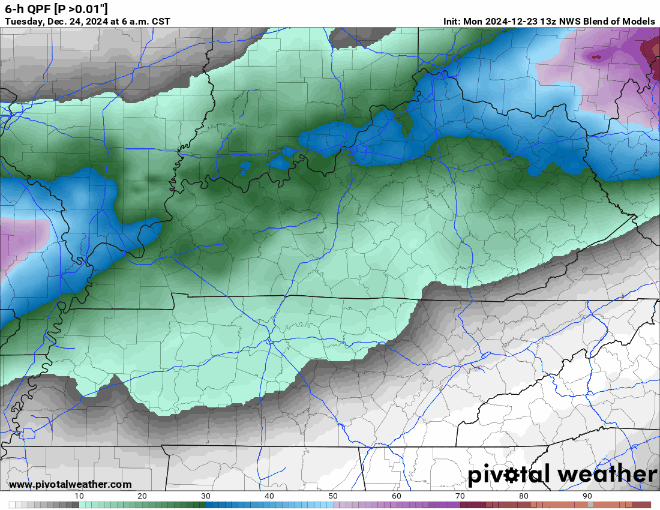
Models have been trending drier for Christmas Eve + Christmas Day.
The NWS Blend of Models shows relatively low chances (>20%) of any measurable rainfall during both days.
Won’t be surprised if a few of us see a quick shower, but certainly not a washout either day. Good weather to try out those new toys.
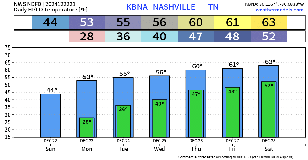
Temps gradually warming throughout the week, getting above average by mid-week.
Showers possible Christmas Eve + Christmas Day, with rain chances continuing thru the rest of the week.
– A few showers possible Christmas Eve, but a little more likely on Christmas Day
You must be logged in to post a comment.