
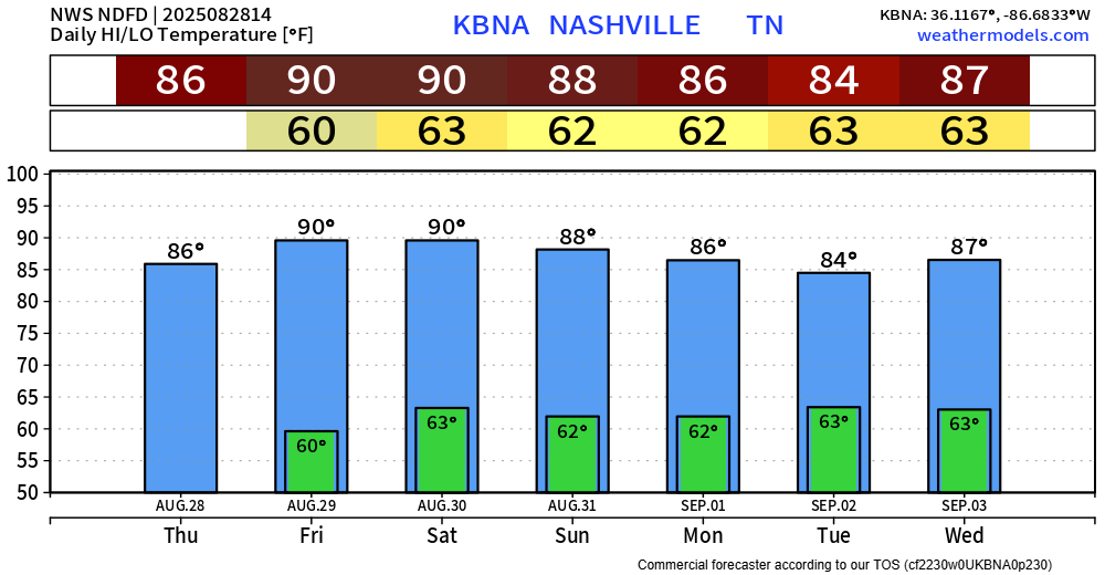
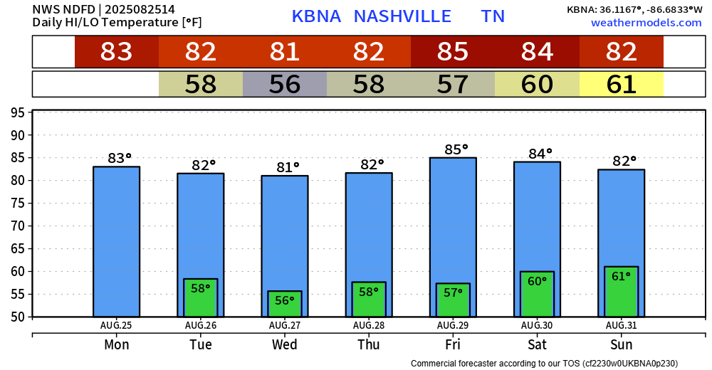
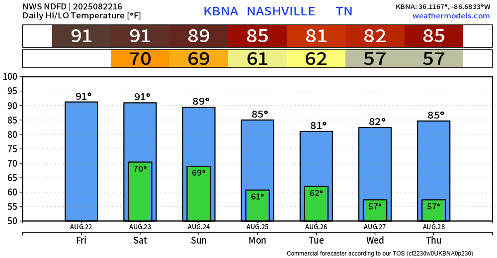
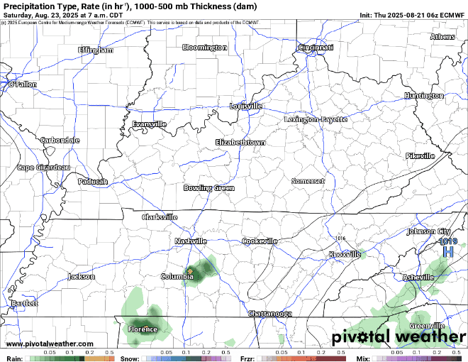
Over the next few days, we’ll deal with high temperatures running slightly above average. Dewpoints will be in the low to mid 50s, so it will still be fairly tolerable.
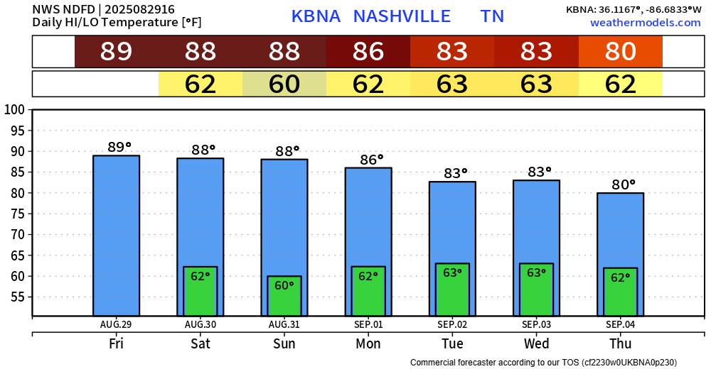
Below average temps return by the middle of next week – they just can’t stay away. Almost like they know it’s football season.


You must be logged in to post a comment.