
A Saturday Evening update from our NWS added Davidson County to the Winter Weather Advisory that had previously been confined to counties north of us.
While impacts appear to be confined to Sunday morning, these impacts could cause car accidents or slip/fall injuries. Sidewalks, roads (particularly bridges and overpasses) may briefly become slick. Be prepared to take it slow on the roads Sunday morning. You may not encounter any ice, but better safe than sorry.
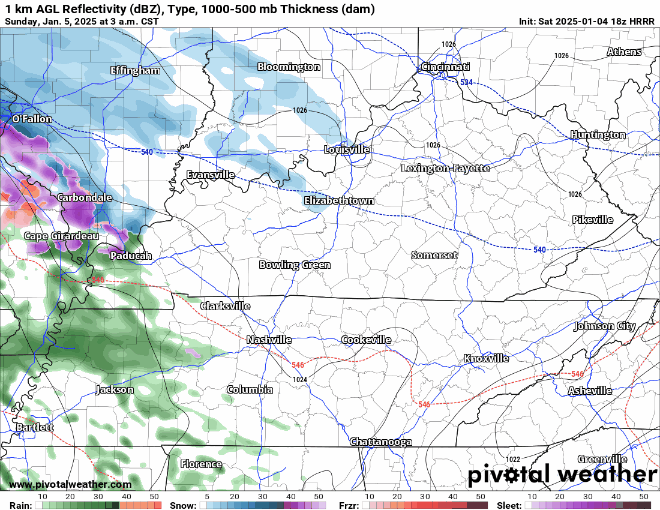
Models are in fairly good agreement about how Sunday/Monday plays out. I’ll let the HRRR model take the show, loop goes from 3a Sunday to 11a Monday.

- Mostly cold rain in the morning, but light freezing rain will be possible
- Temps expected to rise above freezing by 10a Sunday (at the latest), changing to all rain (melting any ice that does accumulate)
- On/off rain showers during the day Sunday (looks mostly dry for the Titans game)
- Line of heavier rain Sunday evening (wind gusts up to 30 mph possible, rainfall totals up to 1 – 1.5″ possible)
- Flurries, maybe a brief light snow shower during the first half of Monday (up to a dusting possible)
The official forecast from NWS Nashville shows maybe a glazing of ice for folks in Nashville and points north. Elevation will likely play a role. Those in places like Oak Hill or atop other area hills may see higher ice accumulation.
Granted, it does not take much ice to cause issues on the road. Please be cautious on the roadways Sunday morning.

And for our snow potential on Monday, this doesn’t look like something to get your hopes up for. Maybe up to a dusting, probabilities of totals greater than 0.5″ are slim. Very little, if any travel impacts expected from this.

Changes are possible to the forecast; we’ll keep you posted on all of our socials (X/Insta/Threads/BlueSky).
Very cold temps will stick around this upcoming week. Temperatures expected to hardly make it above freezing Tuesday thru Friday, with lows getting down into the teens some nights. Now is a good time to winterize your home.

Still watching for another system that could impact us late next week, but we are still wayyy too far out for any guarantees. More details on this in the blog in the coming days. In the meantime, please shield your eyes from any posts on TikTok or X with ridiculous snow amounts telling you some massive snowstorm is coming.
Categories: Featured Blog