Only rain chances to speak about for the next few days will be today.
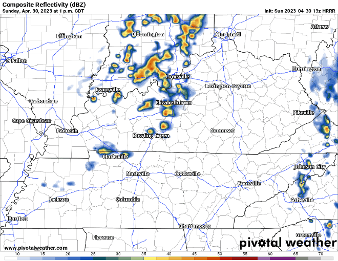
HRRR model (above) thinks best timeframe for some rain will be 1-4pm. No severe weather expected but cannot rule out some lightning.

Only rain chances to speak about for the next few days will be today.
HRRR model (above) thinks best timeframe for some rain will be 1-4pm. No severe weather expected but cannot rule out some lightning.
Sometimes the weather model trends are bad, sometimes they are good. Today they are good.
Yesterday the HRRR showed a pretty wet Saturday. That wasn’t cool. Today (above) it has changed its mind and thinks we get away with a fairly dry Saturday, maybe a quicker shower or two this afternoon. That’s cool.
HRRR model thinks some pop-up rain showers could impact us this afternoon. It doesn’t look like much; you may not get any rain. If you do get any rain, it’ll be like lightly stubbing your toe. The pain(rain) will come and go quick, you’ll think to yourself “wow, that’s annoying” and then your day goes on.
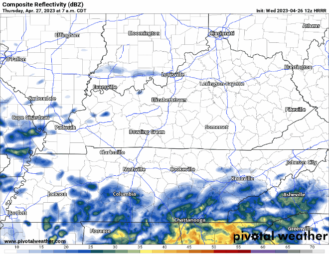
Some showers moving through this morning, they’ll continue on/off thru tonight. Best chance of heavier rain with a storm or two looks to be this evening and tonight, as shown by the HRRR model below. I do not know if your outdoor rolly ball sports will get rained out, but it doesn’t look too promising.
Some rain moved to our S this morning, the dry air monster was hungry, so we stayed dry. We’ll continue this dry trend all day until some showers move in this afternoon/evening. The D.A.M will get full and let a few showers pass through, won’t amount to much. Outdoor rolly ball sports may be good to go.
It’s the perfect date.
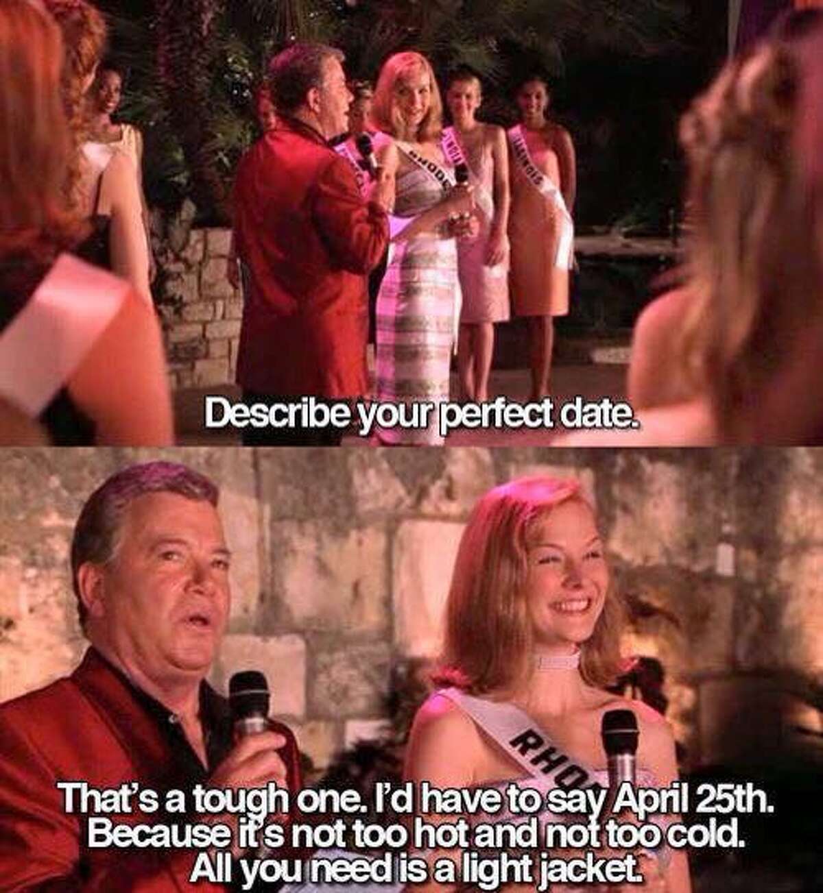
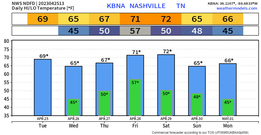
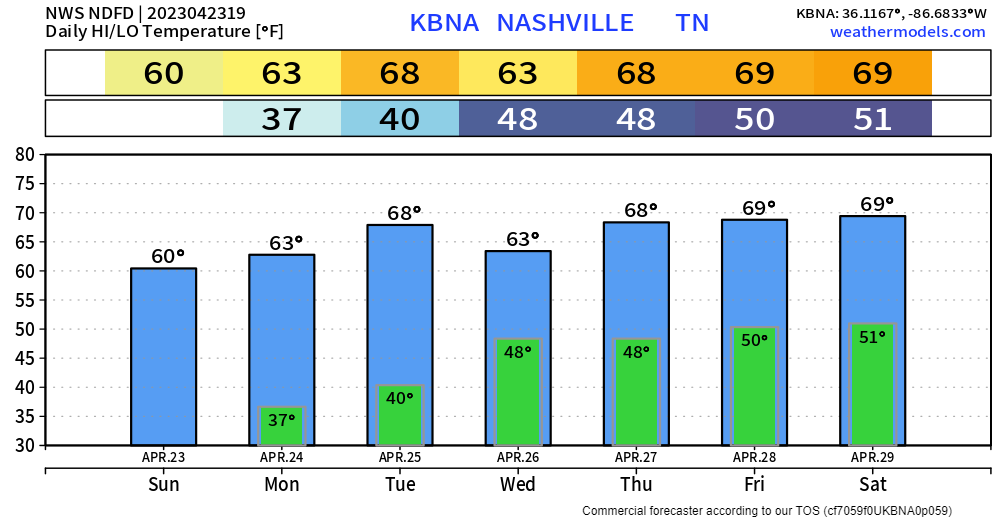
Today won’t be too hot, won’t be too cold. Perfect weather for a light jacket. Last rain-free chance day for the week.
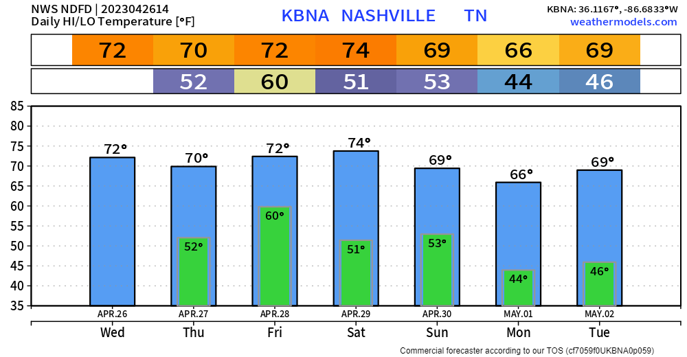
Wednesday rain chances are still relatively low, maybe some showers in the morning and at night. Outdoor sports may be spared.
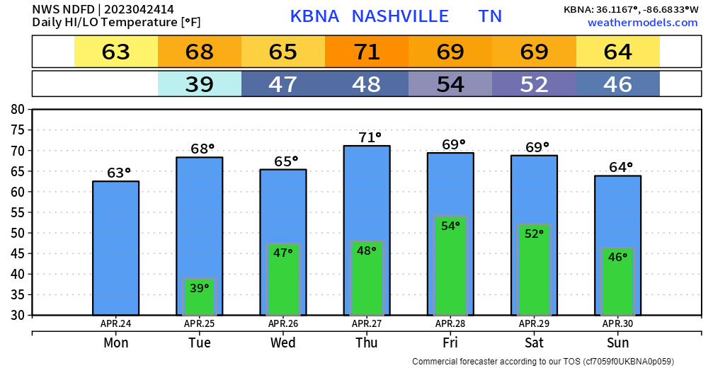
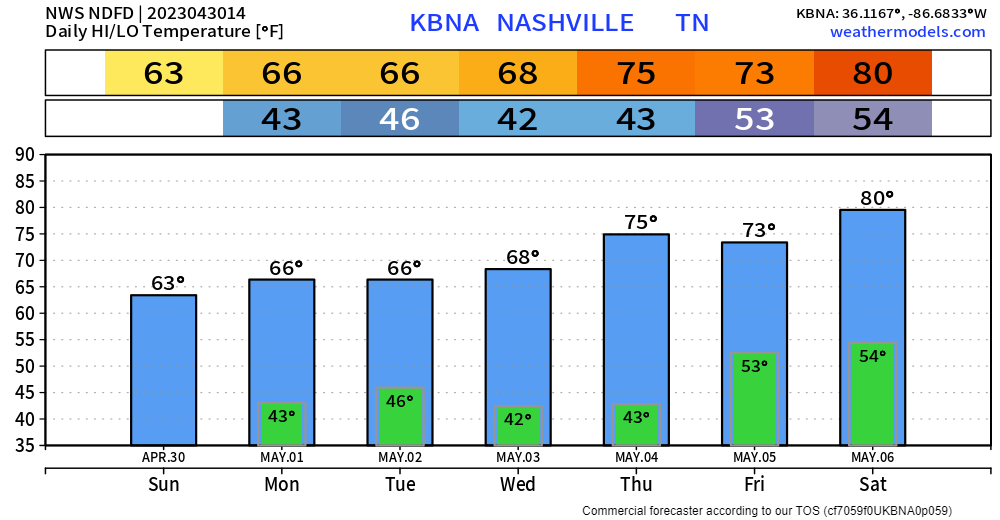
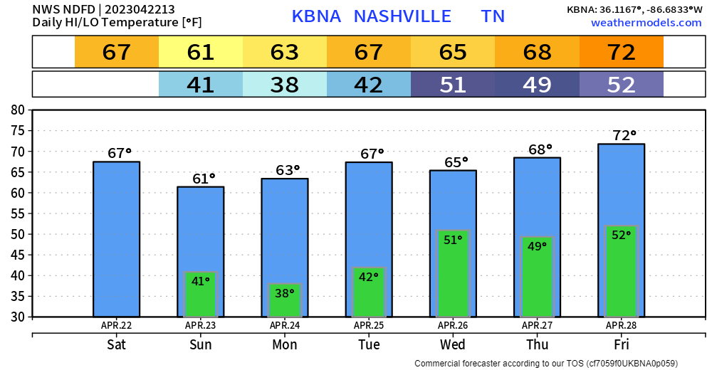
Temps are quickly recovering from the mid 30’s, we’ll end up somewhere around 63° for a high temp today. An abundance of sun will hopefully make it feel not as cool.
Low temps tonight will dip back down into the upper 30’s. Some cloud cover should prevent frost, but it also wouldn’t hurt just to keep them covered up.
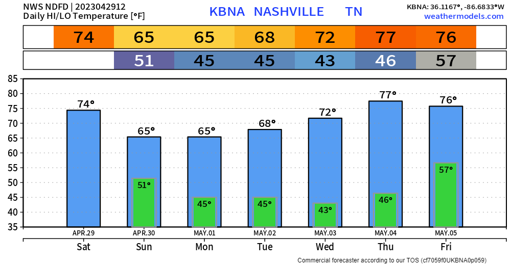
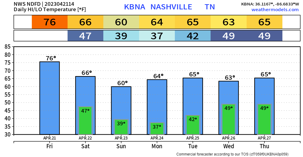
High temps well below normal today will set us up for frost tonight, as low temps will dip all the way down into the mid 30’s. Protect plants and such before you go to bed.
The GFS model think rain returns on Wednesday, and the EURO model thinks the rain holds off for the most part until Thursday PM. More models lean towards the Wednesday solution, but things tend to change in weather. The models should come into agreement sooner than later. But generally speaking, every day during the back half of the week has rain chances.


Quick References:
Weather changes constantly.
Follow @NashSevereWx on Twitter for any changes to this forecast.
Live coverage during tornado and severe thunderstorm warnings:

Look good.
Support the mission.
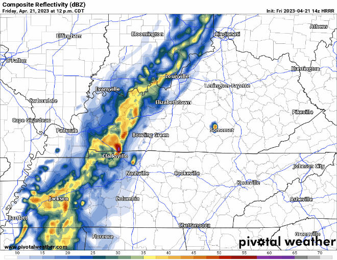
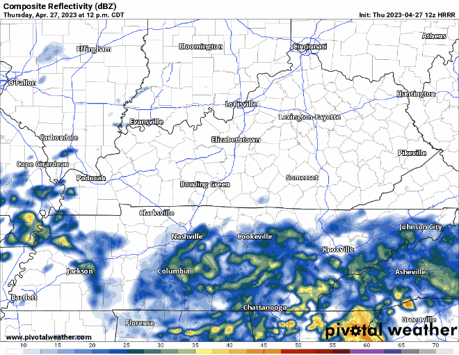
A line of rain is slowly, but surely, making its way toward us. When it gets here, nobody knows. JK we kinda have an idea of when.
HRRR model (above) shows rain creeping in sometime this afternoon. This run holds the majority of it off until around 3 or 4pm, but I think any time after noon, you can expect on/off rain. Coverage will increase as we head into the evening, transitioning into a good, soaking rain for a few hours. No severe weather or flooding concerns. You may hear some thunder, but nothin’ crazy. Rainfall totals around an inch, your grass will be thankful.
You must be logged in to post a comment.