
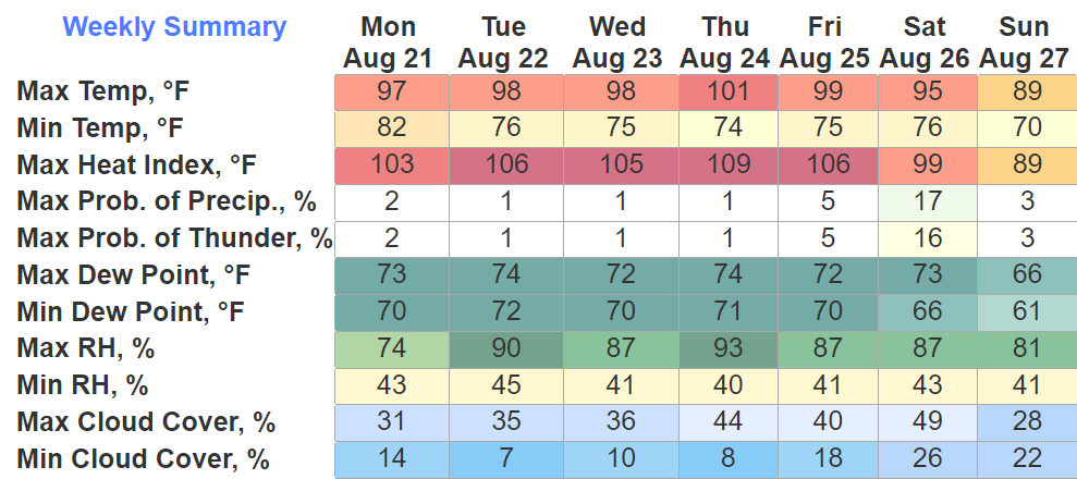
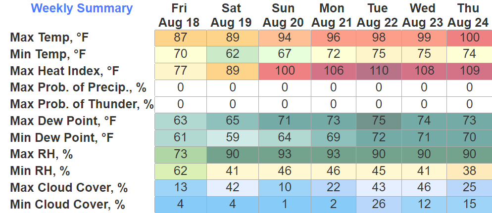
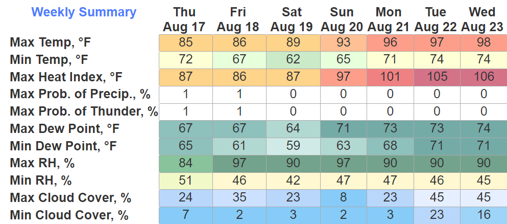
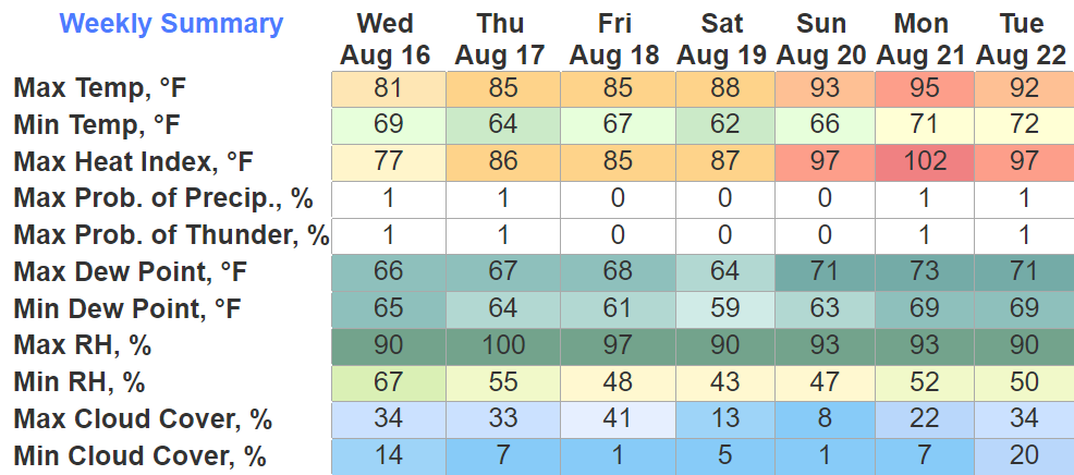
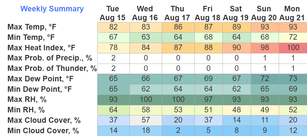
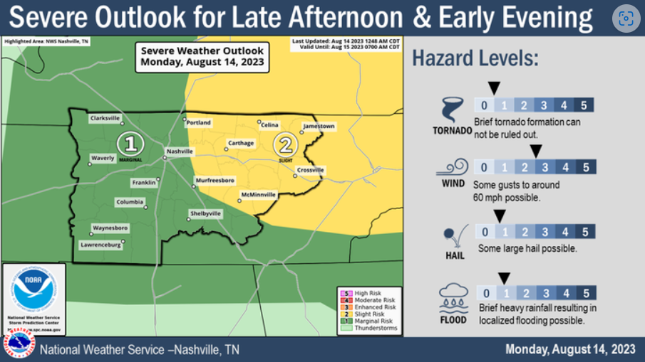
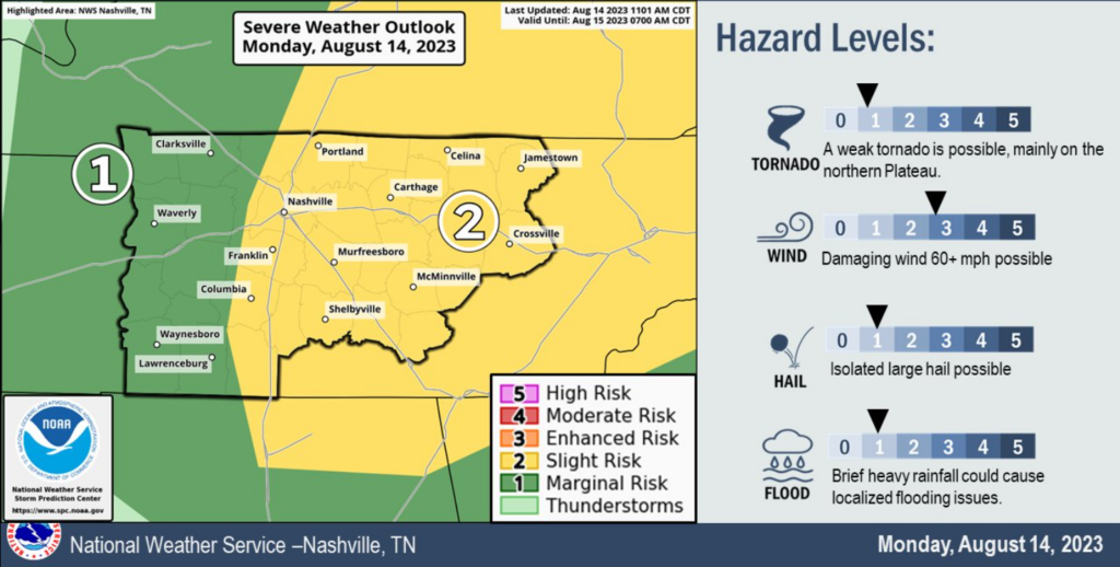
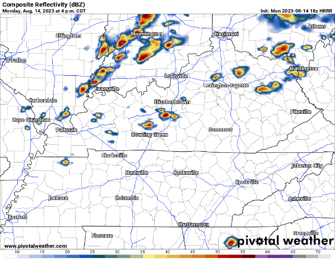
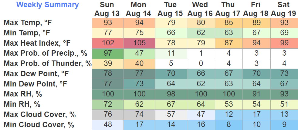
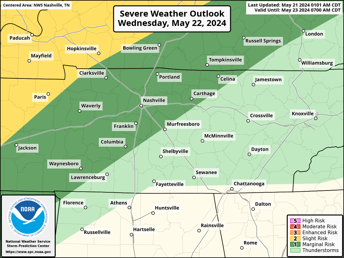
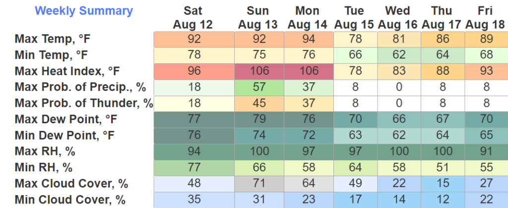
Just a really gross forecast over the next five days.

Today thru Friday we will be under a Heat Advisory, heat index values will reach 105°+ daily.
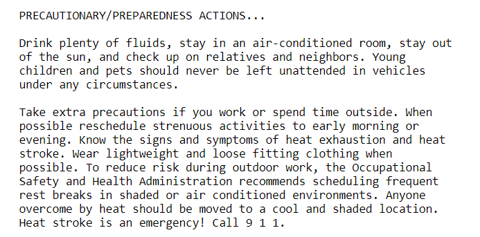
Please, heed above advice. Heat is a dangerous thing and can be deadly if not taken seriously. Always look before you lock.


You must be logged in to post a comment.