
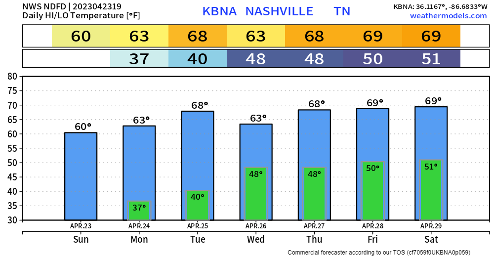
High temps well below normal today will set us up for frost tonight, as low temps will dip all the way down into the mid 30’s. Protect plants and such before you go to bed.
The GFS model think rain returns on Wednesday, and the EURO model thinks the rain holds off for the most part until Thursday PM. More models lean towards the Wednesday solution, but things tend to change in weather. The models should come into agreement sooner than later. But generally speaking, every day during the back half of the week has rain chances.
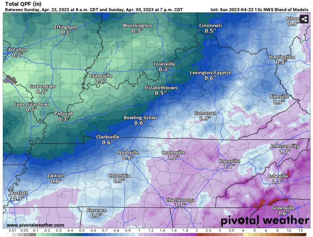
The NWS Blend of Models thinks we get a little less than an inch of rain throughout the next week.
As of right now, no severe weather or flooding concerns in the next seven days.
Quick References:
Weather changes constantly.
Follow @NashSevereWx on Twitter for any changes to this forecast.
Live coverage during tornado and severe thunderstorm warnings:

Look good.
Support the mission.

We are 100% community supported. No ads. No subscription fees. Keep it free for everyone.


Quick References:
Weather changes constantly.
Follow @NashSevereWx on Twitter for any changes to this forecast.
Live coverage during tornado and severe thunderstorm warnings:
Look good.
Support the mission.
We are 100% community supported. No ads. No subscription fees. Keep it free for everyone.
Categories: Forecast Blogs (Legacy)
You must be logged in to post a comment.