
Thankfully, no more sub-freezing temperatures expected in the next 7 days after dipping down into the low to mid 20s last night.
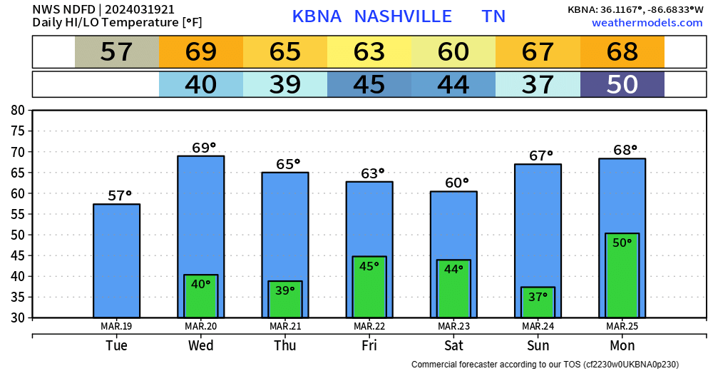
High temps back near 70 degrees tomorrow, with high staying in the 60s for the remainder of the week.
Marginal fire danger continues thru this evening and will stick around Wednesday and Thursday. Outdoor burning will continue to be discouraged.
Our dry conditions will end Friday when some light showers arrive.
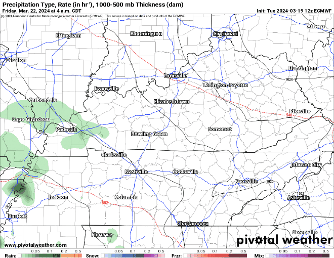
The EURO model (above) shows rain arriving Friday morning, lasting on/off thru early Saturday morning.
No severe weather expected, rainfall totals only around 0.25″, NBD.
Rain will taper off Saturday morning leaving us with a dry and warm rest of the weekend.
Rain chances return Monday afternoon thru Tuesday. No shenanigans expected as of right now.
Categories: Featured Blog